File:Baie des Cochons locator map.svg
Jump to navigation
Jump to search

Size of this PNG preview of this SVG file: 800 × 323 pixels. Other resolutions: 320 × 129 pixels | 640 × 259 pixels | 1,024 × 414 pixels | 1,280 × 517 pixels | 2,560 × 1,035 pixels | 851 × 344 pixels.
Original file (SVG file, nominally 851 × 344 pixels, file size: 623 KB)
Captions
Captions
Add a one-line explanation of what this file represents
Summary[edit]
| Description |
|
||
| Date | (UTC) | ||
| Source |
|
||
| Author | Sémhur (talk), Urutseg, NordNordWest | ||
| Other versions |
| ||
| SVG | W3C-validity not checked.
|
||
| Graphic Lab |

| Object location | | View this and other nearby images on: OpenStreetMap |
|---|
| Object location | | View this and other nearby images on: OpenStreetMap |
|---|
Licensing[edit]
I, the copyright holder of this work, hereby publish it under the following license:
| This file is made available under the Creative Commons CC0 1.0 Universal Public Domain Dedication. | |
| The person who associated a work with this deed has dedicated the work to the public domain by waiving all of their rights to the work worldwide under copyright law, including all related and neighboring rights, to the extent allowed by law. You can copy, modify, distribute and perform the work, even for commercial purposes, all without asking permission.
|
File history
Click on a date/time to view the file as it appeared at that time.
| Date/Time | Thumbnail | Dimensions | User | Comment | |
|---|---|---|---|---|---|
| current | 15:22, 20 April 2021 | 851 × 344 (623 KB) | Εὐθυμένης (talk | contribs) | File uploaded using svgtranslate tool (https://svgtranslate.toolforge.org/). Added translation for el. | |
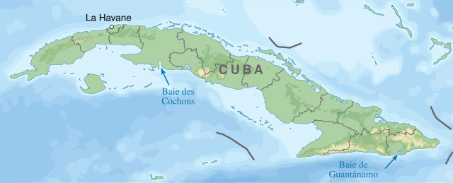
| 17:46, 2 August 2014 | 851 × 344 (618 KB) | Sémhur (talk | contribs) | == {{int:filedesc}} == {{Information |Description={{Multilingual description |en= Locator map of en:Bay of Pigs and en:Guantánamo Bay in Cuba. |fr= Carte montrant l'emplacement des baies des Cochons et de [[:fr:Bai... |
You cannot overwrite this file.
File usage on Commons
The following page uses this file:
File usage on other wikis
The following other wikis use this file:
- Usage on fr.wikipedia.org
- Discussion:Baie des Cochons
- Cuba
- Wikipédia:Le saviez-vous ?/Archives/2014
- Wikipédia:Atelier graphique/Cartes/Archives/août 2014
- Utilisateur:GhosterBot/BacASable/testStat bis/Visibilité des anecdotes (2014)
- Utilisateur:GhosterBot/BacASable/testStat b/Visibilité des anecdotes (2014)
- Utilisateur:GhosterBot/BacASable/testStat/Visibilité des anecdotes (2014)
- Utilisateur:GhosterBot/BacASable/testStat/Visibilité des anecdotes (2014)/2014 09
- Utilisateur:GhosterBot/BacASable/testStat/Visibilité des anecdotes (2014)/2014 10
- Utilisateur:GhosterBot/BacASable/testStat/Visibilité des anecdotes (2014)/2014 11
- Wikipédia:Statistiques des anecdotes de la page d'accueil/Visibilité des anecdotes (2014)
- Wikipédia:Statistiques des anecdotes de la page d'accueil/Visibilité des anecdotes (2014)/2014 08