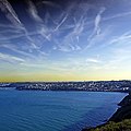
File:Baie de Saint.jpg

Original file (3,000 × 3,000 pixels, file size: 5.27 MB, MIME type: image/jpeg)
Captions
Captions
Summary[edit]
| DescriptionBaie de Saint.jpg |
English: Saint-Laurent de la Mer depuis la Pointe du Roselier, Plérin, Côtes-d'Armor, Bretagne
La pointe du Roselier, qui surplombe Martin-Plage et son rocher ainsi que la plage de Saint-Laurent, offre un point de vue sur la baie de Saint-Brieuc. On y trouve également un éperon barré qui témoigne d'une occupation à l'âge de fer, un four à boulets (de canon) datant de 1794 et un monument aux péris en mer érigé à la fin du 20ème siècle. Elle a été récemment réaménagée, les voitures ont été éloignées et les camping-cars n'y ont plus accès. www.ouest-france.fr/bretagne/plerin-22190/a-plerin-la-poi... Saint-Laurent de la Mer depuis la Pointe du Roselier, Plérin, Côtes-d'Armor, Bretagne The Pointe du Roselier, overlooking Martin-Plage and its rock, as well as the beach of Saint-Laurent, offers a view of the bay of Saint-Brieuc. There is also a barred spur that testifies to an occupation in the Iron Age, a ball kiln (cannon) dating from 1794 and a monument to the Dead at sea erected at the end of the 20th century. It has been recently refurbished, the cars have been moved away and the campers no longer have access. Baie de Saint-Brieuc La baie de Saint-Brieuc est une baie de la Manche bordant une partie du littoral des Côtes-d'Armor en France. Elle s'étend sur 800 km2 entre l'archipel de Bréhat et le cap Fréhel. fr.wikipedia.org/wiki/Baie_de_Saint-Brieuc The bay of Saint-Brieuc is a bay of the Channel bordering a part of the coast of the Côtes-d'Armor in France. It covers 800 km2 between the Bréhat archipelago and Cape Fréhel. July 2022 - Uploaded 2022/09/21 |
| Date | |
| Source | https://www.flickr.com/photos/pom-angers/52373661250/ |
| Author | Pom' |
| Camera location | 48° 33′ 13.97″ N, 2° 42′ 54.91″ W | View this and other nearby images on: OpenStreetMap |
|---|
Licensing[edit]
- You are free:
- to share – to copy, distribute and transmit the work
- to remix – to adapt the work
- Under the following conditions:
- attribution – You must give appropriate credit, provide a link to the license, and indicate if changes were made. You may do so in any reasonable manner, but not in any way that suggests the licensor endorses you or your use.
- share alike – If you remix, transform, or build upon the material, you must distribute your contributions under the same or compatible license as the original.
| This image was originally posted to Flickr by pom'. at https://flickr.com/photos/146832554@N06/52373661250. It was reviewed on 24 March 2023 by FlickreviewR 2 and was confirmed to be licensed under the terms of the cc-by-sa-2.0. |
24 March 2023
File history
Click on a date/time to view the file as it appeared at that time.
| Date/Time | Thumbnail | Dimensions | User | Comment | |
|---|---|---|---|---|---|
| current | 16:50, 24 March 2023 |  | 3,000 × 3,000 (5.27 MB) | Hogo-2020 (talk | contribs) | Uploaded a work by Pom' from https://www.flickr.com/photos/pom-angers/52373661250/ with UploadWizard |
You cannot overwrite this file.
File usage on Commons
There are no pages that use this file.
Metadata
This file contains additional information such as Exif metadata which may have been added by the digital camera, scanner, or software program used to create or digitize it. If the file has been modified from its original state, some details such as the timestamp may not fully reflect those of the original file. The timestamp is only as accurate as the clock in the camera, and it may be completely wrong.
| Camera manufacturer | Panasonic |
|---|---|
| Camera model | DMC-TZ101 |
| Exposure time | 1/2,000 sec (0.0005) |
| F-number | f/2.9 |
| ISO speed rating | 125 |
| Date and time of data generation | 20:10, 15 July 2022 |
| Lens focal length | 9.1 mm |
| Orientation | Normal |
| Horizontal resolution | 180 dpi |
| Vertical resolution | 180 dpi |
| Software used | Adobe Photoshop CS2 Windows |
| File change date and time | 21:46, 20 September 2022 |
| Y and C positioning | Co-sited |
| Exposure Program | Landscape mode (for landscape photos with the background in focus) |
| Exif version | 2.3 |
| Date and time of digitizing | 20:10, 15 July 2022 |
| Meaning of each component |
|
| Image compression mode | 4 |
| APEX exposure bias | 0 |
| Maximum land aperture | 3.0703125 APEX (f/2.9) |
| Metering mode | Pattern |
| Light source | Unknown |
| Flash | Flash did not fire, compulsory flash suppression |
| DateTime subseconds | 575 |
| DateTimeOriginal subseconds | 575 |
| DateTimeDigitized subseconds | 575 |
| Supported Flashpix version | 1 |
| Color space | sRGB |
| Sensing method | One-chip color area sensor |
| File source | Digital still camera |
| Scene type | A directly photographed image |
| Custom image processing | Normal process |
| Exposure mode | Auto exposure |
| White balance | Auto white balance |
| Digital zoom ratio | 0 |
| Focal length in 35 mm film | 32 mm |
| Scene capture type | Standard |
| Scene control | Low gain up |
| Contrast | Normal |
| Saturation | Normal |
| Sharpness | Normal |
| Supported Flashpix version | 1 |
| Image width | 3,000 px |
| Image height | 3,000 px |
| Date metadata was last modified | 23:46, 20 September 2022 |