File:Bahnstrecke Neckarelz–Osterburken Höhenprofil.png
Jump to navigation
Jump to search
Size of this preview: 800 × 488 pixels. Other resolutions: 320 × 195 pixels | 640 × 391 pixels | 1,024 × 625 pixels | 1,280 × 781 pixels | 2,090 × 1,276 pixels.
Original file (2,090 × 1,276 pixels, file size: 219 KB, MIME type: image/png)
Captions
Captions
Add a one-line explanation of what this file represents
Summary
[edit]
| Description |
|
| Date | |
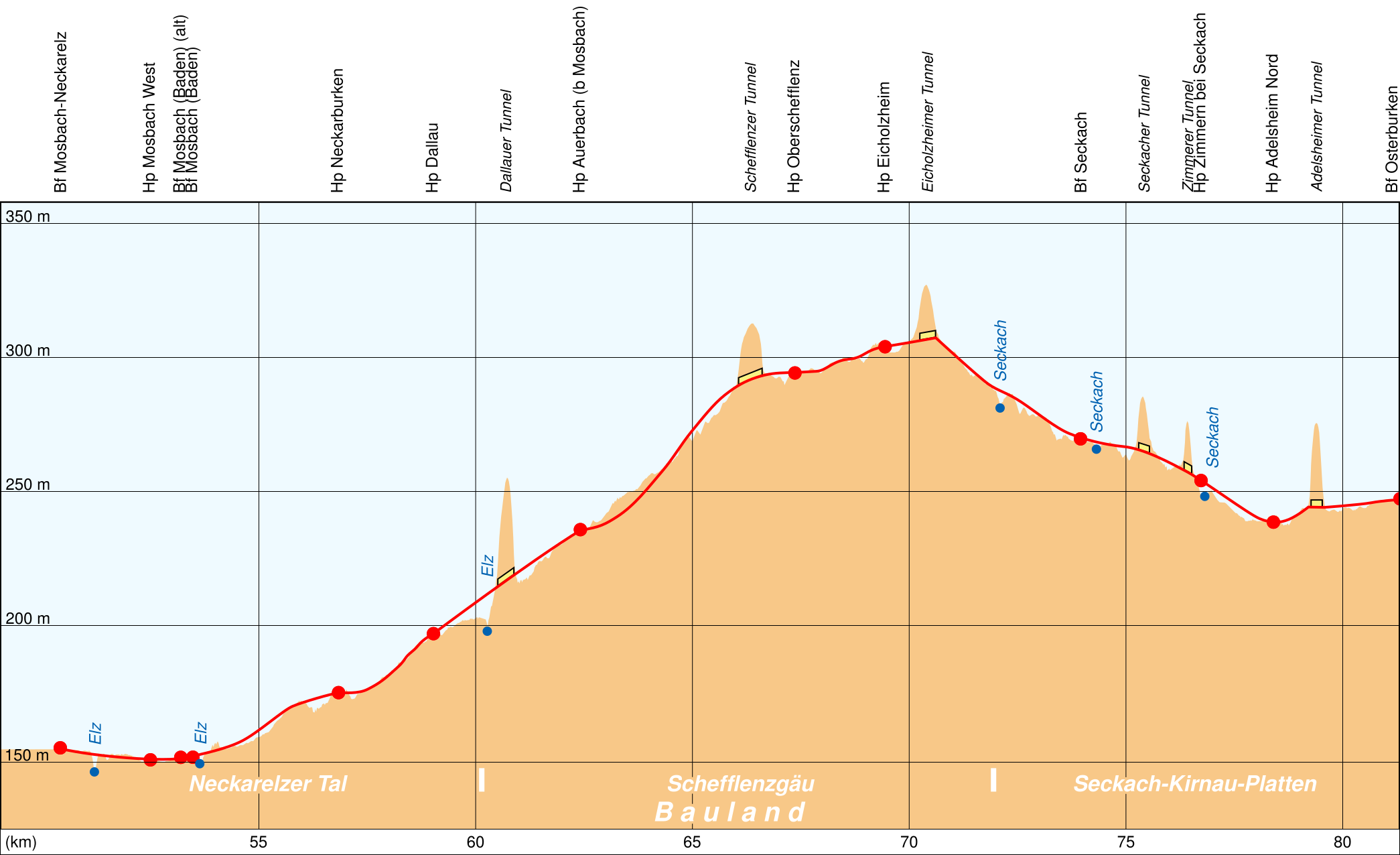
| Source | source for height data: Scharf ("Eisenbahn zwischen Neckar und Main") and topographic map TK25 Baden-Württemberg. Source for ground profile data: TK25. |
| Author | K. Jähne |
Licensing
[edit]
| This work has been released into the public domain by its author, I, Kjunix. This applies worldwide. In some countries this may not be legally possible; if so: I, Kjunix grants anyone the right to use this work for any purpose, without any conditions, unless such conditions are required by law. |
File history
Click on a date/time to view the file as it appeared at that time.
| Date/Time | Thumbnail | Dimensions | User | Comment | |
|---|---|---|---|---|---|
| current | 20:28, 13 March 2017 | | 2,090 × 1,276 (219 KB) | Kjunix (talk | contribs) | == {{int:filedesc}} == {{Information |Description = *{{de|1=Höhenprofil der Bahnstrecke Neckarelz–Osterburken.}} |Source = source for height data: Scharf ("Eisenbahn zwischen Neckar und Main") and topographic map TK25 Baden-Württemberg. Source for... |
You cannot overwrite this file.
File usage on Commons
The following 4 pages use this file:
File usage on other wikis
The following other wikis use this file:
- Usage on de.wikipedia.org