File:Bahnkarte Isartalbahn.jpg
Jump to navigation
Jump to search
Size of this preview: 438 × 599 pixels. Other resolutions: 175 × 240 pixels | 351 × 480 pixels | 561 × 768 pixels | 748 × 1,024 pixels | 1,579 × 2,160 pixels.
Original file (1,579 × 2,160 pixels, file size: 2.14 MB, MIME type: image/jpeg)
Captions
Captions
Add a one-line explanation of what this file represents
| Description |
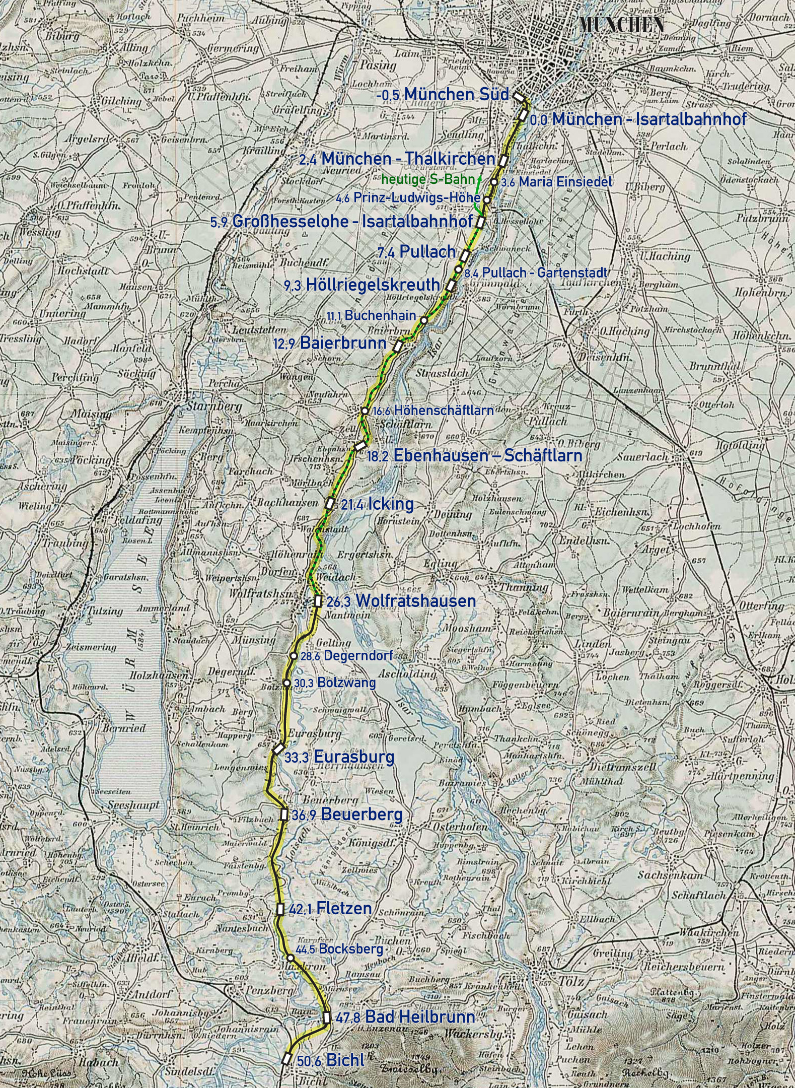
Deutsch: Karte der de:Isartalbahn |
| Date | |
| Source | Own work, using this sheet of the General Map of Central Europe from the 3rd Military Mapping Survey of Austria-Hungary |
| Author | Maximilian Dörrbecker (Chumwa) |
| Permission (Reusing this file) |
I, the copyright holder of this work, hereby publish it under the following license: This file is licensed under the Creative Commons Attribution-Share Alike 2.5 Generic license.
Sie dürfen das Bild zu den folgenden Bedingungen nutzen:
|
| Other versions |
|


.png)
File history
Click on a date/time to view the file as it appeared at that time.
| Date/Time | Thumbnail | Dimensions | User | Comment | |
|---|---|---|---|---|---|
| current | 06:02, 26 March 2012 | | 1,579 × 2,160 (2.14 MB) | Chumwa (talk | contribs) | andere Farbgebung |
| 05:20, 26 March 2012 |  | 1,579 × 2,160 (2.12 MB) | Chumwa (talk | contribs) | {{Information |Description= {{ de }} Karte der de:Isartalbahn |Source={{Own}}, using this sheet of the General Map of Central Europe from the 3rd Military Mapping Survey of... |
You cannot overwrite this file.
File usage on Commons
The following 3 pages use this file:
File usage on other wikis
The following other wikis use this file:
- Usage on de.wikipedia.org
- Usage on en.wikipedia.org
- Usage on www.wikidata.org