File:Baantjegracht Dokkum 2010.jpg
Jump to navigation
Jump to search

Size of this preview: 799 × 599 pixels. Other resolutions: 320 × 240 pixels | 640 × 480 pixels | 1,024 × 768 pixels | 1,280 × 960 pixels | 2,591 × 1,944 pixels.
Original file (2,591 × 1,944 pixels, file size: 1.73 MB, MIME type: image/jpeg)
Captions
Captions
Add a one-line explanation of what this file represents
Summary[edit]
| Camera location | | View this and other nearby images on: OpenStreetMap |
|---|
| Description |
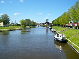
Nederlands: De Baantjegracht met de windmolen Zeldenrust aan de rechterzijde. Genomen vanaf De Hoop in Dokkum.
|
| Date | |
| Source | Own work |
| Author | Krinkle |
Licensing[edit]
This file is licensed under the Creative Commons Attribution 4.0 International license.
Attribution: Timo Tijhof
- You are free:
- to share – to copy, distribute and transmit the work
- to remix – to adapt the work
- Under the following conditions:
- attribution – You must give appropriate credit, provide a link to the license, and indicate if changes were made. You may do so in any reasonable manner, but not in any way that suggests the licensor endorses you or your use.

|
As stated in the above license, you may freely use my photos as long you include the attribution text. These and other aspects of the license could be waived if you get prior consent from me. To discuss details, contact me by e-mail. |
File history
Click on a date/time to view the file as it appeared at that time.
| Date/Time | Thumbnail | Dimensions | User | Comment | |
|---|---|---|---|---|---|
| current | 00:44, 7 May 2010 | | 2,591 × 1,944 (1.73 MB) | Krinkle (talk | contribs) | == {{int:filedesc}} == {{location|53|19|22.88|N|5|59|52.45|E|region:NL_dim:440_heading:NW}} {{Information | Description = {{nl| De Baantjegracht met de windmolen Zeldenrust aan de rechterzijde. Genomen |
You cannot overwrite this file.
File usage on Commons
The following page uses this file:
File usage on other wikis
The following other wikis use this file:
- Usage on en.wikipedia.org
- Usage on www.wikidata.org