File:BSicon hRP4oWeq.svg
Jump to navigation
Jump to search

Size of this PNG preview of this SVG file: 500 × 500 pixels. Other resolutions: 240 × 240 pixels | 480 × 480 pixels | 768 × 768 pixels | 1,024 × 1,024 pixels | 2,048 × 2,048 pixels.
Original file (SVG file, nominally 500 × 500 pixels, file size: 736 bytes)
Captions
Captions
Add a one-line explanation of what this file represents
Summary[edit]
| Description |
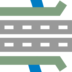
English: four-lane road across on bridge end over water Esperanto: Kvaralea ŝoseo horizontale en pontfino sur akvo Português: Fim de ponte na horizontal em estrada de quatro faixas sobre água |
| Date | |
| Source |
Own work based on: BSicon hRP4oRP2a.svg |
| Author |
derivative work: Tuvalkin |
| Other versions |
Derivative works of this file: |
| SVG development | This BSicon was created with a text editor. |
Licensing[edit]
| This image of simple geometry is ineligible for copyright and therefore in the public domain, because it consists entirely of information that is common property and contains no original authorship. |  |
Original upload log[edit]
This image is a derivative work of the following images:
- BSicon hRP4oRP2a.svg licensed with PD-shape
- 2011-11-24T03:41:17Z Tuvalkin 500x500 (1149 Bytes) == {{int:filedesc}} == {{Information |Description={{en|1= four-lane road on bridge start over two-lane road}} {{eo|1= Kvaralea ŝoseo en ponteko sur dualea ŝoseo}} {{pt|1= Início de ponte em estrada de quatro faixas sobre e
- BSicon WBRÜCKEq.svg licensed with PD-ineligible
- 2010-11-25T17:39:18Z Axpde 500x500 (795 Bytes) Reverted to version as of 20:34, 1 December 2008
- 2010-11-22T16:32:24Z T0118163 500x500 (744 Bytes) New File
- 2008-12-01T20:34:09Z Axpde 500x500 (795 Bytes) new rendered river
- 2008-11-22T23:34:21Z Axpde 500x500 (949 Bytes) {{Information |Description={{en|1=water bridge a''q''ross}} {{de|1=Wasserbrücke quer}} |Source=self-made |Author=[[:de:Benutzer:axpde]] |Date=22.11.2008 |Permission={{cc-by-sa-3.0-de}} |other_versions= }} {{FVBS Bilderkatalo
Uploaded with derivativeFX
File history
Click on a date/time to view the file as it appeared at that time.
| Date/Time | Thumbnail | Dimensions | User | Comment | |
|---|---|---|---|---|---|
| current | 08:02, 26 December 2022 | | 500 × 500 (736 bytes) | Minorax (talk | contribs) | trim // Editing SVG source code using c:User:Rillke/SVGedit.js |
| 03:26, 27 November 2011 |  | 500 × 500 (1,017 bytes) | Tuvalkin (talk | contribs) | == {{int:filedesc}} == {{Information |Description={{en|1= four-lane road across on bridge start over water}} {{eo|1= Kvaralea ŝoseo horizontale en ponteko sur akvo}} {{pt|1= Início de ponte na horizontal em estrada de quatro faixas sobre água}} |Source |
You cannot overwrite this file.
File usage on Commons
The following 16 pages use this file:
- BSicon/Catalogue/generic roads
- User:AlgaeGraphix/BSicon 10
- User:Arieschen62/BSicon
- User:Circeus/BSicon renaming/Blue
- User:JJMC89 bot/report/BSicons/changes/2017-04 (02)
- User:JJMC89 bot/report/BSicons/changes/2017-04 (03)
- User:JJMC89 bot/report/BSicons/changes/2017-10 (02)
- User:JJMC89 bot/report/BSicons/changes/2022-03 (02)
- User:JJMC89 bot/report/BSicons/changes/2022-08
- User:JJMC89 bot/report/BSicons/changes/2022-12 (04)
- User:JJMC89 bot/report/BSicons/logs/upload/2011-11
- User:JJMC89 bot/report/BSicons/logs/upload/2022-12
- File:BSicon hRP2oWaq.svg
- File:BSicon hRP2oWeq.svg
- File:BSicon hRP4oWaq.svg
- Category talk:Icons for motorway descriptions/generic/descriptions
File usage on other wikis
The following other wikis use this file:
- Usage on en.wikipedia.org
- Severn Tunnel Junction railway station
- Newport railway station
- Gloucester–Newport line
- Chepstow railway station
- Caldicot railway station
- Llanwern railway station
- Sandgate Road
- Talk:Wye Valley Railway
- Awre for Blakeney railway station
- Template:Gloucester to Newport Line
- Grange Court railway station
- Newnham railway station
- Magor railway station
- Corgo line
- Template:Portland Streetcar NS Line
- NS Line
- Portskewett railway station
- Usage on es.wikipedia.org
- Usage on fr.wikipedia.org
- Usage on ko.wikipedia.org
- Usage on pt.wikipedia.org
- Usage on ru.wikipedia.org
- Иркутск
- Смолино (станция)
- Сыростан (станция)
- Шакша (станция)
- Инская
- Пенза I
- Миасс II
- Миасс I
- Шаблон:Уфа — Челябинск
- Шаблон:Михайловский завод — Бакал
- Флюсовая (станция)
- Кисегач (станция)
- Златоуст (станция)
- Иркутск-Пассажирский
- Иркутск-Сортировочный
- 1688 км (платформа)
- Шаблон:Иркутский железнодорожный узел
- Чебаркуль (станция)
- Каширинский (остановочный пункт)
- Кая (станция)
- Курамино (станция)
- Ангарск (станция)
- Красный Узел (станция)
- Правая Уфимка (остановочный пункт)
View more global usage of this file.