File:BSicon RP4wRP2.svg
Jump to navigation
Jump to search

Size of this PNG preview of this SVG file: 500 × 500 pixels. Other resolutions: 240 × 240 pixels | 480 × 480 pixels | 768 × 768 pixels | 1,024 × 1,024 pixels | 2,048 × 2,048 pixels.
Original file (SVG file, nominally 500 × 500 pixels, file size: 679 bytes)
Captions
Captions
Add a one-line explanation of what this file represents
Summary
[edit]
| Description |
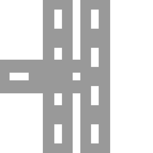
English: four-lane road with two-lane road joining from west Esperanto: Kvaralea ŝoseo kun kuniĝo de kun dualea ŝoseo el okcidento Português: Estrada de quatro faixas com junção de estrada de duas faixas vinda de oeste |
| Date | |
| Source |
Own work based on: BSicon RP4xRP4.svg: |
| Author |
derivative work: Tuvalkin |
| SVG development | This BSicon was created with a text editor. |
Licensing
[edit]
| This image of simple geometry is ineligible for copyright and therefore in the public domain, because it consists entirely of information that is common property and contains no original authorship. |  |
Original upload log
[edit]
This image is a derivative work of the following images:
- BSicon RP4xRP4.svg licensed with PD-self
- 2011-11-05T05:28:33Z Tuvalkin 500x500 (1356 Bytes) == {{int:filedesc}} == {{Information |Description={{en|1= Four-lane road crossing four-lane road}} {{eo|1= Kvaralea ŝoseo kruciĝanta kun kvaralea ŝoseo}} {{pt|1= Estrada de quatro cruzando quatro faixas}} |Source=*[[:File:
Uploaded with derivativeFX
File history
Click on a date/time to view the file as it appeared at that time.
| Date/Time | Thumbnail | Dimensions | User | Comment | |
|---|---|---|---|---|---|
| current | 09:30, 19 January 2023 | | 500 × 500 (679 bytes) | Minorax (talk | contribs) | trim // Editing SVG source code using c:User:Rillke/SVGedit.js |
| 05:04, 6 January 2014 |  | 500 × 500 (895 bytes) | Tuvalkin (talk | contribs) | == {{int:filedesc}} == {{Information |Description={{en|1= four-lane road with two-lane road joining from west}} {{eo|1= Kvaralea ŝoseo kun kuniĝo de kun dualea ŝoseo el okcidento}} {{pt|1= Estrada de quatro faixas com junção de estrada de duas fai... |
You cannot overwrite this file.
File usage on Commons
The following 10 pages use this file:
- BSicon/Catalogue/generic roads
- User:Chumwa/OgreBot/Transport Maps/2023 January 11-20
- User:Chumwa/OgreBot/Travel and communication maps/2023 January 11-20
- User:JJMC89 bot/report/BSicons/changes/2017-04 (02)
- User:JJMC89 bot/report/BSicons/changes/2022-03
- User:JJMC89 bot/report/BSicons/changes/2023-01 (02)
- User:JJMC89 bot/report/BSicons/changes/2023-02
- User:JJMC89 bot/report/BSicons/logs/upload/2014-01
- User:JJMC89 bot/report/BSicons/logs/upload/2023-01
- Category talk:Icons for motorway descriptions/generic/descriptions
File usage on other wikis
The following other wikis use this file:
- Usage on cs.wikipedia.org
- Usage on en.wikipedia.org
- D'Aguilar Highway
- Coronation Drive
- Nicklin Way
- Austin station (CTA Green Line)
- Iron Horse Trail, Ontario
- James Ruse Drive
- Stanley Street, Brisbane
- Fox River Grove station
- Harvey station (Illinois)
- Kingsford Smith Drive, Brisbane
- Sandgate Road
- VIP Road, Kolkata
- Anzac Avenue
- Milton Road
- Arau railway station
- Trams in Graz
- User:Lost on Belmont/South Shore Line
- Maroochydore Road
- Ahmed Adnan Saygun Sanat Merkezi (Tram İzmir)
- Template:VIP Road
- Template:Iron Horse Trail (Ontario)
- User:ArnabSaha/sandbox/map
- Caboolture–Bribie Island Road
- Burpengary–Caboolture Road
- Beerburrum Road
- Caloundra Road
- Brisbane–Woodford Road
- Redcliffe Peninsula road network
- User:Antoni12345/routemaps
- South Pine Road
- Template:Brighton–Redcliffe Road
- Template:Clontarf–Anzac Avenue Road
- Template:Deception Bay Road
- Template:Anzac Avenue
- Template:Kingsford Smith Drive
- User:CaptPicard/Workshop/Graz
- Usage on ja.wikipedia.org
View more global usage of this file.