File:B15 landsat.jpg
Jump to navigation
Jump to search

Size of this preview: 644 × 600 pixels. Other resolutions: 258 × 240 pixels | 515 × 480 pixels | 824 × 768 pixels | 1,099 × 1,024 pixels | 2,400 × 2,236 pixels.
Original file (2,400 × 2,236 pixels, file size: 345 KB, MIME type: image/jpeg)
Captions
Captions
Add a one-line explanation of what this file represents
Summary[edit]
| Description |
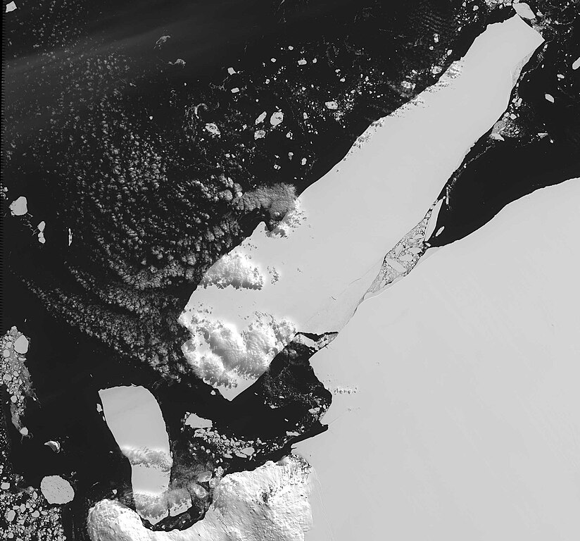
English: Landsat satellite image of Iceberg B-15 in January 2001. The iceberg covered about 11,000 square miles, approximately twice the size of Delaware.
Français : Image satellite du plus grand iceberg du monde, iceberg B-15. Janvier 2001. Il couvrait 28 500 km carrés. |
| Date | |
| Source | http://www-news.uchicago.edu/releases/06/061002.iceberg.shtml (direct link) |
| Author | NASA/GSFC/Robert Bindschadler |
Licensing[edit]
| This file is in the public domain in the United States because it was solely created by NASA. NASA copyright policy states that "NASA material is not protected by copyright unless noted". (See Template:PD-USGov, NASA copyright policy page or JPL Image Use Policy.) | ||
 |
Warnings:
|
File history
Click on a date/time to view the file as it appeared at that time.
| Date/Time | Thumbnail | Dimensions | User | Comment | |
|---|---|---|---|---|---|
| current | 03:17, 21 March 2007 | | 2,400 × 2,236 (345 KB) | Arria Belli (talk | contribs) | {{Information |Description= {{en|Satellite image of Iceberg B-15 on January 2001. The massive iceberg, the world's lagest, covered about 11,000 square miles.}} {{fr|Image satellite du plus grand iceberg du monde, iceberg B-15. Janvier 2001. Il couvrai |
You cannot overwrite this file.
File usage on Commons
The following page uses this file:
File usage on other wikis
The following other wikis use this file:
- Usage on de.wikinews.org
- Usage on en.wikipedia.org
- Usage on fr.wikipedia.org
- Usage on fr.wikinews.org
- Usage on ja.wikipedia.org
- Usage on nn.wikipedia.org
- Usage on oc.wikipedia.org
- Usage on pt.wikipedia.org