File:Bürmoos - Ort - Zillner-Platz - 2020 09 11-6.jpg
Jump to navigation
Jump to search

Size of this preview: 800 × 600 pixels. Other resolutions: 320 × 240 pixels | 640 × 480 pixels | 1,024 × 768 pixels | 1,280 × 960 pixels | 2,560 × 1,920 pixels | 4,032 × 3,024 pixels.
Original file (4,032 × 3,024 pixels, file size: 3.4 MB, MIME type: image/jpeg)
Captions
Captions
Add a one-line explanation of what this file represents
Summary
[edit]
| Description |
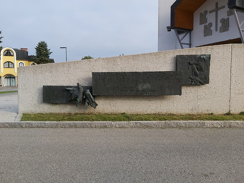
Deutsch: Bürmoos (Bezirk Salzburg-Umgebung): Denkmal an die Typhusepidemie 1945 am Karl-Zillner-Platz vor der evangelischen Kirche. Die Inschrift nennt die Opfer und das Alter der Verstorbenen: ANNA ACKERMANN 21 EDITH DEREGAN 70 RUPERT FISCHER 37 |
| Date | |
| Source | Own work |
| Author | Ewald Ehtreiber |
| Camera location | | View this and other nearby images on: OpenStreetMap |
|---|
Licensing
[edit]
I, the copyright holder of this work, hereby publish it under the following license:
This file is licensed under the Creative Commons Attribution-Share Alike 4.0 International license.
- You are free:
- to share – to copy, distribute and transmit the work
- to remix – to adapt the work
- Under the following conditions:
- attribution – You must give appropriate credit, provide a link to the license, and indicate if changes were made. You may do so in any reasonable manner, but not in any way that suggests the licensor endorses you or your use.
- share alike – If you remix, transform, or build upon the material, you must distribute your contributions under the same or compatible license as the original.

|
Diese Datei wurde im Rahmen von WikiDaheim 2020 in Österreich erstellt und hochgeladen. Sie wurde dem allgemeinen Themenbereich zugeordnet. |
File history
Click on a date/time to view the file as it appeared at that time.
| Date/Time | Thumbnail | Dimensions | User | Comment | |
|---|---|---|---|---|---|
| current | 23:02, 14 September 2020 | | 4,032 × 3,024 (3.4 MB) | Eweht (talk | contribs) | Uploaded own work with UploadWizard |
You cannot overwrite this file.
File usage on Commons
There are no pages that use this file.