File:Béarn des gaves Soubestre 2018-03-11.svg
Jump to navigation
Jump to search

Size of this PNG preview of this SVG file: 800 × 566 pixels. Other resolutions: 320 × 226 pixels | 640 × 453 pixels | 1,024 × 724 pixels | 1,280 × 905 pixels | 2,560 × 1,810 pixels | 1,052 × 744 pixels.
Original file (SVG file, nominally 1,052 × 744 pixels, file size: 9.22 MB)
Captions
Captions
Add a one-line explanation of what this file represents
Summary[edit]
| Description |
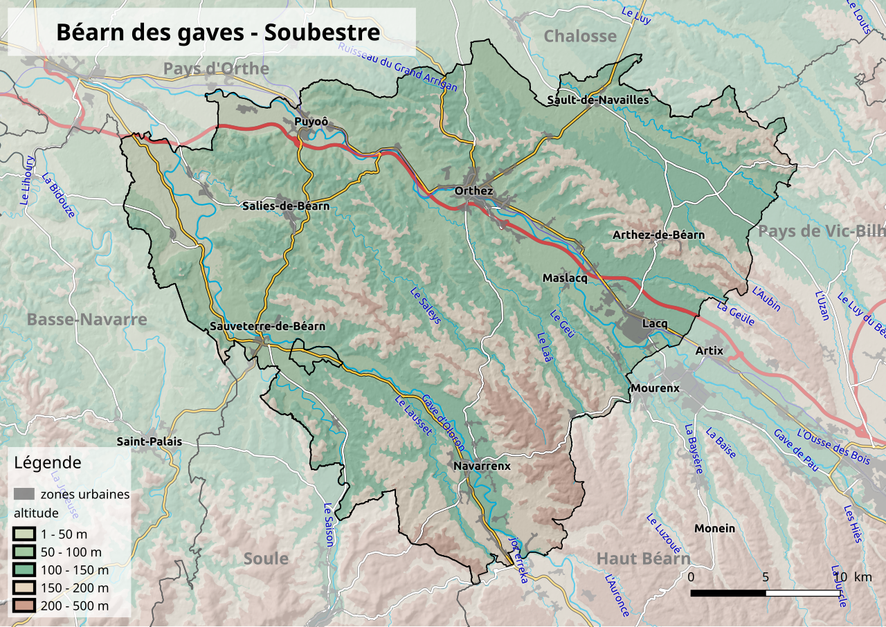
Français : Carte du Béarn des gaves - Soubestre.
Contours approximatifs d'après l'esquisse figurant p. 2 du document "L’habitat traditionnel en Béarn des Gaves - Soubestre" produit par le CAUE 64. Source des données utilisées : le MNT (DEM) est fourni par l'Agence Européenne pour l'Environnement sous le nom "EU-DEM v1.1, European Environment Agency (EEA) under the framework of the Copernicus programme", les routes et les rivières sont extraites de OpenStreetMap. Les zones urbaines sont extraites de Corine Land Cover version 2012 |
| Date | |
| Source | Own work |
| Author | Florent Beck |
Licensing[edit]
I, the copyright holder of this work, hereby publish it under the following license:
This file is licensed under the Creative Commons Attribution-Share Alike 4.0 International license.
- You are free:
- to share – to copy, distribute and transmit the work
- to remix – to adapt the work
- Under the following conditions:
- attribution – You must give appropriate credit, provide a link to the license, and indicate if changes were made. You may do so in any reasonable manner, but not in any way that suggests the licensor endorses you or your use.
- share alike – If you remix, transform, or build upon the material, you must distribute your contributions under the same or compatible license as the original.
File history
Click on a date/time to view the file as it appeared at that time.
| Date/Time | Thumbnail | Dimensions | User | Comment | |
|---|---|---|---|---|---|
| current | 16:25, 11 March 2018 | | 1,052 × 744 (9.22 MB) | BotaFlo (talk | contribs) | User created page with UploadWizard |
You cannot overwrite this file.
File usage on Commons
The following page uses this file: