File:Bärenbach (Urschenbach).jpg
Jump to navigation
Jump to search
Size of this preview: 800 × 515 pixels. Other resolutions: 320 × 206 pixels | 640 × 412 pixels | 1,024 × 659 pixels | 1,280 × 824 pixels | 2,560 × 1,648 pixels | 3,658 × 2,355 pixels.
Original file (3,658 × 2,355 pixels, file size: 4.28 MB, MIME type: image/jpeg)
Captions
Captions
Add a one-line explanation of what this file represents
| Description |
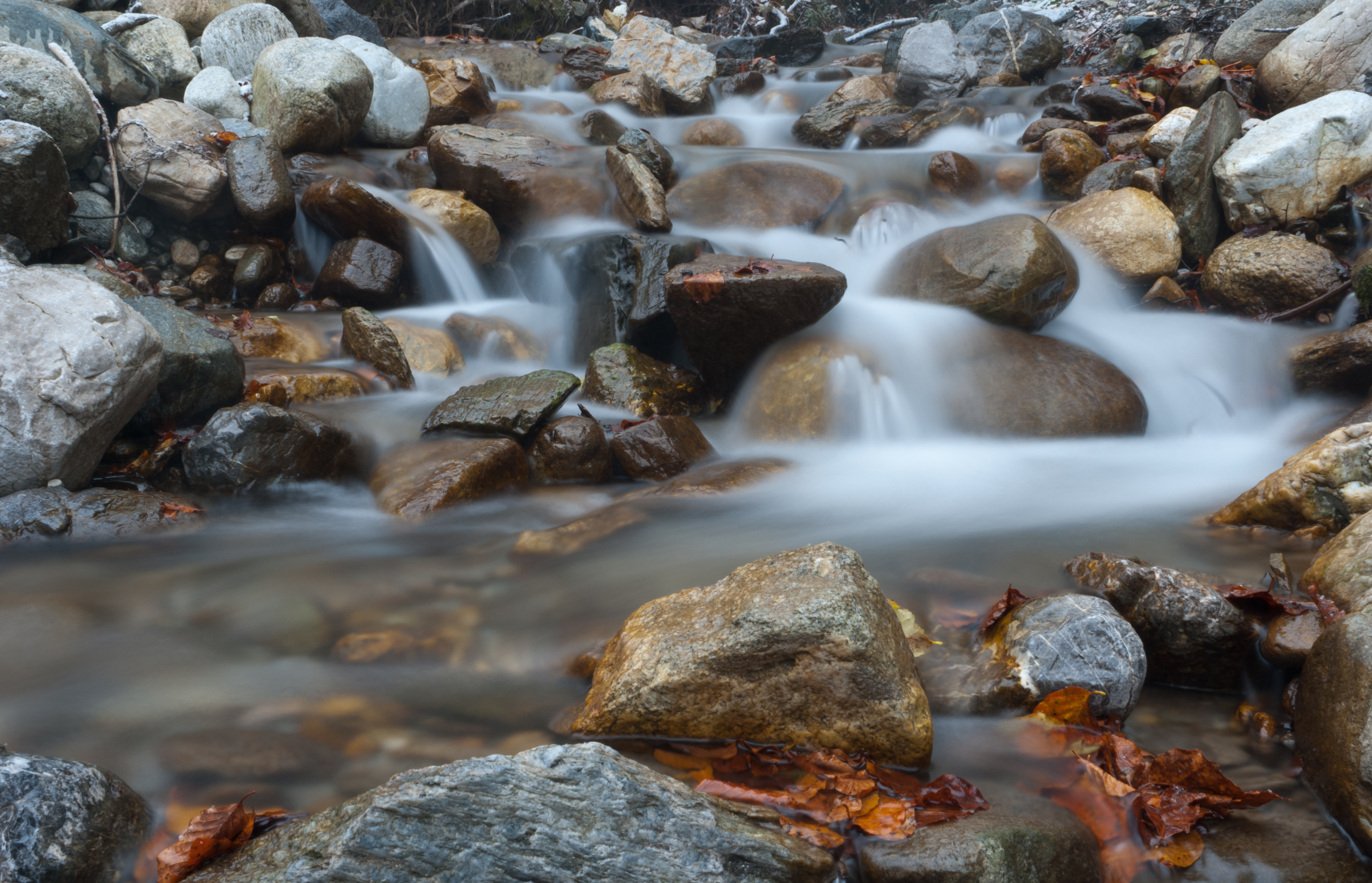
Deutsch: Der Bärenbach zwischen Fritzens und Gnadenwald, der in seinem Oberlauf Urschenbach (von lat. "ursus" = Bär) heißt English: The Bärenbach stream between Fritzens and Gnadenwald. In the upper reaches the stream is called "Urschenbach" which comes from the latin word "ursus"=bear Español: El Bärenbach (algo así como el Arroyo de los osos, pues Bären en alemán significa osos) entre Fritzens y Gnadenwald, que en su curso alto se denomina Urschenbach, del latín ursus, que también significa oso. |
| Date | |
| Source | Own work |
| Author | Hermann Hammer (User:Haneburger) |
| Permission (Reusing this file) |
English: You are free to use the picture, if you want, mention "Hermann Hammer" as author Deutsch: Freie Verwendung, als Autor kann man "Hermann Hammer" angeben |
| Camera location | | View this and other nearby images on: OpenStreetMap |
|---|
.jpg¶ms=047.314941_N_0011.563368_E_globe:Earth_type:camera_region:AT_heading:315.00&language=en)
I, the copyright holder of this work, hereby publish it under the following license:
| This file is made available under the Creative Commons CC0 1.0 Universal Public Domain Dedication. | |
| The person who associated a work with this deed has dedicated the work to the public domain by waiving all of their rights to the work worldwide under copyright law, including all related and neighboring rights, to the extent allowed by law. You can copy, modify, distribute and perform the work, even for commercial purposes, all without asking permission.
|
This image has been assessed using the Quality image guidelines and is considered a Quality image.
|
File history
Click on a date/time to view the file as it appeared at that time.
| Date/Time | Thumbnail | Dimensions | User | Comment | |
|---|---|---|---|---|---|
| current | 15:01, 5 November 2012 | | 3,658 × 2,355 (4.28 MB) | Haneburger (talk | contribs) | CAs removed |
| 07:39, 29 October 2012 |  | 3,658 × 2,355 (4.72 MB) | Haneburger (talk | contribs) | turned a little bit to the left | |
| 18:34, 28 October 2012 |  | 3,872 × 2,592 (5.99 MB) | Haneburger (talk | contribs) | {{Information |Description=Der Bärenbach zwischen Fritzens und Gnadenwald, der in seinem Oberlauf Urschenbach heißt |Source={{own}} |Date=2012-10-28 |Author=Hermann Hammer (User:Haneburger) |Permission= {{en|1=You are free to use the picture... |
You cannot overwrite this file.
File usage on Commons
The following 3 pages use this file:
.jpg&oldid=871231023)