File:Avenue de l'Opéra, Paris, France - panoramio (110).jpg
Jump to navigation
Jump to search

Size of this preview: 800 × 450 pixels. Other resolutions: 320 × 180 pixels | 640 × 360 pixels | 1,024 × 576 pixels | 1,280 × 720 pixels | 1,920 × 1,080 pixels.
Original file (1,920 × 1,080 pixels, file size: 603 KB, MIME type: image/jpeg)
Captions
Captions
Add a one-line explanation of what this file represents
Summary
[edit].jpg&action=edit§ion=1)
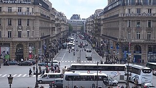
| Description | Avenue de l'Opéra and Place de l'Opéra | ||
| Date | Taken on 5 May 2012 | ||
| Source | https://web.archive.org/web/20161031073306/http://www.panoramio.com/photo/113534075 | ||
| Author | Seko Naotomo | ||
| Permission (Reusing this file) |
This file is licensed under the Creative Commons Attribution 3.0 Unported license. Attribution: Seko Naotomo
|
||
| Panoramio Tags | Paris |
| Camera location | | View this and other nearby images on: OpenStreetMap |
|---|
.jpg¶ms=048.870809_N_0002.332279_E_globe:Earth_type:camera_source:Panoramio_&language=en)
File history
Click on a date/time to view the file as it appeared at that time.
| Date/Time | Thumbnail | Dimensions | User | Comment | |
|---|---|---|---|---|---|
| current | 16:51, 7 May 2017 | | 1,920 × 1,080 (603 KB) | Panoramio upload bot (talk | contribs) | == {{int:filedesc}} == {{Information |description=Saint-Germain-l'Auxerrois, Paris, France |date={{Taken on|2012-05-05}} |source=http://www.panoramio.com/photo/113534075 |author=[http://www.panoramio.com/user/674116?with_photo_id=113534075 Seko Naotomo... |
You cannot overwrite this file.
File usage on Commons
The following page uses this file:
.jpg&redirect=no)
.jpg&oldid=809106557)