File:Atlas de Trudaine pour la généralité de Paris. Département de Versailles. 1 - Archives Nationales - CP-F-14-8448 n°23.jpg
Jump to navigation
Jump to search

Size of this preview: 800 × 537 pixels. Other resolutions: 320 × 215 pixels | 640 × 430 pixels | 1,024 × 688 pixels | 1,280 × 860 pixels | 2,000 × 1,343 pixels.
Original file (2,000 × 1,343 pixels, file size: 1.32 MB, MIME type: image/jpeg)
Captions
Captions
Add a one-line explanation of what this file represents
French: Atlas de Trudaine pour la généralité de Paris. Département de Versailles.
(1)( |
|||||||||||||||||||||
|---|---|---|---|---|---|---|---|---|---|---|---|---|---|---|---|---|---|---|---|---|---|
| Title |
French:
(1)Atlas de Trudaine pour la généralité de Paris. Département de Versailles. |
||||||||||||||||||||
| Description |
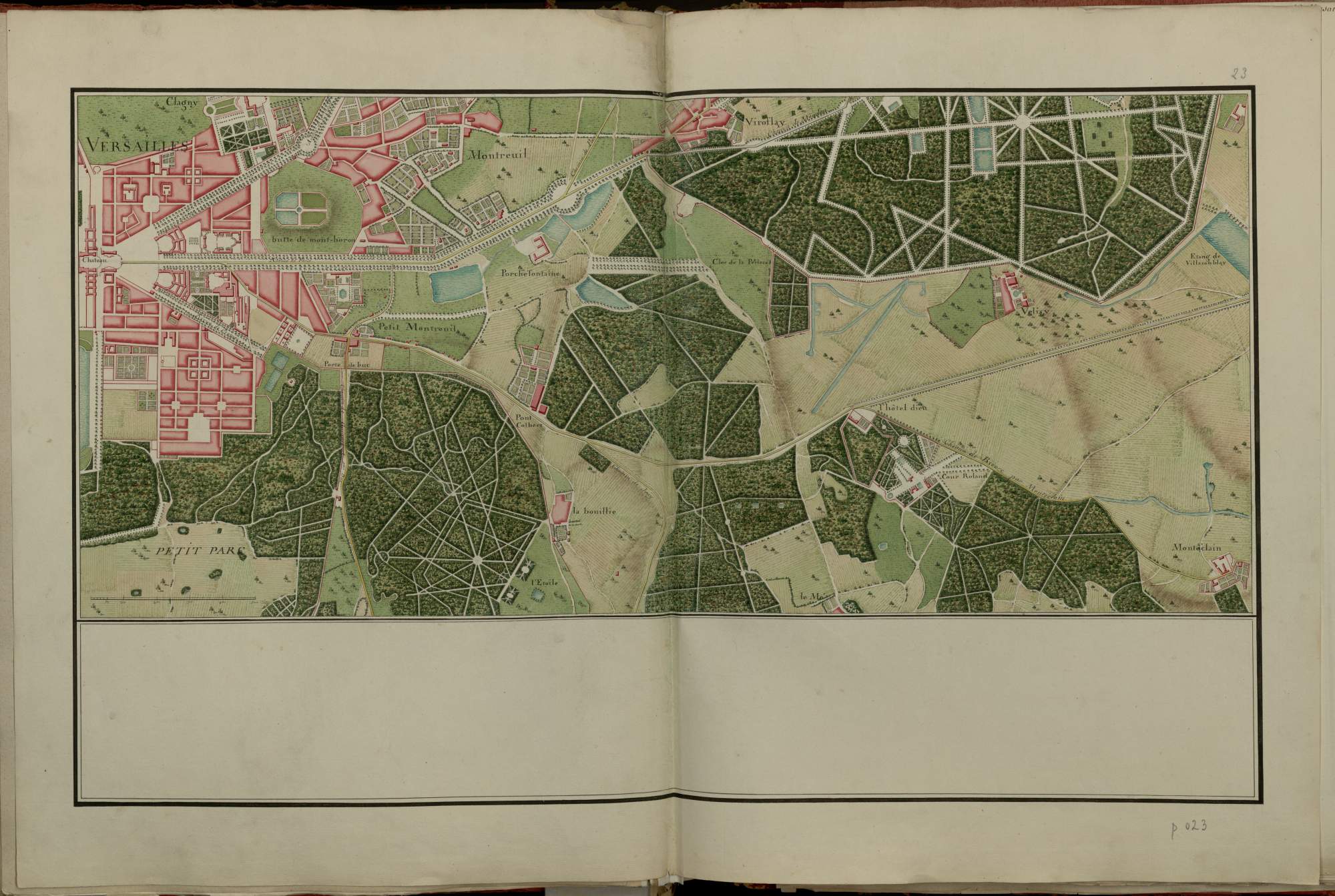
Français : Atlas de Trudaine pour la généralité de Paris. Département de Versailles. Portion de route à partir du château de Versailles jusqu'à Viroflay d'un côté, et à l'étang de Villacoublay d'un autre côté, avec croisement du chemin de Guiancourt par Buc et embranchement à l'Hôtel-Dieu du chemin de Bièvre par Monteclain. |
||||||||||||||||||||
| Date | between 1745 and 1780 | ||||||||||||||||||||
| Medium | drawing paper | ||||||||||||||||||||
| Dimensions | height: 59.5 cm (23.4 in); width: 88.5 cm (34.8 in) | ||||||||||||||||||||
| Collection |
|
||||||||||||||||||||
| Accession number |
CP/F/14/8448 n°23 |
||||||||||||||||||||
| References |
|
||||||||||||||||||||
| Source/Photographer |
|
||||||||||||||||||||
| Permission (Reusing this file) |
|
||||||||||||||||||||


| Object location | | View this and other nearby images on: OpenStreetMap |
|---|
File history
Click on a date/time to view the file as it appeared at that time.
| Date/Time | Thumbnail | Dimensions | User | Comment | |
|---|---|---|---|---|---|
| current | 09:59, 7 September 2014 | | 2,000 × 1,343 (1.32 MB) | ArchivesNationalesBot (talk | contribs) | {{subst:Commons:Archives_Nationales/Ingestion |_ext=jpg |Fichier=Atlas-Trudaine_ville_de_Versailles_F_14_8448_23.jpg |Titre du document=Atlas de Trudaine pour la généralité de Paris. Département de Versailles. |Description du document=Atlas de Trud... |
You cannot overwrite this file.
File usage on Commons
The following page uses this file:
File usage on other wikis
The following other wikis use this file:
- Usage on fr.wikipedia.org
- Usage on it.wikipedia.org
- Usage on www.wikidata.org
Metadata
Categories:
- Atlas de Trudaine
- Historical images of the Palace of Versailles
- Maps of Vélizy-Villacoublay
- Maps of Viroflay
- Media contributed by the Archives Nationales (France)/3
- Media contributed by the Archives Nationales (France)/2015
- Yvelines (département) in the Archives nationales (France)
- 18th century documents in the Archives nationales (France)