File:Atlantic Star Airlines route network.svg
Jump to navigation
Jump to search

Size of this PNG preview of this SVG file: 580 × 599 pixels. Other resolutions: 232 × 240 pixels | 465 × 480 pixels | 744 × 768 pixels | 991 × 1,024 pixels | 1,983 × 2,048 pixels | 1,190 × 1,229 pixels.
Original file (SVG file, nominally 1,190 × 1,229 pixels, file size: 1.75 MB)
Captions
Captions
Add a one-line explanation of what this file represents
Summary[edit]
| Description |
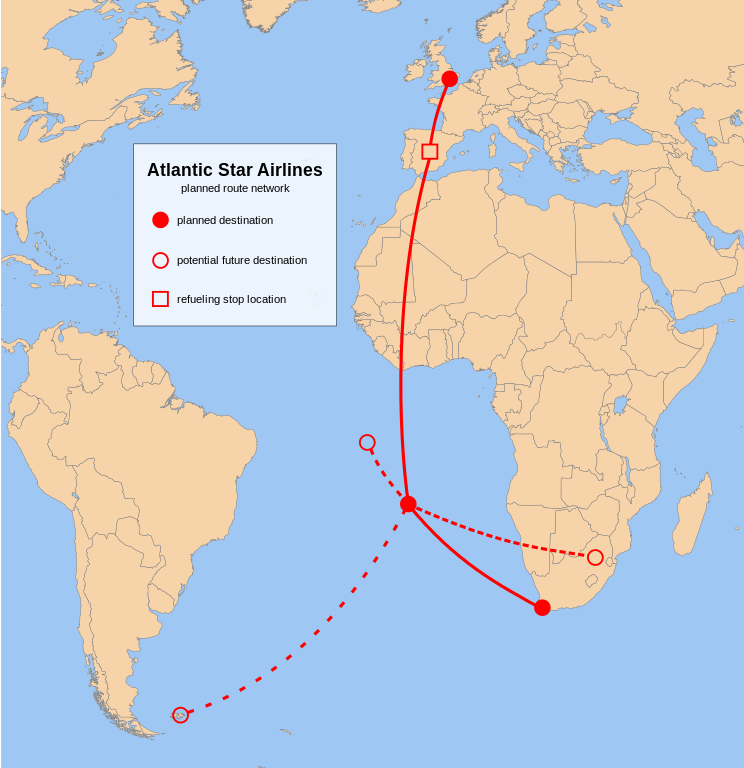
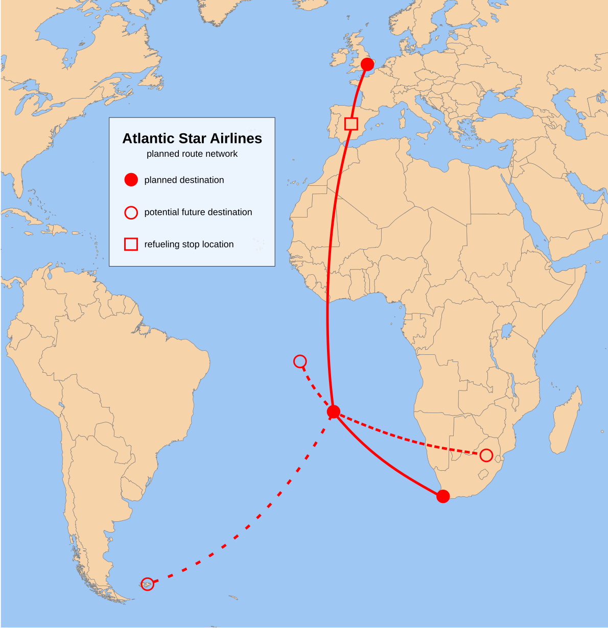
English: planned route network of Atlantic Star Airlines |
| Date | |
| Source | Own work based on: ColoredBlankMap-World-10E.svg by Shadowxfox |
| Author | Cvdr |
| SVG development |
Licensing[edit]
I, the copyright holder of this work, hereby publish it under the following license:
| This file is made available under the Creative Commons CC0 1.0 Universal Public Domain Dedication. | |
| The person who associated a work with this deed has dedicated the work to the public domain by waiving all of their rights to the work worldwide under copyright law, including all related and neighboring rights, to the extent allowed by law. You can copy, modify, distribute and perform the work, even for commercial purposes, all without asking permission.
|
File history
Click on a date/time to view the file as it appeared at that time.
| Date/Time | Thumbnail | Dimensions | User | Comment | |
|---|---|---|---|---|---|
| current | 15:37, 26 January 2014 | | 1,190 × 1,229 (1.75 MB) | Cvdr (talk | contribs) | moved refuelling stop location from Malaga to Madrid |
| 23:35, 20 June 2013 |  | 1,190 × 1,229 (1.75 MB) | Cvdr (talk | contribs) | updated according to news article {{cite news | last = Pipe | first = Simon | title = Ascension shuttle is ‘do-able’, says would-be airline chief | newspaper = St Helena Online | location = Jamestown | date = 20 June 2013 | url = http://sthelenaon... | |
| 22:37, 17 June 2013 |  | 1,149 × 1,149 (1.75 MB) | Cvdr (talk | contribs) | improved visibility | |
| 20:24, 17 June 2013 |  | 1,149 × 1,149 (1.75 MB) | Cvdr (talk | contribs) | fonts fixed | |
| 20:20, 17 June 2013 |  | 1,149 × 1,149 (1.75 MB) | Cvdr (talk | contribs) | {{Information |Description ={{en|1=planned route network of Atlantic Star Airlines}} |Source ={{own}} based on File:ColoredBlankMap-World-10E.svg |Author =Cvdr based on work of Shadowfox |Date ... |
You cannot overwrite this file.
File usage on Commons
There are no pages that use this file.
File usage on other wikis
The following other wikis use this file:
- Usage on es.wikipedia.org
- Usage on fr.wikipedia.org