File:Aschergraben Fotothek Oberreit, Sect. Altenberg, 1821 (01).jpg
Jump to navigation
Jump to search
Size of this preview: 500 × 599 pixels. Other resolutions: 200 × 240 pixels | 401 × 480 pixels | 793 × 950 pixels.
Original file (793 × 950 pixels, file size: 932 KB, MIME type: image/jpeg)
Captions
Captions
Add a one-line explanation of what this file represents
| Description |
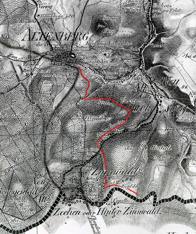
Deutsch: Das Bild zeigt den Verlauf des Aschgrabens zwischen Zinnwald und Altenberg. Der 7 km lange Graben ist eine der ältesten erhaltenen Anlagen der bergmännischen Wasserwirtschaft im Erzgebirge. |
||||||
| Date | |||||||
| Source | |||||||
| Author | Deutsche Fotothek (Jakob Andreas Hermann Oberreit (1821): Topographischer Atlas des Königreichs Sachsen. 1:57.600. Dresden) | ||||||
| Permission (Reusing this file) |
|
||||||
File history
Click on a date/time to view the file as it appeared at that time.
| Date/Time | Thumbnail | Dimensions | User | Comment | |
|---|---|---|---|---|---|
| current | 22:20, 21 October 2010 | | 793 × 950 (932 KB) | Norbert Kaiser (talk | contribs) | {{Information |Description = {{en|.}} {{de|Das Bild zeigt den Verlauf des Aschgrabens zwischen Zinnwald und Altenberg. Der 7 km lange Graben ist eine der ältesten erhaltenen Anlagen de |
You cannot overwrite this file.
File usage on Commons
The following page uses this file:
File usage on other wikis
The following other wikis use this file:
- Usage on de.wikipedia.org
.jpg&oldid=854001967)