File:Aschaffenburg LTA BLSA W.jpg
Jump to navigation
Jump to search

Size of this preview: 800 × 480 pixels. Other resolutions: 320 × 192 pixels | 1,024 × 614 pixels | 1,280 × 768 pixels | 2,500 × 1,500 pixels.
Original file (2,500 × 1,500 pixels, file size: 4.48 MB, MIME type: image/jpeg)
Captions
Captions
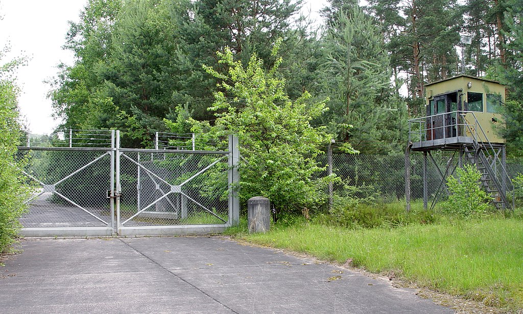
Aschaffenburg, Schweinheim LTA, BLSA
Summary[edit]
| Description |
Deutsch: Aschaffenburg, Standortübungsplatz Schweinheim, Westeingang zu BLSA (basic load storage area) Aschaffenburg, ex NATO Site 21. Das Gelände wird nicht mehr militärisch genutzt und gehört nun zu einem Naturschutzgebiet.
English: Aschaffenburg, Schweinheim LTA (local training area), west entrance to Aschaffenburg BLSA (basic load storage area), ex NATO Site 21. The area is out of military use and now part of a natural reserve. |
| Date | |
| Source | Own work |
| Author | KaiBorgeest |
| Camera location | | View this and other nearby images on: OpenStreetMap |
|---|
Licensing[edit]
I, the copyright holder of this work, hereby publish it under the following license:
This file is licensed under the Creative Commons Attribution-Share Alike 4.0 International license.
- You are free:
- to share – to copy, distribute and transmit the work
- to remix – to adapt the work
- Under the following conditions:
- attribution – You must give appropriate credit, provide a link to the license, and indicate if changes were made. You may do so in any reasonable manner, but not in any way that suggests the licensor endorses you or your use.
- share alike – If you remix, transform, or build upon the material, you must distribute your contributions under the same or compatible license as the original.
File history
Click on a date/time to view the file as it appeared at that time.
| Date/Time | Thumbnail | Dimensions | User | Comment | |
|---|---|---|---|---|---|
| current | 22:16, 7 December 2021 | | 2,500 × 1,500 (4.48 MB) | KaiBorgeest (talk | contribs) | Uploaded own work with UploadWizard |
You cannot overwrite this file.
File usage on Commons
The following 4 pages use this file: