File:Arthur H. Compton House (7373049818).jpg

Original file (3,648 × 2,736 pixels, file size: 5.23 MB, MIME type: image/jpeg)
Captions
Captions
Summary[edit]
.jpg&action=edit§ion=1)
| Description |
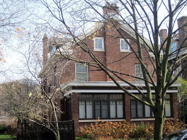
The Arthur H. Compton House in Chicago, a national landmark (1916). Compton was born in Ohio as the son of the dean of the College of Wooster. Arthur Compton earned his Ph.D. from Princeton, just like his other two brothers. Compton is best known for Compton scattering, which demonstrated the particle aspect of electromagnetic radiation. He fired X-rays at a known wavelength at atoms to observe the effect on wavelength. If light was indeed a particle, then the wavelength would inevitably change upon contact with the atom. Indeed, scattered rays had a larger wavelength than the initial X-ray, since the atom absorbed some of the momentum. He was able to devise a formula to predict the change in wavelength based on the rest mass of the electron, establishing the Compton wavelength (2.426 x 10^-12 m for the electron). Compton won the Nobel Prize for Physics in 1927. He began to teach at the University of Chicago two years later. In 1941, Compton was tasked with the S-1 Uranium Committee, which later evolved into the Manhattan Project. Compton wanted to isolate plutonium at Chicago, a plan that immediately sprang into motion after the attack on Pearl Harbor. He organized the Metallurgical Laboratory, the top-secret lab at Chicago. In September 1942, plutonium was isolated, and in December, a team led by Enrico Fermi sustained a chain reaction in the world's first nuclear reactor. After the nuclear bomb was assembled in 1945, Compton advocated for its use against Japanese cities.
|
||
| Date | |||
| Source |
|
||
| Author | Teemu008 from Palatine, Illinois |
| Camera location | | View this and other nearby images on: OpenStreetMap |
|---|
.jpg¶ms=041.792156_N_-087.596188_E_globe:Earth_type:camera_source:Flickr_&language=en)
Licensing[edit]
.jpg&action=edit§ion=2)
- You are free:
- to share – to copy, distribute and transmit the work
- to remix – to adapt the work
- Under the following conditions:
- attribution – You must give appropriate credit, provide a link to the license, and indicate if changes were made. You may do so in any reasonable manner, but not in any way that suggests the licensor endorses you or your use.
- share alike – If you remix, transform, or build upon the material, you must distribute your contributions under the same or compatible license as the original.
| This image, originally posted to Flickr, was reviewed on 8 November 2013 by the administrator or reviewer File Upload Bot (Magnus Manske), who confirmed that it was available on Flickr under the stated license on that date. |
File history
Click on a date/time to view the file as it appeared at that time.
| Date/Time | Thumbnail | Dimensions | User | Comment | |
|---|---|---|---|---|---|
| current | 03:52, 8 November 2013 | | 3,648 × 2,736 (5.23 MB) | File Upload Bot (Magnus Manske) (talk | contribs) | Transferred from Flickr by User:AlbertHerring |
You cannot overwrite this file.
File usage on Commons
There are no pages that use this file.
File usage on other wikis
The following other wikis use this file:
- Usage on en.wikipedia.org
- Usage on ja.wikipedia.org
- Usage on mk.wikipedia.org
- Usage on ro.wikipedia.org
- Usage on th.wikipedia.org
- Usage on zh.wikipedia.org
.jpg&oldid=804323697)