File:Arroyo del gato puente calle 7.jpg
Original file (3,968 × 2,976 pixels, file size: 3.91 MB, MIME type: image/jpeg)
Captions
Summary
[edit]DescriptionArroyo del gato puente calle 7.jpg |
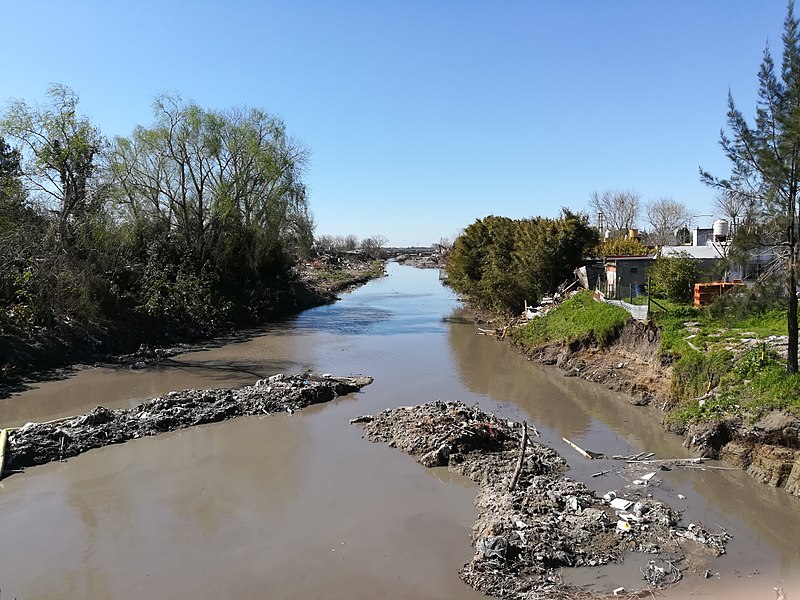
Español: El arroyo del gato visto desde el puente en calle 7, al fondo se ve el viaducto del Ferrocarril Roca |
Date | |
Source | Own work |
Author | BugWarp |
Camera location | 34° 53′ 09.83″ S, 57° 59′ 18.9″ W | View this and other nearby images on: OpenStreetMap | -34.886063; -57.988583 |
---|
Licensing
[edit]The file is licenced under Revision 42 of the Beerware Licence. I wrote this file. As long as you retain this notice you can do whatever you want with this stuff. If we meet some day, and you think this stuff is worth it, you can buy me a beer in return.Beerware LicenseBeerwarehttps://en.wikipedia.org/wiki/Beerwarefalse |
File history
Click on a date/time to view the file as it appeared at that time.
Date/Time | Thumbnail | Dimensions | User | Comment | |
---|---|---|---|---|---|
current | 23:30, 19 September 2017 | 3,968 × 2,976 (3.91 MB) | BugWarp (talk | contribs) | User created page with UploadWizard |
You cannot overwrite this file.
File usage on Commons
There are no pages that use this file.
File usage on other wikis
The following other wikis use this file:
- Usage on es.wikipedia.org
- Usage on www.wikidata.org
Metadata
This file contains additional information such as Exif metadata which may have been added by the digital camera, scanner, or software program used to create or digitize it. If the file has been modified from its original state, some details such as the timestamp may not fully reflect those of the original file. The timestamp is only as accurate as the clock in the camera, and it may be completely wrong.
Image title | dav |
---|---|
Camera manufacturer | HUAWEI |
Camera model | BLN-L24 |
Exposure time | 1,111/1,000,000 sec (0.001111) |
F-number | f/2.2 |
ISO speed rating | 50 |
Date and time of data generation | 14:48, 19 September 2017 |
Lens focal length | 3.83 mm |
Latitude | 34° 53′ 9.83″ S |
Longitude | 57° 59′ 18.9″ W |
Altitude | 0 meters above sea level |
Width | 3,968 px |
Height | 2,976 px |
Bits per component |
|
Orientation | 0 |
Horizontal resolution | 72 dpi |
Vertical resolution | 72 dpi |
Software used | BLN-L24C567B360 |
File change date and time | 14:48, 19 September 2017 |
Y and C positioning | Centered |
Exposure Program | Normal program |
Exif version | 2.1 |
Date and time of digitizing | 14:48, 19 September 2017 |
Meaning of each component |
|
APEX shutter speed | 29.8973 |
APEX aperture | 2.27 |
APEX brightness | 0 |
APEX exposure bias | 0 |
Metering mode | Pattern |
Light source | Daylight |
Flash | Flash did not fire, auto mode |
DateTime subseconds | 754063 |
DateTimeOriginal subseconds | 754063 |
DateTimeDigitized subseconds | 754063 |
Supported Flashpix version | 1 |
Color space | sRGB |
Sensing method | One-chip color area sensor |
File source | Digital still camera |
Scene type | A directly photographed image |
Custom image processing | Custom process |
Exposure mode | Auto exposure |
White balance | Auto white balance |
Digital zoom ratio | 1 |
Focal length in 35 mm film | 26 mm |
Scene capture type | Standard |
Scene control | None |
Contrast | Normal |
Saturation | Normal |
Sharpness | Normal |
Subject distance range | Unknown |
GPS time (atomic clock) | 17:47 |
GPS date | 19 September 2017 |
GPS tag version | 2.2.0.0 |