File:Arlington Archeological Site overview.jpg
Jump to navigation
Jump to search

Size of this preview: 800 × 532 pixels. Other resolutions: 320 × 213 pixels | 640 × 426 pixels | 1,024 × 681 pixels | 1,280 × 851 pixels | 2,560 × 1,702 pixels | 6,016 × 4,000 pixels.
Original file (6,016 × 4,000 pixels, file size: 6.34 MB, MIME type: image/jpeg)
Captions
Captions
Add a one-line explanation of what this file represents
|
This is an image of a place or building that is listed on the National Register of Historic Places in the United States of America. Its reference number is 08000422. |
| Camera location | | View this and other nearby images on: OpenStreetMap |
|---|
| Description |
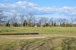
English: Overview of the Arlington Archeological Site, located on Arlington Chase Road south of Cape Charles in Northampton County, Virginia, United States. The site of the first plantation on the Eastern Shore of Virginia, it is an archaeological site and listed on the National Register of Historic Places. |
||
| Date | Taken on 30 December 2016 | ||
| Source | Own work | ||
| Author | Nyttend | ||
| Permission (Reusing this file) |
|
| Annotations | This image is annotated: View the annotations at Commons |
File history
Click on a date/time to view the file as it appeared at that time.
| Date/Time | Thumbnail | Dimensions | User | Comment | |
|---|---|---|---|---|---|
| current | 01:03, 26 January 2017 | | 6,016 × 4,000 (6.34 MB) | Nyttend (talk | contribs) | {{NRHP|08000422}} {{Location|37|13|44|N|76|0|11|W}} {{Information |Description={{en|Overview of the {{w|Arlington Archeological Site}}, located on Arlington Chase Road south of {{w|Cape Charles, Virginia|Cape Charles}} in {{w|Northampton County, Virgin... |
You cannot overwrite this file.
File usage on Commons
The following page uses this file:
File usage on other wikis
The following other wikis use this file:
- Usage on en.wikipedia.org
- Usage on it.wikipedia.org
- Usage on www.wikidata.org