File:Arizona Regional Hunt Units.svg
Jump to navigation
Jump to search

Size of this PNG preview of this SVG file: 517 × 599 pixels. Other resolutions: 207 × 240 pixels | 414 × 480 pixels | 663 × 768 pixels | 883 × 1,024 pixels | 1,767 × 2,048 pixels | 5,462 × 6,331 pixels.
Original file (SVG file, nominally 5,462 × 6,331 pixels, file size: 122 KB)
Captions
Captions
Add a one-line explanation of what this file represents
| Description |
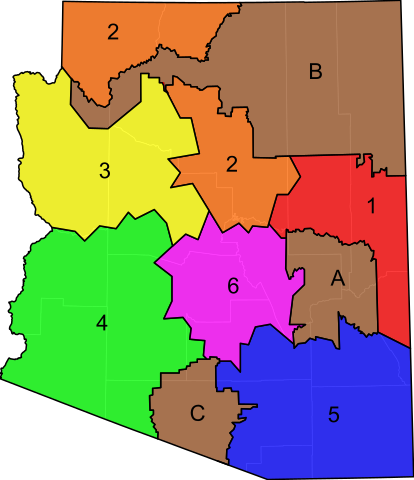
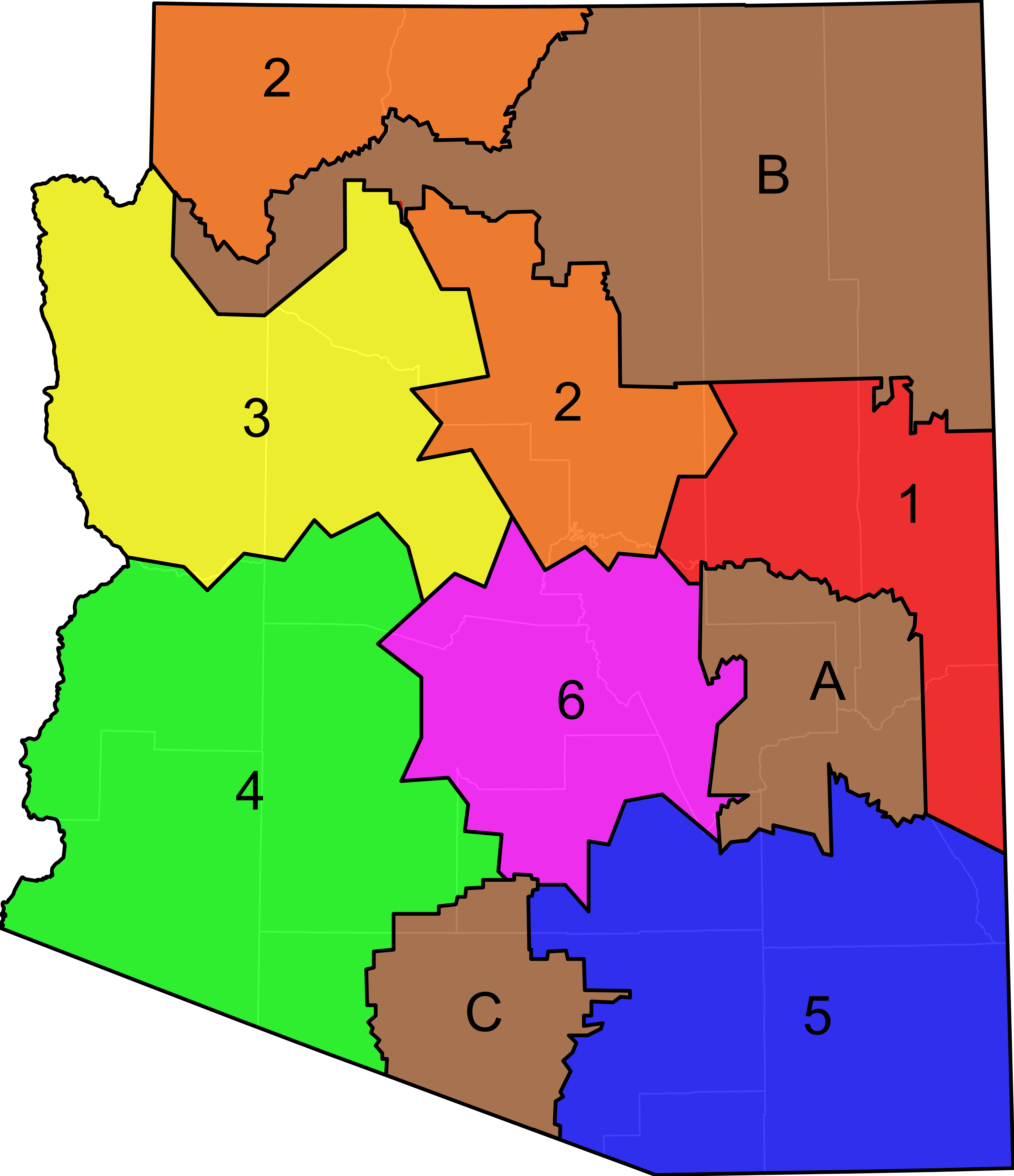
An SVG map of Arizona showing the 6 regional hunt units. The units are semi-transparent so that county boundaries can be visualized.
Data from Arizona Game and Fish Department. |
|
| Date | (UTC) | |
| Source | ||
| Author |
|
I, the copyright holder of this work, hereby publish it under the following license:
| I, the copyright holder of this work, release this work into the public domain. This applies worldwide. In some countries this may not be legally possible; if so: I grant anyone the right to use this work for any purpose, without any conditions, unless such conditions are required by law. |
Original upload log[edit]
This image is a derivative work of the following images:
- File:Blank_Map_of_Arizona.svg licensed with PD-self
- 2011-04-03T04:19:21Z Ninjatacoshell 5462x6331 (60585 Bytes) {{Information |Description=A blank SVG map of Arizona showing the 15 counties. |Source=*[[:File:Map_of_Arizona_highlighting_Coconino_County.svg|]] |Date=2011-04-03 04:16 (UTC) |Author=*[[:File:Map_of_Arizona_highlighting_Coco
Uploaded with derivativeFX
File history
Click on a date/time to view the file as it appeared at that time.
| Date/Time | Thumbnail | Dimensions | User | Comment | |
|---|---|---|---|---|---|
| current | 05:05, 3 April 2011 | | 5,462 × 6,331 (122 KB) | Ninjatacoshell (talk | contribs) | Appear |
| 04:59, 3 April 2011 |  | 5,462 × 6,331 (122 KB) | Ninjatacoshell (talk | contribs) | {{Information |Description=An SVG map of Arizona showing the 6 regional hunt units. The units are semi-transparent so that county boundaries can be visualized.<br><br><table border="0" cellspacing="0" cellpadding="1" style="background:transparent"> <tr va |
You cannot overwrite this file.
File usage on Commons
The following page uses this file: