File:Ararat-Location.png
Jump to navigation
Jump to search
No higher resolution available.
Ararat-Location.png (631 × 321 pixels, file size: 18 KB, MIME type: image/png)
Captions
Captions
Add a one-line explanation of what this file represents
Summary[edit]
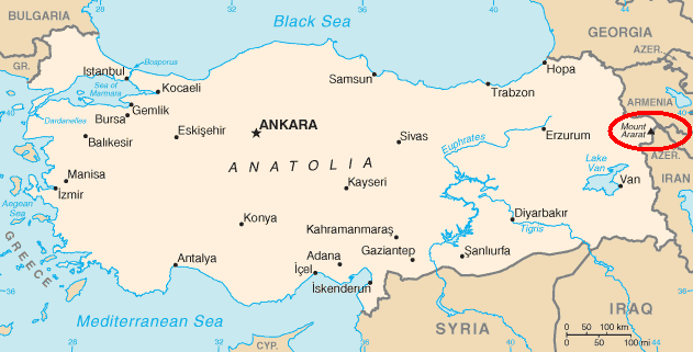
Mount Ararat - Location
This image is in the public domain because it contains materials that originally came from the United States Central Intelligence Agency's World Factbook.
|
 |
File history
Click on a date/time to view the file as it appeared at that time.
| Date/Time | Thumbnail | Dimensions | User | Comment | |
|---|---|---|---|---|---|
| current | 15:40, 20 June 2010 | | 631 × 321 (18 KB) | Ras67 (talk | contribs) | cropped |
| 23:48, 16 December 2004 |  | 634 × 324 (21 KB) | Mschlindwein (talk | contribs) | Mount Ararat - Location |
You cannot overwrite this file.
File usage on Commons
The following 2 pages use this file:
File usage on other wikis
The following other wikis use this file:
- Usage on ar.wikipedia.org
- Usage on ckb.wikipedia.org
- Usage on cy.wikipedia.org
- Usage on en.wikipedia.org
- Usage on fr.wikipedia.org
- Usage on hr.wikipedia.org
- Usage on hy.wikipedia.org
- Usage on it.wikipedia.org
- Usage on ku.wikipedia.org
- Usage on la.wiktionary.org
- Usage on nl.wikipedia.org
- Usage on pt.wikipedia.org
- Usage on sh.wikipedia.org
- Usage on simple.wikipedia.org