File:Appalachian Mountains (MODIS 2020-09-28).jpg

Original file (2,453 × 1,998 pixels, file size: 676 KB, MIME type: image/jpeg)
Captions
Captions
Summary
[edit].jpg&action=edit§ion=1)
| Description |
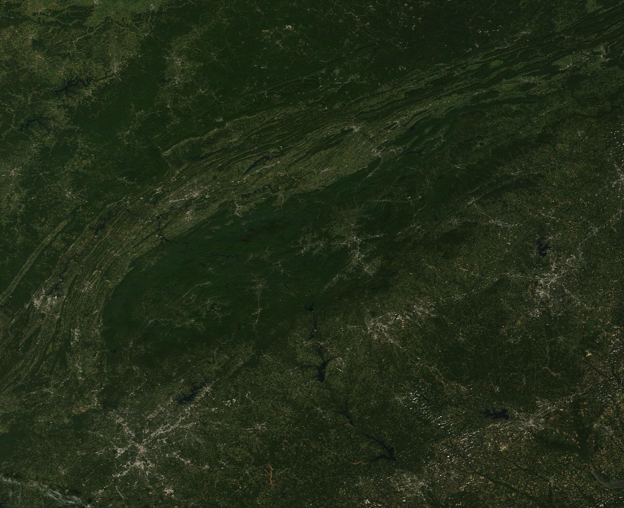
English: On September 21, 2020, the Moderate Resolution Imaging Spectroradiometer (MODIS) acquired a true-color image of the closing of summer over the Appalachian Mountains.
The broad arc of the ridge-and-valley structure of the Appalachian Mountains curves from the southwest to the northeast, stretching approximately 1,500 miles (2,400 km) from the state of Alabama, USA to Newfoundland, Canada. Although a relatively low mountain chain, the Appalachians are one of the oldest mount chains in the world. The rocks that form these ridges are estimated to be 300 to 540 million years old. This image captures only a small part of the southern part of the Appalachians as they sweep through the states of Alabama, Georgia, South Carolina, Tennessee, and North Carolina. The deep greens primarily mark forests of deciduous trees intermingled with spruce and fir, which are abundant in the lower elevations and foothills, especially in the eastern section of the Appalachians, which is also known as the Blue Ridge Mountains. The highest peaks rise above the timberline, where tall trees are replaced by shorter, sparser vegetation. Gray pixels mark the handiwork of humans – roads and cities. The large city of Atlanta, Georgia sits near the southern border of the image, expanding from the center much like a spider web. Moving to the northeast, the city of Greenville, South Carolina is visible. Asheville, North Carolina can be seen north and slightly west of Greenville. |
||
| Date | Taken on 21 September 2020 | ||
| Source |
Appalachian Mountains (direct link)
|
||
| Author | MODIS Land Rapid Response Team, NASA GSFC |
| This media is a product of the Terra mission Credit and attribution belongs to the mission team, if not already specified in the "author" row |
Licensing
[edit].jpg&action=edit§ion=2)
| This file is in the public domain in the United States because it was solely created by NASA. NASA copyright policy states that "NASA material is not protected by copyright unless noted". (See Template:PD-USGov, NASA copyright policy page or JPL Image Use Policy.) | ||
 |
Warnings:
|
File history
Click on a date/time to view the file as it appeared at that time.
| Date/Time | Thumbnail | Dimensions | User | Comment | |
|---|---|---|---|---|---|
| current | 02:35, 17 February 2024 | | 2,453 × 1,998 (676 KB) | OptimusPrimeBot (talk | contribs) | #Spacemedia - Upload of http://modis.gsfc.nasa.gov/gallery/images/image09282020_250m.jpg via Commons:Spacemedia |
You cannot overwrite this file.
File usage on Commons
There are no pages that use this file.
.jpg&oldid=852698984)