File:Aourir douar in Timenkar.jpg
Jump to navigation
Jump to search

Size of this preview: 600 × 600 pixels. Other resolutions: 240 × 240 pixels | 480 × 480 pixels | 768 × 768 pixels | 1,024 × 1,024 pixels | 2,048 × 2,048 pixels | 2,992 × 2,992 pixels.
Original file (2,992 × 2,992 pixels, file size: 3.1 MB, MIME type: image/jpeg)
Captions
Captions
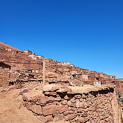
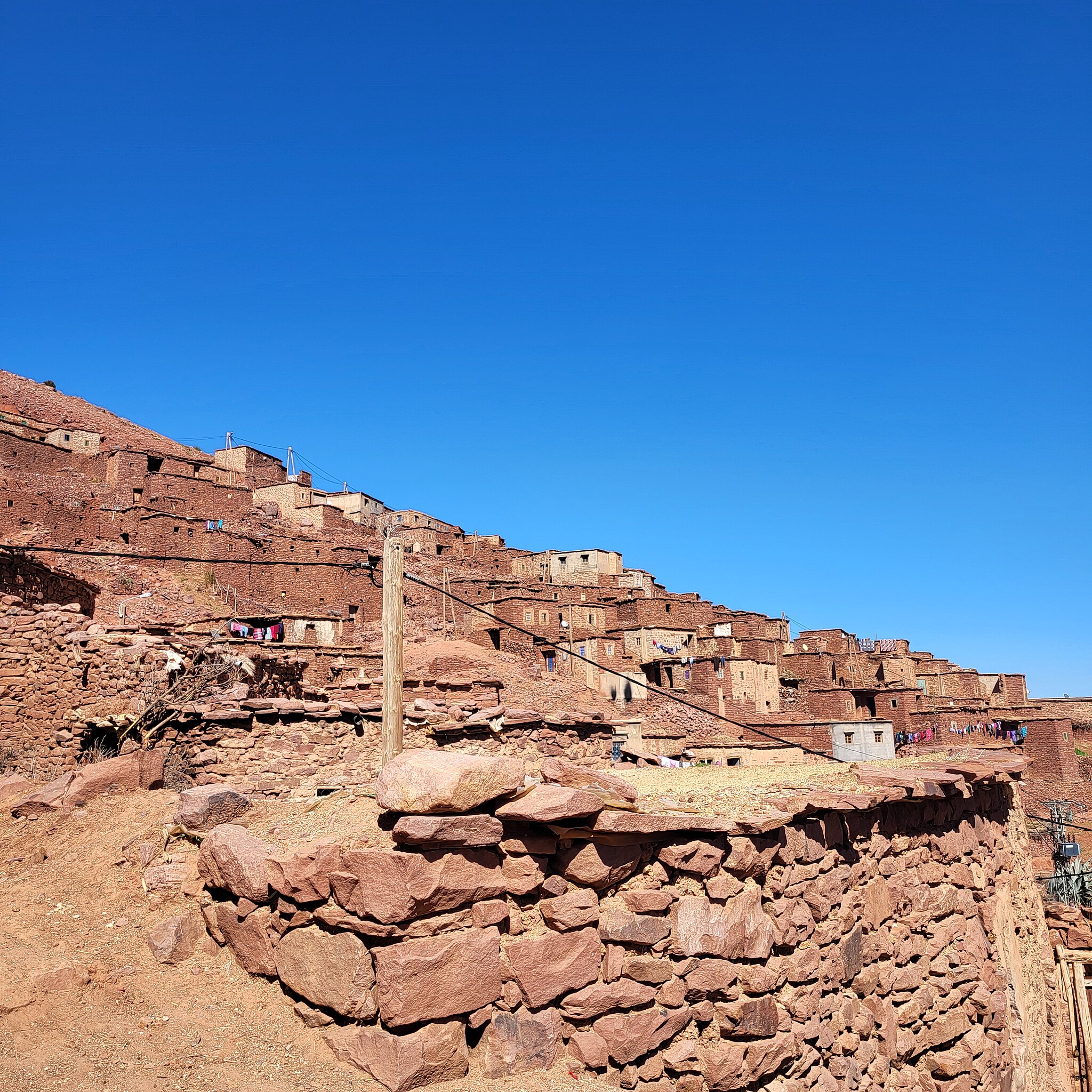
Aourir douar in Timenkar
Summary[edit]
| Description |
English: Aourir is small Douar in the Timenkar plateau of the High Atlas. Located between 2000 and 2300m altitude at approx. 80km southeast of Marrakech. |
| Date | 18 February 2024 (according to Exif data) |
| Source | Own work |
| Author | Oumaima Loudini |
| Camera location | | View this and other nearby images on: OpenStreetMap |
|---|
Licensing[edit]
I, the copyright holder of this work, hereby publish it under the following license:
This file is licensed under the Creative Commons Attribution 4.0 International license.
- You are free:
- to share – to copy, distribute and transmit the work
- to remix – to adapt the work
- Under the following conditions:
- attribution – You must give appropriate credit, provide a link to the license, and indicate if changes were made. You may do so in any reasonable manner, but not in any way that suggests the licensor endorses you or your use.
| This file was uploaded via Mobile Android App (Commons mobile app) 4.2.1~14b6c455b. |
File history
Click on a date/time to view the file as it appeared at that time.
| Date/Time | Thumbnail | Dimensions | User | Comment | |
|---|---|---|---|---|---|
| current | 20:26, 26 February 2024 | | 2,992 × 2,992 (3.1 MB) | Bjh21 (talk | contribs) | Exif orientation reset to 1 (upright) using exiftool |
| 14:46, 26 February 2024 |  | 2,992 × 2,992 (3.1 MB) | Oumaima Loudini (talk | contribs) | Uploaded using Commons Mobile App |
You cannot overwrite this file.
File usage on Commons
The following page uses this file: