File:Ans - Liège-Bastogne-Liège, 26 avril 2015, arrivée (B02) (cropped).JPG
From Wikimedia Commons, the free media repository
Jump to navigation
Jump to search
Size of this preview: 448 × 600 pixels. Other resolutions: 179 × 240 pixels | 358 × 480 pixels | 574 × 768 pixels | 765 × 1,024 pixels | 1,530 × 2,048 pixels | 2,904 × 3,888 pixels.
Original file (2,904 × 3,888 pixels, file size: 4.03 MB, MIME type: image/jpeg)
File information
Structured data
Captions
Summary
[edit]DescriptionAns - Liège-Bastogne-Liège, 26 avril 2015, arrivée (B02) (cropped).JPG |
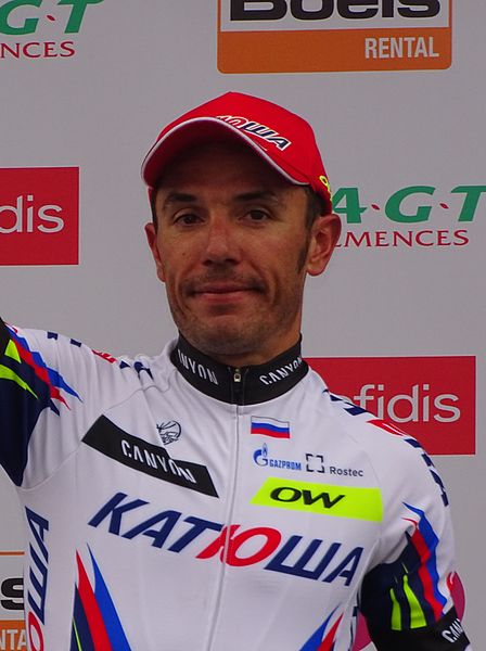
Français : Reportage réalisé le dimanche 26 avril à l'occasion de l'arrivée de Liège-Bastogne-Liège 2015 à Ans, Belgique.
| |||||||||||||||||||||||
Wikimédia France InfoField |
|
|||||||||||||||||||||||
Date | ||||||||||||||||||||||||
Source | Own work | |||||||||||||||||||||||
Author |
creator QS:P170,Q58229383 |
|||||||||||||||||||||||
Permission (Reusing this file) |
This file is licensed under the Creative Commons Attribution-Share Alike 3.0 Unported license.
| |||||||||||||||||||||||
Attribution (required by the license) InfoField | Jérémy-Günther-Heinz Jähnick / Ans - Liège-Bastogne-Liège, 26 avril 2015, arrivée (B02) (cropped) / Wikimedia Commons / | |||||||||||||||||||||||
InfoField | Jérémy-Günther-Heinz Jähnick / Ans - Liège-Bastogne-Liège, 26 avril 2015, arrivée (B02) (cropped) / Wikimedia Commons |
Personality rightsAlthough this work is freely licensed or in the public domain, the person(s) shown may have rights that legally restrict certain re-uses unless those depicted consent to such uses. In these cases, a model release or other evidence of consent could protect you from infringement claims. Though not obliged to do so, the uploader may be able to help you to obtain such evidence. See our general disclaimer for more information. |
Camera location | 50° 39′ 15.17″ N, 5° 31′ 41.17″ E | View this and other nearby images on: OpenStreetMap | 50.654213; 5.528103 |
---|
This file has been extracted from another file : Ans - Liège-Bastogne-Liège, 26 avril 2015, arrivée (B02).JPG |
File history
Click on a date/time to view the file as it appeared at that time.
Date/Time | Thumbnail | Dimensions | User | Comment | |
---|---|---|---|---|---|
current | 03:17, 1 August 2015 | 2,904 × 3,888 (4.03 MB) | BaldBoris (talk | contribs) | File:Ans - Liège-Bastogne-Liège, 26 avril 2015, arrivée (B02).JPG cropped 31 % horizontally using CropTool with lossless mode. |
You cannot overwrite this file.
File usage on Commons
There are no pages that use this file.
File usage on other wikis
The following other wikis use this file:
- Usage on en.wikipedia.org
- Usage on es.wikipedia.org
- Usage on pt.wikipedia.org
Metadata
This file contains additional information such as Exif metadata which may have been added by the digital camera, scanner, or software program used to create or digitize it. If the file has been modified from its original state, some details such as the timestamp may not fully reflect those of the original file. The timestamp is only as accurate as the clock in the camera, and it may be completely wrong.
Camera manufacturer | SONY |
---|---|
Camera model | DSC-HX400V |
Exposure time | 1/250 sec (0.004) |
F-number | f/5.6 |
ISO speed rating | 160 |
Date and time of data generation | 16:58, 26 April 2015 |
Lens focal length | 71.3 mm |
Latitude | 50° 39′ 15.17″ N |
Longitude | 5° 31′ 41.17″ E |
Altitude | 187.6 meters above sea level |
Orientation | Normal |
Horizontal resolution | 350 dpi |
Vertical resolution | 350 dpi |
Software used | DSC-HX400V v2.00 |
File change date and time | 10:49, 27 April 2015 |
Y and C positioning | Co-sited |
Exposure Program | Normal program |
Exif version | 2.3 |
Date and time of digitizing | 16:58, 26 April 2015 |
Meaning of each component |
|
Image compression mode | 2 |
APEX brightness | 7.66171875 |
APEX exposure bias | 0 |
Maximum land aperture | 4.9708536585366 APEX (f/5.6) |
Metering mode | Pattern |
Light source | Unknown |
Flash | Flash fired, strobe return light not detected, compulsory flash firing |
Supported Flashpix version | 1 |
Color space | sRGB |
File source | Digital still camera |
Scene type | A directly photographed image |
Custom image processing | Normal process |
Exposure mode | Auto exposure |
White balance | Auto white balance |
Digital zoom ratio | 1 |
Scene capture type | Standard |
Contrast | Normal |
Saturation | Normal |
Sharpness | Normal |
Unique image ID | BB0F4A8B35514D6EB1236DB00293598C |
GPS time (atomic clock) | 14:58:27.252 |
Receiver status | Measurement in progress |
Measurement mode | 3-dimensional measurement |
Measurement precision | Poor (1.44) |
Speed unit | Kilometers per hour |
Speed of GPS receiver | 0.26 |
Reference for direction of movement | True direction |
Direction of movement | 162.61 |
Geodetic survey data used | WGS-84 |
GPS date | 26 April 2015 |
GPS differential correction | 0 |
GPS tag version | 2.3.0.0 |
Structured data
Items portrayed in this file
depicts
26 April 2015
50°39'15.16702"N, 5°31'41.17102"E
image/jpeg
afa3202cbfe287c2586e105890356cbfa9fbe634
4,227,036 byte
3,888 pixel
2,904 pixel
Hidden categories:
- Media supported by Wikimedia France
- CC-BY-SA-3.0
- Information field template with formatting
- Images by JÄNNICK Jérémy
- Personality rights warning
- Files with coordinates missing SDC location of creation (50° N, 5° E)
- Extracted images
- Taken with Sony DSC-HX400V
- Belgium photographs taken on 2015-04-26
- Pages with maps