File:Angola location map.svg
Jump to navigation
Jump to search

Size of this PNG preview of this SVG file: 547 × 600 pixels. Other resolutions: 219 × 240 pixels | 438 × 480 pixels | 700 × 768 pixels | 934 × 1,024 pixels | 1,868 × 2,048 pixels | 1,266 × 1,388 pixels.
Original file (SVG file, nominally 1,266 × 1,388 pixels, file size: 478 KB)
Captions
Captions
Add a one-line explanation of what this file represents
Summary[edit]
| Description |
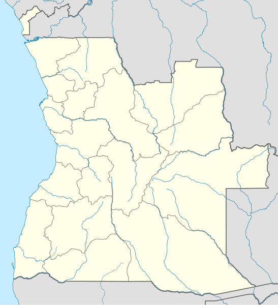
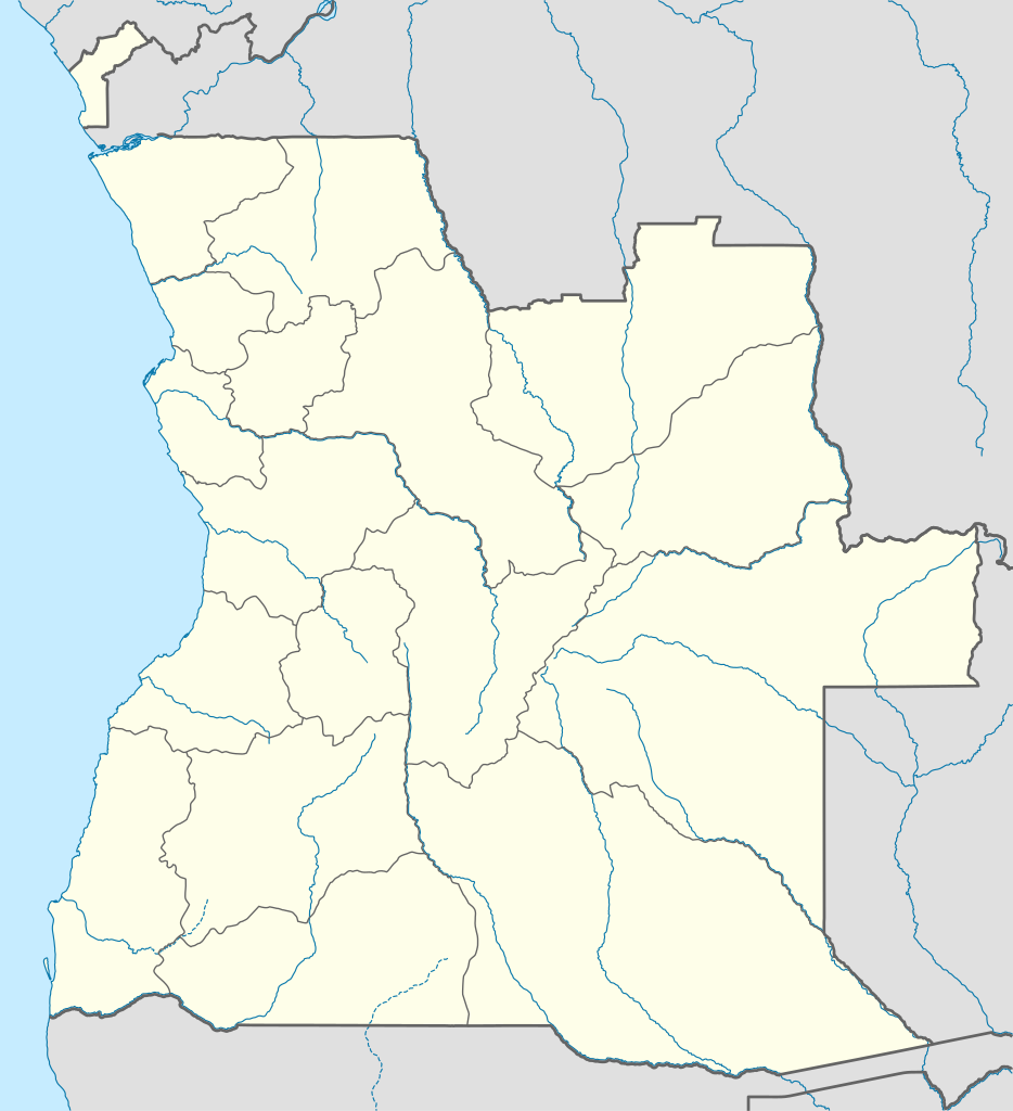
Deutsch: Positionskarte von Angola
Quadratische Plattkarte, N-S-Streckung 102 %. Geographische Begrenzung der Karte:
English: Location map of Angola
Equirectangular projection, N/S stretching 102 %. Geographic limits of the map:
|
||
| Date | |||
| Source |
Own work, using
|
||
| Author | NordNordWest | ||
| Permission (Reusing this file) |
I, the copyright holder of this work, hereby publish it under the following license: This file is licensed under the Creative Commons Attribution-Share Alike 3.0 Unported license.
|
||
| SVG development | This map was created with an unknown SVG tool.
|

File history
Click on a date/time to view the file as it appeared at that time.
| Date/Time | Thumbnail | Dimensions | User | Comment | |
|---|---|---|---|---|---|
| current | 18:15, 21 August 2019 | | 1,266 × 1,388 (478 KB) | Hallel (talk | contribs) | Inclusão de novo mapa com as alterações territoriais das províncias do Bengo e Luanda |
| 17:35, 20 October 2009 |  | 1,266 × 1,388 (478 KB) | NordNordWest (talk | contribs) | =={{int:filedesc}}== {{Information |Description= {{de|Positionskarte von Angola}} Quadratische Plattkarte, N-S-Streckung 102 %. Geographische Begrenzung der Karte: * N: 4.1° S * S: 18.5° S * W: 11.1° O * O: 24.5° O {{en|Location map of |
You cannot overwrite this file.
File usage on Commons
The following 48 pages use this file:
- Atlas of Angola
- User:Jcornelius/Angola/2019 August 21-31
- User:NordNordWest/Gallery/Location maps
- Commons:Graphic Lab/Map workshop/Archive/2020
- File:Angola relief location map.jpg
- File:Bengo in Angola.svg
- File:Bengo in Angola (before 2011).svg
- File:Benguela in Angola.svg
- File:Bié in Angola.svg
- File:Cabinda in Angola.svg
- File:Cabinda in Angola (special marker).svg
- File:Cuando Cubango in Angola.svg
- File:Cuanza Norte in Angola.svg
- File:Cuanza Sul in Angola.svg
- File:Cunene in Angola.svg
- File:First Extraordinary Congress of the MPLA-PT (September - November 1980).svg
- File:Huambo in Angola.svg
- File:Huila in Angola.svg
- File:Luanda in Angola.svg
- File:Luanda in Angola (before 2011).svg
- File:Luanda in Angola (special marker).svg
- File:Lunda Norte in Angola.svg
- File:Lunda Sul in Angola.svg
- File:Malanje in Angola.svg
- File:Moxico in Angola.svg
- File:Namibe in Angola.svg
- File:Northern Angola Offensive (December 1975 - February 1976).svg
- File:Operation Askari (December 1983 - January 1984).svg
- File:Operation Bunda (April - July 1983).svg
- File:Operation Final Assault and UNITA's 1989-91 Campaign (December 1989 - May 1991).svg
- File:Operation General Antonio Maceo (January - March 1976).svg
- File:Operation Protea (August - September 1981).svg
- File:Operation Savannah (October 1975 - January 1976).svg
- File:Operations Cuangar and Toma de la Frontera (July - October 1979).svg
- File:Operations Iron Fist and Alpha Centauri (May - November 1986).svg
- File:Operations Saluting October and Moduler (July - November 1987).svg
- File:Operations Second Congress, Magneto, and Wallpaper (July - October 1985).svg
- File:Operations Victorious June and FAPLA 10 Years of Victory (May - September 1984).svg
- File:UNITA's 1979 Campaign.svg
- File:UNITA's 1980 Campaign and Operation Tiro-Tiro.svg
- File:UNITA's Early 1981 Campaign.svg
- File:UNITA's Early 1982 Campaign.svg
- File:UNITA's Early 1983 Campaign.svg
- File:UNITA's Late 1981 Campaign.svg
- File:UNITA's Late 1982 Campaign.svg
- File:UNITA's Late 1983 Campaign and Operation Karton.svg
- File:Uíge in Angola.svg
- File:Zaire in Angola.svg
.svg)
.svg)
.svg)
.svg)
.svg)
.svg)
.svg)
.svg)
.svg)
.svg)
.svg)
.svg)
.svg)
.svg)
.svg)
.svg)
.svg)
File usage on other wikis
The following other wikis use this file:
- Usage on af.wikipedia.org
- Usage on am.wikipedia.org
- Usage on an.wikipedia.org
- Usage on ar.wikipedia.org
- Usage on ast.wikipedia.org
- Luanda
- Ríu Congu
- Bolongongo
- Bembe
- Londuimbale
- Songo (Angola)
- Camanongue
- N'Zeto
- Lucala
- Lubalo
- África Central
- Comité Paralímpicu Angolanu
- Lubango
- Área de caltenimientu Kavango-Zambeze
- Ríu Zambeze
- Morro do Moco
- Benguela
- Módulu:Mapa de llocalización/datos/Angola
- Módulu:Mapa de llocalización/datos/Angola/usu
- Aeropuertu Internacional Quatro de Fevereiro
- Aeropuertu de Benguela
- Aeropuertu de Cabinda
View more global usage of this file.