File:Angela guianensis MHNT male vol.jpg
Jump to navigation
Jump to search

Size of this preview: 430 × 600 pixels. Other resolutions: 172 × 240 pixels | 344 × 480 pixels | 551 × 768 pixels | 734 × 1,024 pixels | 1,468 × 2,048 pixels | 4,652 × 6,488 pixels.
Original file (4,652 × 6,488 pixels, file size: 4.98 MB, MIME type: image/jpeg)
Captions
Captions
Add a one-line explanation of what this file represents
Summary[edit]
|
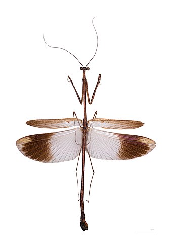
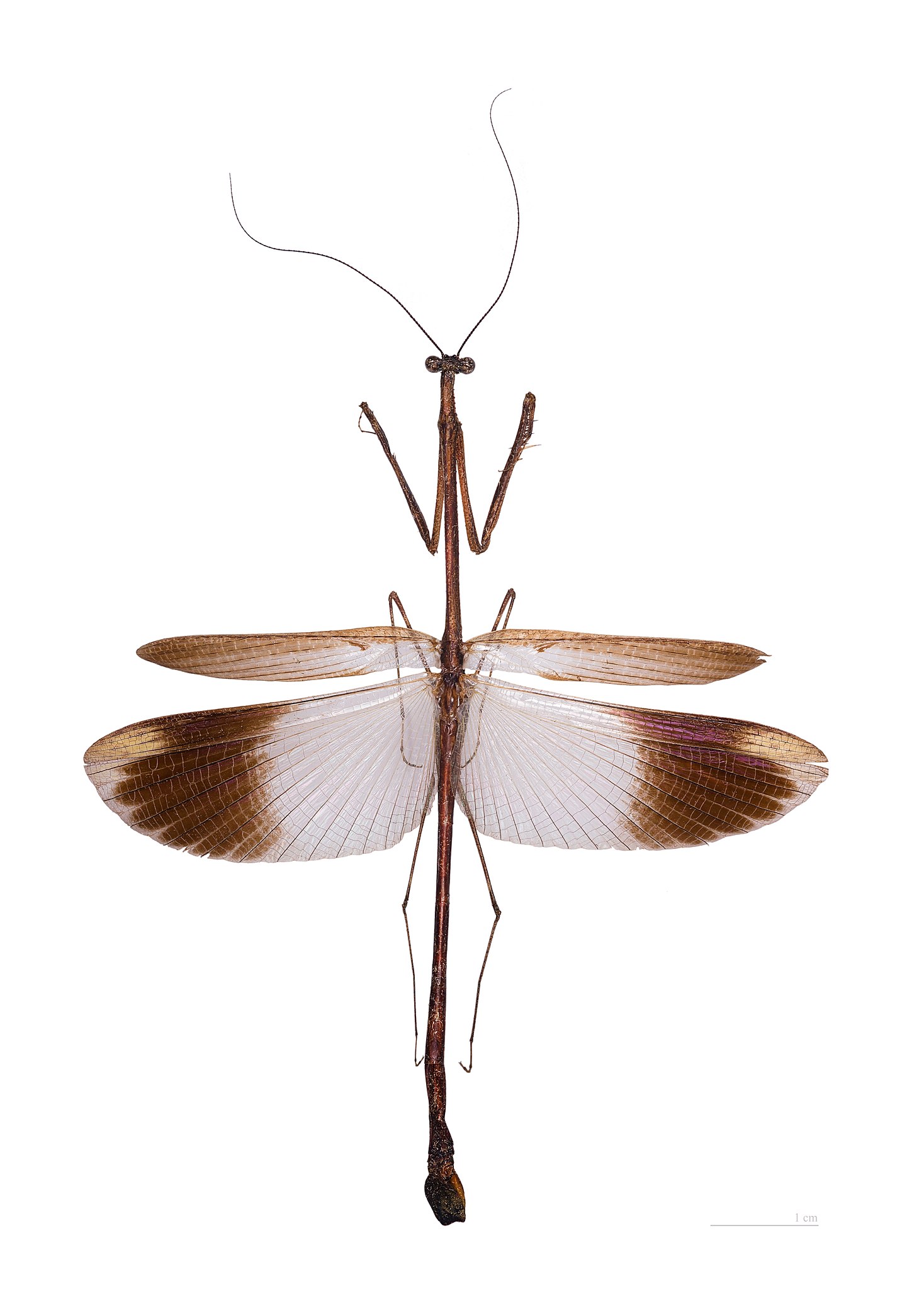
Angela guianensis Rehn, 1906 | ||||||||||||||||||||||||||||||||||||||||||||||||
| ||||||||||||||||||||||||||||||||||||||||||||||||


File history
Click on a date/time to view the file as it appeared at that time.
| Date/Time | Thumbnail | Dimensions | User | Comment | |
|---|---|---|---|---|---|
| current | 14:45, 26 December 2011 | | 4,652 × 6,488 (4.98 MB) | Archaeodontosaurus (talk | contribs) | {{Information |Description ={{en|1=x}} |Source ={{own}} |Author =Archaeodontosaurus |Date = |Permission = |other_versions = }} |
You cannot overwrite this file.
File usage on Commons
The following 23 pages use this file:
- User:Beria/POTY per date
- User:Jean-Frédéric/WmFr/2011/12
- User:Miya/POTY/2014
- User talk:Archaeodontosaurus/Premier trimestre 2012
- User talk:Kasir
- Commons:Featured picture candidates/File:Angela guianensis MHNT male vol.jpg
- Commons:Featured picture candidates/Log/May 2014
- Commons:Featured pictures/Animals/Arthropods
- Commons:Featured pictures/chronological/2014-A
- Commons:Picture of the Year/2014/Candidates
- Commons:Picture of the Year/2014/R1/Gallery/2014-A
- Commons:Picture of the Year/2014/R1/Gallery/ALL
- Commons:Picture of the Year/2014/R1/Gallery/Arthropods
- Commons:Picture of the Year/2014/R1/Gallery/M05
- Commons:Picture of the Year/2014/R1/Results/Arthropods
- Commons:Picture of the Year/2014/R1/Results/Candidates
- Commons:Picture of the Year/2014/R1/Results/Candidates/Arthropods
- Commons:Picture of the Year/2014/R1/v/Angela guianensis MHNT male vol.jpg
- Commons:Valued image candidates/Angela guianensis MHNT male vol.jpg
- Commons:Valued images by topic/Life forms/Animals/Arthropods/Mantids (Mantodea)
- Category:Angela
- Category:Angela guianensis
- Category:Angelinae
File usage on other wikis
The following other wikis use this file:
- Usage on ceb.wikipedia.org
- Usage on en.wikipedia.org
- Usage on es.wikipedia.org
- Usage on fa.wikipedia.org
- Usage on fr.wikipedia.org
- Usage on it.wikipedia.org
- Usage on pl.wikipedia.org
- Usage on pt.wikipedia.org
- Usage on ru.wikipedia.org
- Usage on species.wikimedia.org
- Usage on sv.wikipedia.org
- Usage on uk.wikipedia.org
- Usage on war.wikipedia.org
- Usage on www.wikidata.org
- Usage on zh.wikipedia.org