File:Ancient near east 540 bc.svg
Jump to navigation
Jump to search

Size of this PNG preview of this SVG file: 800 × 444 pixels. Other resolutions: 320 × 178 pixels | 640 × 355 pixels | 1,024 × 568 pixels | 1,280 × 710 pixels | 2,560 × 1,420 pixels | 1,249 × 693 pixels.
Original file (SVG file, nominally 1,249 × 693 pixels, file size: 263 KB)
Captions
Captions
Add a one-line explanation of what this file represents
Summary[edit]
| Description |
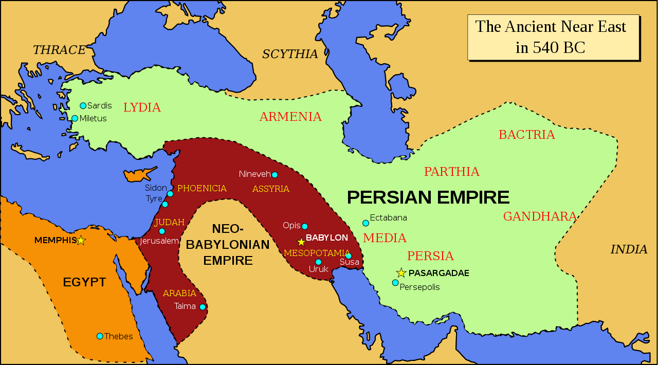
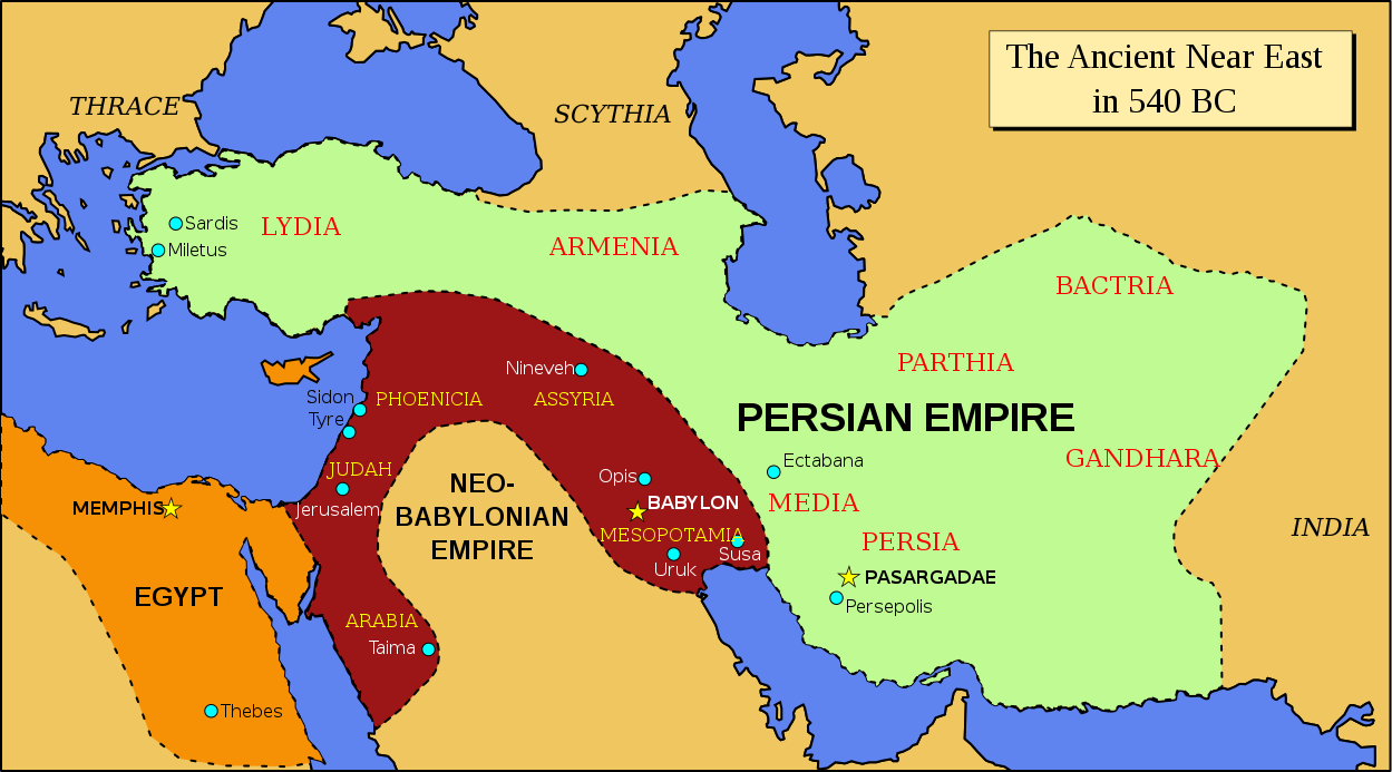
English: Map of the ancient Near East in 540 BC |
| Date | |
| Source | Derived from Image:Oriente Medio 600 adC (vacío).svg; modified to follow the map of the Achemenid empire of Persia - 559-480 BC in the Concise Atlas of World History (Andromeda, 1997). |
| Author | ChrisO |
.svg)
Licensing[edit]
| I, the copyright holder of this work, release this work into the public domain. This applies worldwide. In some countries this may not be legally possible; if so: I grant anyone the right to use this work for any purpose, without any conditions, unless such conditions are required by law. |
File history
Click on a date/time to view the file as it appeared at that time.
| Date/Time | Thumbnail | Dimensions | User | Comment | |
|---|---|---|---|---|---|
| current | 12:36, 3 September 2021 | | 1,249 × 693 (263 KB) | Darafsh (talk | contribs) | File uploaded using svgtranslate tool (https://svgtranslate.toolforge.org/). Added translation for fa. |
| 20:14, 25 October 2008 |  | 1,249 × 693 (245 KB) | ChrisO (talk | contribs) | ||
| 19:55, 25 October 2008 |  | 1,249 × 693 (245 KB) | ChrisO (talk | contribs) | ||
| 18:17, 25 October 2008 |  | 1,249 × 693 (244 KB) | ChrisO (talk | contribs) | ||
| 18:14, 25 October 2008 |  | 1,249 × 693 (244 KB) | ChrisO (talk | contribs) | ||
| 18:13, 25 October 2008 |  | 1,249 × 693 (244 KB) | ChrisO (talk | contribs) | ||
| 20:53, 24 October 2008 |  | 1,249 × 693 (243 KB) | ChrisO (talk | contribs) | Category:Maps of the ancient Near East | |
| 20:52, 24 October 2008 |  | 1,249 × 693 (244 KB) | ChrisO (talk | contribs) | Category:Maps of the ancient Near East | |
| 20:48, 24 October 2008 |  | 1,249 × 693 (243 KB) | ChrisO (talk | contribs) | {{Information |Description={{en|1=Map of the ancient Near East in 540 BC}} |Source=Derived from Image:Oriente Medio 600 adC (vacío).svg |Author=ChrisO |Date=24 October 2008 |Permission= |other_versions= }} <!--{{ImageUpload|full}}-- |
You cannot overwrite this file.
File usage on Commons
The following 2 pages use this file:
File usage on other wikis
The following other wikis use this file:
- Usage on ar.wikipedia.org
- Usage on azb.wikipedia.org
- Usage on bg.wikipedia.org
- Usage on ca.wikipedia.org
- Usage on en.wikipedia.org
- Usage on fa.wikipedia.org
- Usage on fr.wikipedia.org
- Usage on hr.wikipedia.org
- Usage on it.wikipedia.org
- Usage on ja.wikipedia.org
- Usage on no.wikipedia.org
- Usage on pt.wikipedia.org
- Usage on ru.wikipedia.org
- Usage on sh.wikipedia.org
- Usage on sr.wikipedia.org
- Usage on th.wikipedia.org
- Usage on tl.wikipedia.org
- Usage on tr.wikipedia.org
- Usage on www.wikidata.org