File:An old pole - Guyhirn and Rings End - geograph.org.uk - 1736636.jpg
Jump to navigation
Jump to search

Size of this preview: 800 × 600 pixels. Other resolutions: 320 × 240 pixels | 640 × 480 pixels | 1,024 × 768 pixels | 1,280 × 960 pixels | 2,560 × 1,920 pixels | 2,848 × 2,136 pixels.
Original file (2,848 × 2,136 pixels, file size: 3.04 MB, MIME type: image/jpeg)
Captions
Captions
Add a one-line explanation of what this file represents
Summary[edit]
| Description |
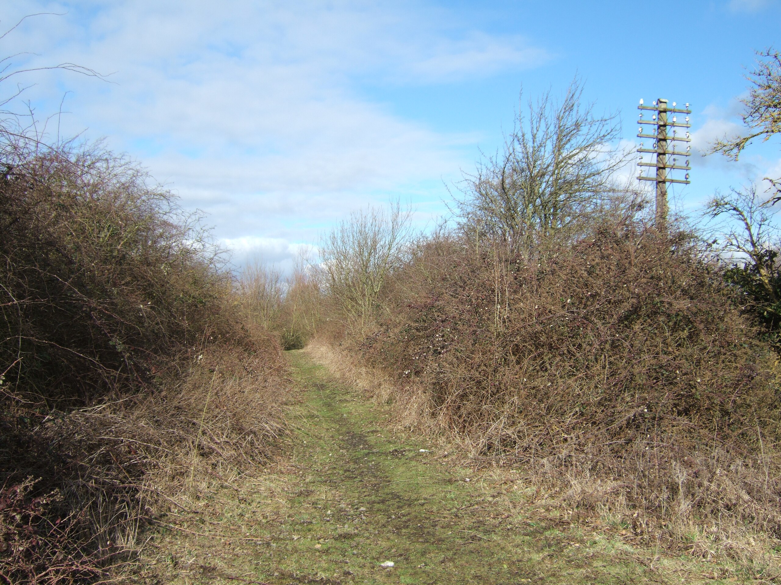
English: Guyhirn railway station - In Rings End Looking along the route of the old railway line which once ran through Guyhirn and Rings End. This is part of the elevated section which rose up from the flat fenlands to carry the line over 2 rivers and 2 main roads. It is now part of a "pocket park" at Rings End. Guyhirn station, which closed in 1953, once stood on this site. Two flights of wooden steps went up the embankment to the platforms which were built entirely of wood and at the time of closure of the station they had started to slide down the embankment. A signal box was also built on the embankment on the left of the camera position. The line, operated by The GE and GN Joint Railways ran from Spalding to March and was closed in November 1982. |
| Date | |
| Source | From geograph.org.uk |
| Author | Richard Humphrey |
| Camera location | | View this and other nearby images on: OpenStreetMap |
|---|
_heading:315.00&language=en)
| Object location | | View this and other nearby images on: OpenStreetMap |
|---|
_heading:315.00&language=en)
Licensing[edit]

|
This image was taken from the Geograph project collection. See this photograph's page on the Geograph website for the photographer's contact details. The copyright on this image is owned by Richard Humphrey and is licensed for reuse under the Creative Commons Attribution-ShareAlike 2.0 license.
|
This file is licensed under the Creative Commons Attribution-Share Alike 2.0 Generic license.
Attribution: Richard Humphrey
- You are free:
- to share – to copy, distribute and transmit the work
- to remix – to adapt the work
- Under the following conditions:
- attribution – You must give appropriate credit, provide a link to the license, and indicate if changes were made. You may do so in any reasonable manner, but not in any way that suggests the licensor endorses you or your use.
- share alike – If you remix, transform, or build upon the material, you must distribute your contributions under the same or compatible license as the original.
File history
Click on a date/time to view the file as it appeared at that time.
| Date/Time | Thumbnail | Dimensions | User | Comment | |
|---|---|---|---|---|---|
| current | 14:31, 5 March 2011 | | 2,848 × 2,136 (3.04 MB) | GeographBot (talk | contribs) | == {{int:filedesc}} == {{Information |description={{en|1=An old pole - Guyhirn and Rings End Looking along the route of the old railway line which once ran through Guyhirn and Rings End. The line, operated by The GE and GN Joint Railways ran from Spalding |
You cannot overwrite this file.
File usage on Commons
There are no pages that use this file.