File:Amchitka Island Map.jpg
Jump to navigation
Jump to search
No higher resolution available.
Amchitka_Island_Map.jpg (794 × 564 pixels, file size: 113 KB, MIME type: image/jpeg)
Captions
Captions
Add a one-line explanation of what this file represents
| Description |
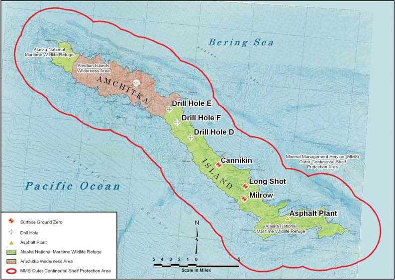
English: Map of Amchitka Island. |
|||
| Date | Unknown date | |||
| Source | Amchitka Site Fact Sheet | |||
| Author | Federal Government of the United States | |||
| Permission (Reusing this file) |
|

File history
Click on a date/time to view the file as it appeared at that time.
| Date/Time | Thumbnail | Dimensions | User | Comment | |
|---|---|---|---|---|---|
| current | 15:23, 19 September 2011 | | 794 × 564 (113 KB) | Bomazi (talk | contribs) | {{Information |Description ={{en|1=Map of Amchitka Island.}} |Source =http://www.lm.doe.gov/Amchitka/Sites.aspx |Author =Federal Government of the United States |Date = |Permission ={{PD-USGov-DOE}} |other_versions = }} [ |
You cannot overwrite this file.
File usage on Commons
There are no pages that use this file.
File usage on other wikis
The following other wikis use this file:
- Usage on gl.wikipedia.org
- Usage on nl.wikipedia.org
- Usage on pl.wikipedia.org