File:All Saints, Toftrees, Norfolk.jpg
From Wikimedia Commons, the free media repository
Jump to navigation
Jump to search
All_Saints,_Toftrees,_Norfolk.jpg (640 × 425 pixels, file size: 115 KB, MIME type: image/jpeg)
File information
Structured data
Captions
This is a photo of listed building number 1049295. |
Summary
[edit]DescriptionAll Saints, Toftrees, Norfolk.jpg |
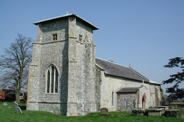
English: All Saints' parish church, Toftrees, Norfolk, seen from the southwest |
||
Date | |||
Source | geograph.org.uk | ||
Author | John Salmon | ||
Permission (Reusing this file) |
This file is licensed under the Creative Commons Attribution-Share Alike 2.0 Generic license. Attribution: John Salmon
|
Object location | 52° 48′ 44″ N, 0° 48′ 51″ E | View this and other nearby images on: OpenStreetMap | 52.812230; 0.814200 |
---|
File history
Click on a date/time to view the file as it appeared at that time.
Date/Time | Thumbnail | Dimensions | User | Comment | |
---|---|---|---|---|---|
current | 17:29, 5 October 2008 | 640 × 425 (115 KB) | Stavros1 (talk | contribs) | {{Information |Description= All Saints Parish Church, Toftrees, Norfolk |Source=http://www.geograph.org.uk/photo/309294 |Date=Friday, 5 April, 2002 |Author=John Salmon |Permission= {{Geograph|309294|John Salmon}} |other_versions= }} [[Category:Churches |
You cannot overwrite this file.
File usage on Commons
The following page uses this file:
File usage on other wikis
The following other wikis use this file:
- Usage on en.wikipedia.org
- Usage on es.wikipedia.org
- Usage on www.wikidata.org
Metadata
This file contains additional information such as Exif metadata which may have been added by the digital camera, scanner, or software program used to create or digitize it. If the file has been modified from its original state, some details such as the timestamp may not fully reflect those of the original file. The timestamp is only as accurate as the clock in the camera, and it may be completely wrong.
Camera manufacturer | NIKON |
---|---|
Camera model | E990 |
Exposure time | 10/3,531 sec (0.0028320589068253) |
F-number | f/7 |
ISO speed rating | 100 |
Date and time of data generation | 12:34, 5 April 2002 |
Lens focal length | 8.2 mm |
Orientation | Normal |
Horizontal resolution | 300 dpi |
Vertical resolution | 300 dpi |
Software used | E990v1.0 |
File change date and time | 12:34, 5 April 2002 |
Y and C positioning | Co-sited |
Exposure Program | Normal program |
Exif version | 2.1 |
Date and time of digitizing | 12:34, 5 April 2002 |
Image compression mode | 3 |
APEX exposure bias | 0 |
Maximum land aperture | 3.5 APEX (f/3.36) |
Metering mode | Pattern |
Light source | Unknown |
Flash | Flash did not fire |
Color space | sRGB |
Structured data
Items portrayed in this file
depicts
5 April 2002
52°48'44.03"N, 0°48'51.12"E
image/jpeg
fe99fbe0f59a480f5ecaf986d0527a44dbd07145
117,295 byte
425 pixel
640 pixel
Hidden categories:
- Listed buildings in England with known IDs
- CC-BY-SA-2.0
- Images from Geograph Britain and Ireland
- Images from Geograph Britain and Ireland missing SDC creator
- Images from Geograph Britain and Ireland missing SDC source of file
- Images from Geograph Britain and Ireland missing SDC coordinates of the point of view
- Images by John Salmon
- Pages with maps