File:All Aboard - Flickr - Jocey K.jpg

Original file (1,000 × 666 pixels, file size: 131 KB, MIME type: image/jpeg)
Captions
Captions
Summary
[edit]
| Description |
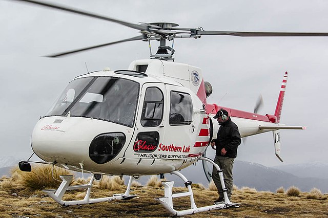
It was such a wonderful morning we booked a helicopter trip over the Remarkables. But by the time we went up there the cloud had come in. Never mind it still was a great experience! The Remarkables are a mountain range and skifield in Otago, South Island of New Zealand. Located on the southeastern shore of Lake Wakatipu, the range lives up to its name by rising sharply to create an impressive backdrop for the waters. The range is clearly visible from the nearby town of Queenstown. High point in the range is Double Cone (2319 metres) with Ben Nevis (2230 metres, named after the Scottish mountain of the same name) further south in the Hector mountains. The mountains were named The Remarkables by Alexander Garvie in 1857-58, allegedly because they are one of only two mountain ranges in the world which run directly north to south. An alternate explanation for the name given by locals is that early Queenstown settlers, upon seeing the mountain range during sunset one evening, named them the Remarkables to describe the sight. Our first day in Queenstown on our fourth day of my friends trip around the South Island. Not many more days and they have to return back home to the UK. Taken from and for More Info: en.wikipedia.org/wiki/The_Remarkables November 5, 2013 New Zealand. Queenstown (Māori: Tahuna) is a resort town in Otago in the south-west of New Zealand's South Island. It is built around an inlet called Queenstown Bay on Lake Wakatipu, a long thin Z-shaped lake formed by glacial processes, and has spectacular views of nearby mountains such as The Remarkables, Cecil Peak, Walter Peak and just above the town; Ben Lomond and Queenstown Hill. The Queenstown-Lakes District has a land area of 8,704.97 km² (3,361.01 sq mi) not counting its inland lakes (Lake Hāwea, Lake Wakatipu, and Lake Wanaka). Its neighbouring towns include Arrowtown, Wanaka, Alexandra, and Cromwell. The nearest cities are Dunedin and Invercargill. Queenstown is now known for its commerce-oriented tourism, especially adventure and ski tourism. It is popular with young international and New Zealand and Australian travellers alike. A resort town, Queenstown boasted 220 adventure tourism activities in 2012. Skiing and snowboarding, jet boating, whitewater rafting, bungy jumping, mountain biking, skateboarding, tramping, Parapenting, Sky diving and fly fishing are all popular. Most activities are safe except for the odd paraglider stuck up a tree. Queenstown is a major centre for snow sports in New Zealand, with people from all over the country and many parts of the world travelling to ski at the four main mountain skifields (Cardrona Alpine Resort, Coronet Peak, The Remarkables and Treble Cone). Cross country skiing is also available at the Waiorau Snowfarm, near Cardrona village. The 100 year old twin screw coal fired steamer TSS Earnslaw traverses Lake Wakatipu. Queenstown lies close to the centre of a small wine producing region, reputed to be the world's southernmost.[citation needed] The Two Paddocks vineyard is owned by local actor Sam Neill. Neighbouring, historic Arrowtown features restaurants and bars. Queenstown is a locations for television and film to be flimed. Jane Campion's six-part drama mystery Top of the Lake was shot during 2012 for pay TV release in 2013. The lakes of the Wakatipu appear ominous, and the Southern Alps spectacular. The main location is Moke Lake and scenes were shot on Lower Beach Street and Coronation Drive, and at a supermarket and bottle store on Shotover Street. Top of the Lake's international cast includes Holly Hunter, Elisabeth Moss, Peter Mullan, David Wenham, and Thomas M Wright. Taken from and for More Info: en.wikipedia.org/wiki/Queenstown,_New_Zealand
|
| Date | Taken on 5 November 2013, 15:10 |
| Source | All Aboard |
| Author | Jocelyn Kinghorn from Christchurch, New Zealand |
| Flickr tags | sky, clouds, new zealand, south island, central otago, landscape nz queenstown, mountain range, people, heilcopter, remarkables, helicopter trip |
Licensing
[edit]
- You are free:
- to share – to copy, distribute and transmit the work
- to remix – to adapt the work
- Under the following conditions:
- attribution – You must give appropriate credit, provide a link to the license, and indicate if changes were made. You may do so in any reasonable manner, but not in any way that suggests the licensor endorses you or your use.
- share alike – If you remix, transform, or build upon the material, you must distribute your contributions under the same or compatible license as the original.
| This image was originally posted to Flickr by Jocey K at https://flickr.com/photos/48627921@N05/11095766503. It was reviewed on 23 July 2020 by FlickreviewR 2 and was confirmed to be licensed under the terms of the cc-by-sa-2.0. |
File history
Click on a date/time to view the file as it appeared at that time.
| Date/Time | Thumbnail | Dimensions | User | Comment | |
|---|---|---|---|---|---|
| current | 06:40, 23 July 2020 | | 1,000 × 666 (131 KB) | Red panda bot (talk | contribs) | In Flickr Explore: 2013-11-27 |
You cannot overwrite this file.
File usage on Commons
There are no pages that use this file.