File:Alaska regions and watersheds NRCS.PNG
Jump to navigation
Jump to search
Size of this preview: 800 × 479 pixels. Other resolutions: 320 × 192 pixels | 640 × 383 pixels | 1,024 × 613 pixels | 1,301 × 779 pixels.
Original file (1,301 × 779 pixels, file size: 756 KB, MIME type: image/png)
Captions
Captions
Add a one-line explanation of what this file represents
Summary[edit]
| Description |
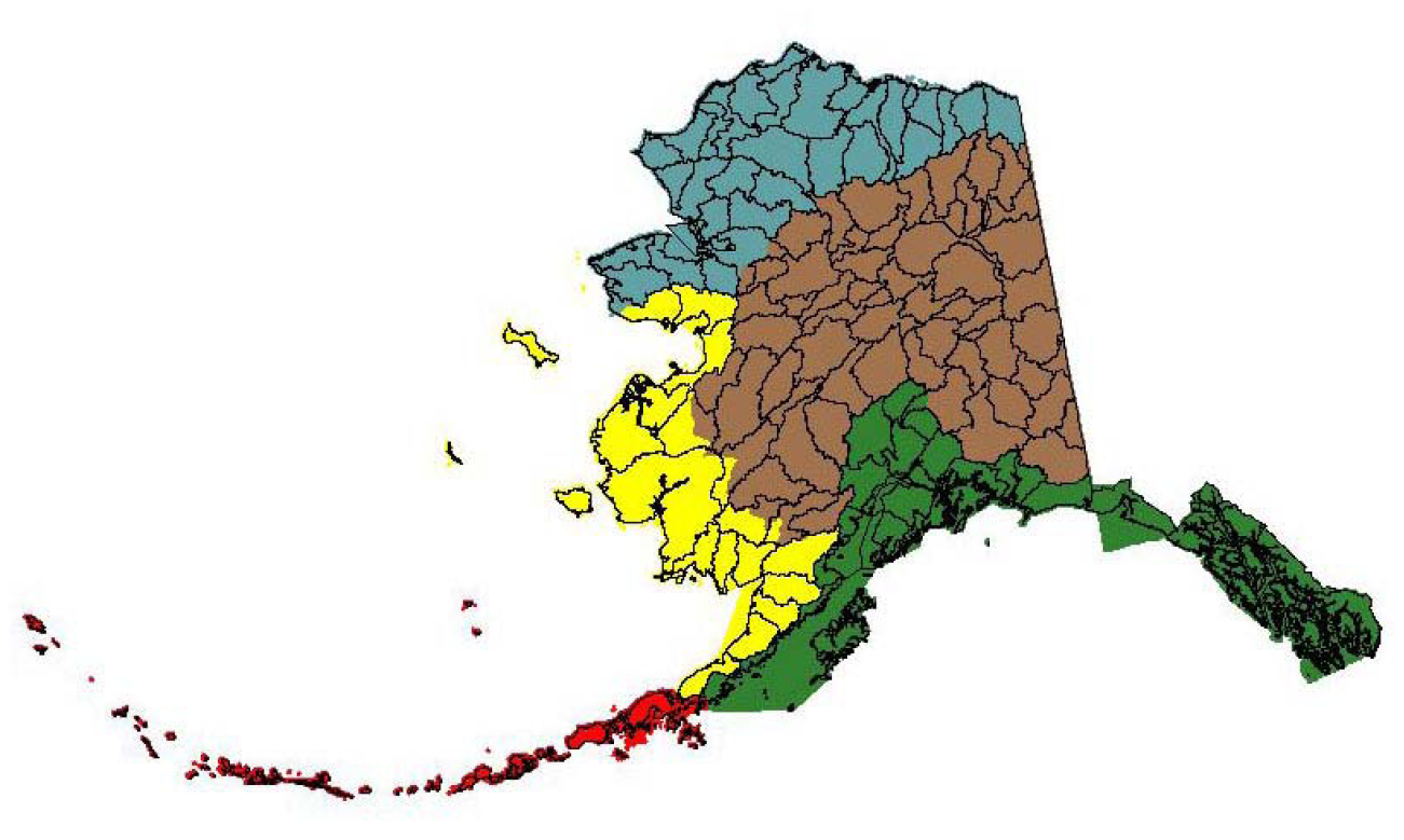
English: Comparison of major land resource regions of Alaska with watershed (8-digit hydrological unit) boundaries. The regions are Southern Alaska (green), Aleutian Alaska (red), Western Alaska (yellow), Interior Alaska (brown), and Northern Alaska (blue). p 89, region identification on the main map p9. |
| Date | |
| Source | [1] Land Resource Regions and Major Land Resource Areas of Alaska |
| Author | Natural Resources Conservation Service, USDA; D.R.Kautz and Pam Tabor, eds, USDA, NRCS |
Licensing[edit]
This work is in the public domain in the United States because it is a work prepared by an officer or employee of the United States Government as part of that person’s official duties under the terms of Title 17, Chapter 1, Section 105 of the US Code.
Note: This only applies to original works of the Federal Government and not to the work of any individual U.S. state, territory, commonwealth, county, municipality, or any other subdivision. This template also does not apply to postage stamp designs published by the United States Postal Service since 1978. (See § 313.6(C)(1) of Compendium of U.S. Copyright Office Practices). It also does not apply to certain US coins; see The US Mint Terms of Use.
|
 | |
| This file has been identified as being free of known restrictions under copyright law, including all related and neighboring rights. | ||
File history
Click on a date/time to view the file as it appeared at that time.
| Date/Time | Thumbnail | Dimensions | User | Comment | |
|---|---|---|---|---|---|
| current | 15:58, 27 July 2012 | | 1,301 × 779 (756 KB) | Dankarl (talk | contribs) |
You cannot overwrite this file.
File usage on Commons
There are no pages that use this file.
File usage on other wikis
The following other wikis use this file:
- Usage on ga.wikipedia.org