File:Al-hasa.png
Jump to navigation
Jump to search

Size of this preview: 772 × 600 pixels. Other resolutions: 309 × 240 pixels | 618 × 480 pixels | 942 × 732 pixels.
Original file (942 × 732 pixels, file size: 1.95 MB, MIME type: image/png)
Captions
Captions
Add a one-line explanation of what this file represents
Summary[edit]
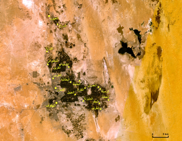
صورة فضائية للأحساء تبيّن مواقع بعض المدن والقرى .
Modified from an image obtained from NASA's WorldWind Program.
Licensing[edit]
| This image is in the public domain because it is a screenshot from NASA’s globe software World Wind using a public domain layer, such as Blue Marble, MODIS, Landsat, SRTM, USGS or GLOBE.
|
 |
File history
Click on a date/time to view the file as it appeared at that time.
| Date/Time | Thumbnail | Dimensions | User | Comment | |
|---|---|---|---|---|---|
| current | 23:25, 17 November 2007 | | 942 × 732 (1.95 MB) | Slackerlawstudent~commonswiki (talk | contribs) | == Summary == صورة فضائية للأحساء تبيّن مواقع بعض المدن والقرى . Modified from an image obtained from NASA's WorldWind Program. == Licensing == {{PD-WorldWind}} Category:Maps of Saudi Arabia [[Category:Satell |
You cannot overwrite this file.
File usage on Commons
There are no pages that use this file.
File usage on other wikis
The following other wikis use this file:
- Usage on ar.wikipedia.org
- Usage on de.wikipedia.org
- Usage on hr.wikipedia.org
- Usage on sh.wikipedia.org