File:Afrika Karte 1914.svg
Jump to navigation
Jump to search

Size of this PNG preview of this SVG file: 635 × 599 pixels. Other resolutions: 254 × 240 pixels | 508 × 480 pixels | 814 × 768 pixels | 1,085 × 1,024 pixels | 2,169 × 2,048 pixels | 1,430 × 1,350 pixels.
Original file (SVG file, nominally 1,430 × 1,350 pixels, file size: 1.73 MB)
Captions
Captions
Add a one-line explanation of what this file represents
Summary
[edit]
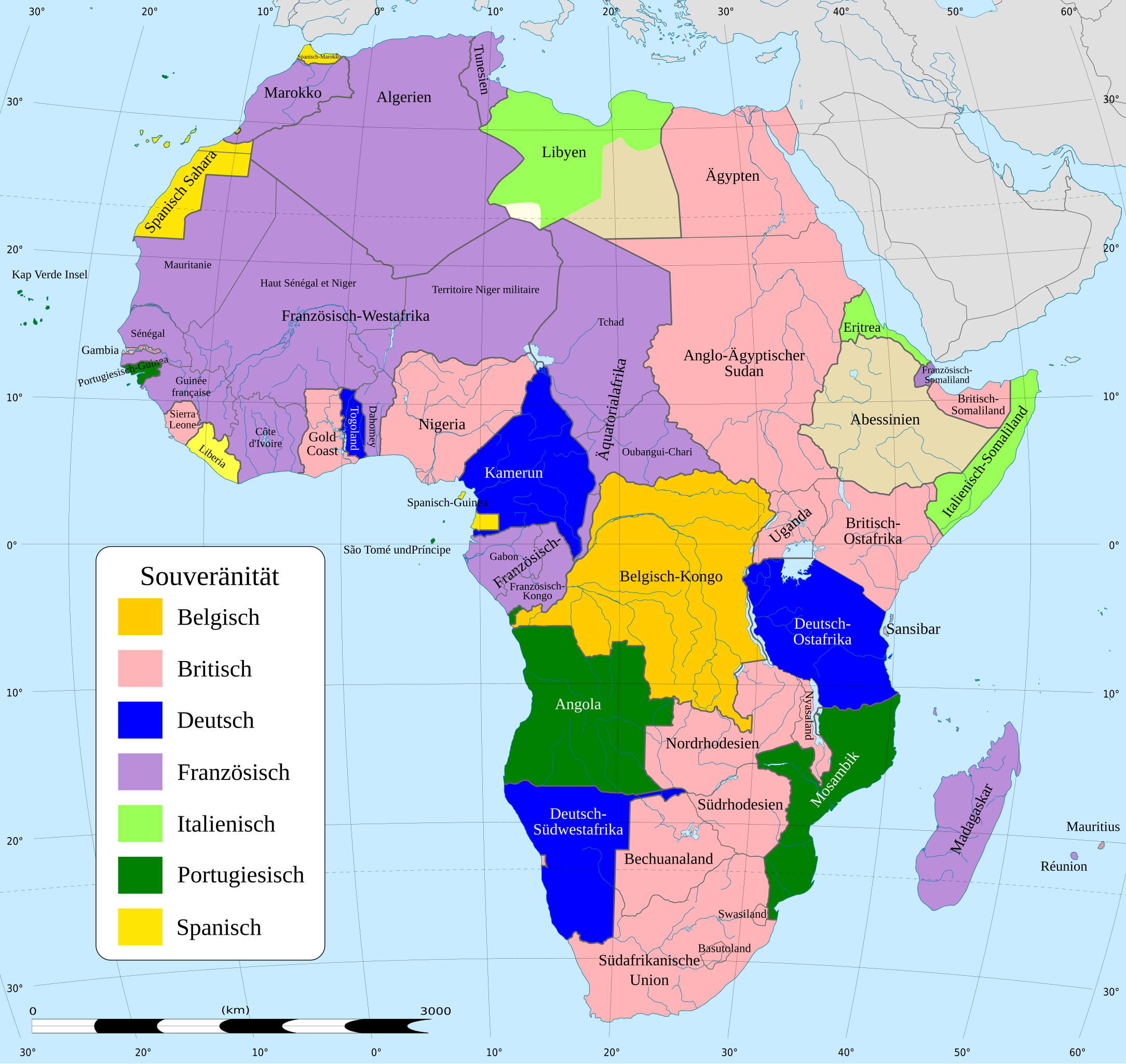
| Description | {{de:Landkarte von Afrika in 1914, mit Farben für Souveränität}} | ||
| Date | |||
| Source | Africa map 1914.svg | ||
| Author | Hogweard | ||
| Permission (Reusing this file) |
|
||
| Other versions | Africa map 1914.svg |
File history
Click on a date/time to view the file as it appeared at that time.
| Date/Time | Thumbnail | Dimensions | User | Comment | |
|---|---|---|---|---|---|
| current | 17:06, 17 December 2023 | | 1,430 × 1,350 (1.73 MB) | Hogweard (talk | contribs) | Namen auf zwei Zeilen |
| 16:59, 17 December 2023 |  | 1,430 × 1,350 (1.73 MB) | Hogweard (talk | contribs) | == {{int:filedesc}} == {{Information |Description={{de:Landkarte von Afrika in 1914, mit Farben für Souveränität}} |Source={{f|Africa map 1914.svg}} |Date=2023-12-17 |Author={{u|Hogweard}} |Permission={{PD-self}} |other_versions={{f|Africa map 1914.svg}} }} Category:SVG maps showing history of Africa Category:Maps of 20th-century Africa Category:German-language SVG maps showing history Category:German-language maps of Africa |
You cannot overwrite this file.
File usage on Commons
The following page uses this file:
File usage on other wikis
The following other wikis use this file:
- Usage on de.wikipedia.org
- Usage on lt.wikipedia.org