File:Africa contours.svg
Jump to navigation
Jump to search

Size of this PNG preview of this SVG file: 671 × 600 pixels. Other resolutions: 269 × 240 pixels | 537 × 480 pixels | 859 × 768 pixels | 1,146 × 1,024 pixels | 2,292 × 2,048 pixels.
Original file (SVG file, nominally 800 × 715 pixels, file size: 6.77 MB)
Captions
Captions
Add a one-line explanation of what this file represents
Summary[edit]
| Description |
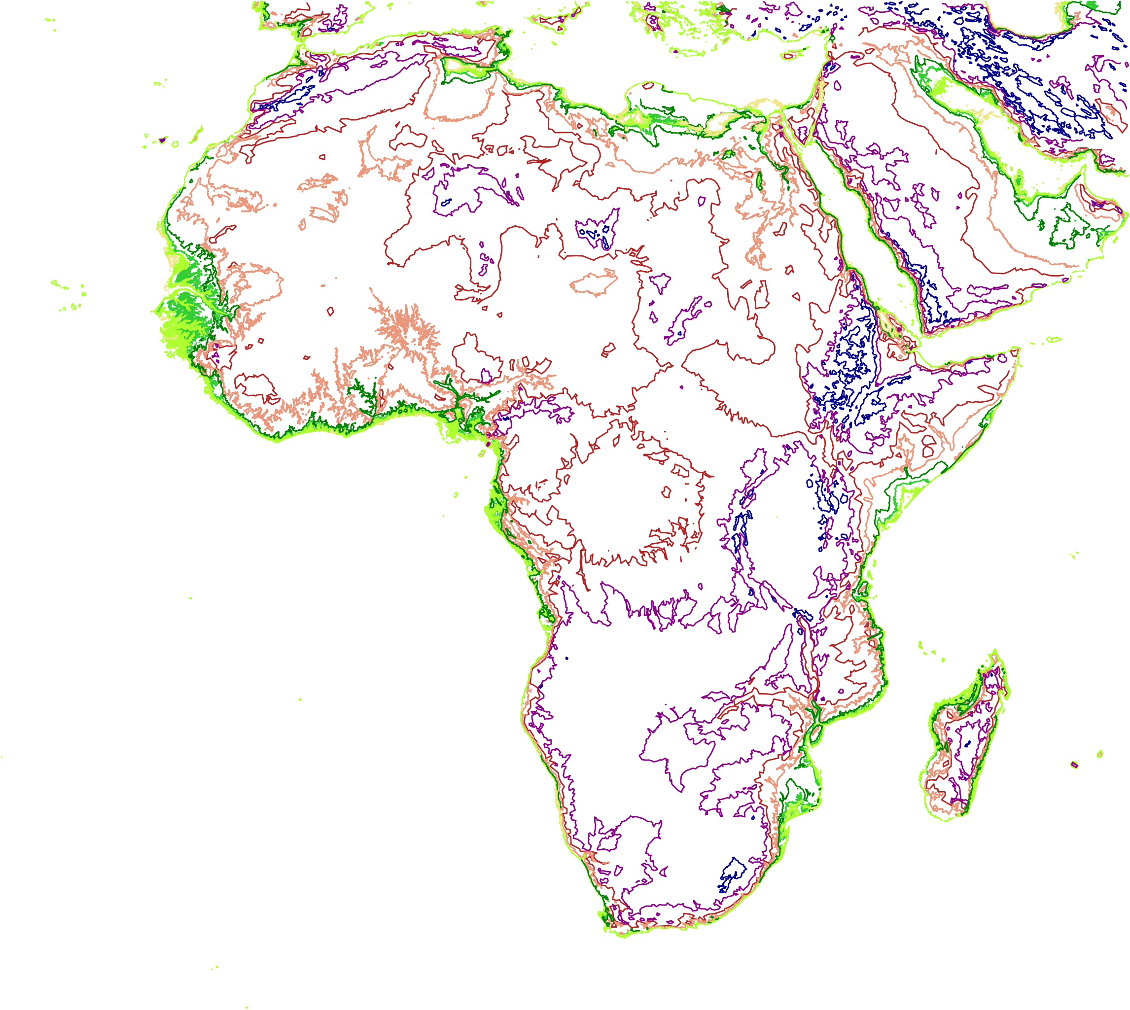
Africa with elevation contours at 0 (khaki), 25 (greenyellow), 50 (limegreen), 100 (green), 250 (darksalmon), 500 (firebrick), 1000 (darkmagenta) and 2000 (darkblue) m elevations.
|
||||||||||||||||
| Date | |||||||||||||||||
| Source | SRTM Raster data resampled-reduced, run through QGIS to produce vector contours which were then smoothed/simplified and converted to SVG by mapshaper.org and SVG optimized by https://www.ofoct.com/image-converter/svg-optimizer.html | ||||||||||||||||
| Author | Base data from SRTM - NASA | ||||||||||||||||
| Permission (Reusing this file) |
|

File history
Click on a date/time to view the file as it appeared at that time.
| Date/Time | Thumbnail | Dimensions | User | Comment | |
|---|---|---|---|---|---|
| current | 17:50, 23 March 2018 | | 800 × 715 (6.77 MB) | Shyamal (talk | contribs) | Crunched by https://www.ofoct.com/image-converter/svg-optimizer.html |
| 17:31, 23 March 2018 |  | 800 × 715 (14.17 MB) | Shyamal (talk | contribs) | Colored lines | |
| 16:26, 23 March 2018 |  | 800 × 715 (14.87 MB) | Shyamal (talk | contribs) | {{Information |Description=Africa with elevation contours at 0, 25, 50, 100, 250, 500, 1000 and 2000 m elevations. |Source=SRTM Raster data resampled-reduced, run through QGIS to produce vector contours which were then smoothed by mapshaper.org |Date=2017 |Author=Base data from SRTM - NASA |Permission = {{pd-gov-US}} |other_versions= }} Category:Maps of Africa |
You cannot overwrite this file.
File usage on Commons
The following page uses this file: