File:Aerial view of Seward Park, Seattle.jpg
Jump to navigation
Jump to search
Size of this preview: 800 × 576 pixels. Other resolutions: 320 × 230 pixels | 640 × 460 pixels | 1,024 × 737 pixels | 1,312 × 944 pixels.
Original file (1,312 × 944 pixels, file size: 555 KB, MIME type: image/jpeg)
Captions
Captions
Add a one-line explanation of what this file represents
Summary
[edit]
| Description |
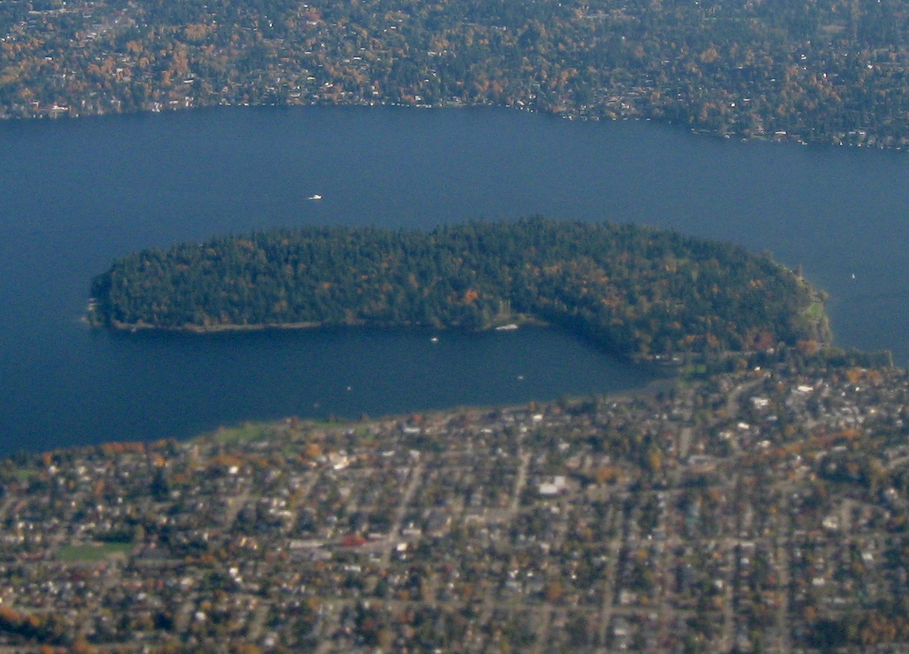
English: Aerial view of Seward Park, Seattle, viewed from west looking east. Seattle is at bottom and Mercer Island at top, with Lake Washington surrounding the park. Crop of File:Aerial view of Seward Park and Mercer Island.jpg. Taken by myself from a commercial airliner window. |
| Date | |
| Source | Own work |
| Author | Dcoetzee |
| Camera location | | View this and other nearby images on: OpenStreetMap |
|---|
Licensing
[edit]
| I, the copyright holder of this work, release this work into the public domain. This applies worldwide. In some countries this may not be legally possible; if so: I grant anyone the right to use this work for any purpose, without any conditions, unless such conditions are required by law. |
File history
Click on a date/time to view the file as it appeared at that time.
| Date/Time | Thumbnail | Dimensions | User | Comment | |
|---|---|---|---|---|---|
| current | 03:48, 27 May 2009 | | 1,312 × 944 (555 KB) | Dcoetzee (talk | contribs) | {{Information |Description={{en|1=Aerial view of Seward Park, Seattle, viewed from west looking east. Seattle is at bottom and Mercer Island at top, with Lake Washington surrounding the park. Crop of [[:File:Aerial view of Seward Park and Mercer Island.jp |
You cannot overwrite this file.
File usage on Commons
The following 4 pages use this file:
File usage on other wikis
The following other wikis use this file:
- Usage on azb.wikipedia.org
- Usage on ceb.wikipedia.org
- Usage on en.wikipedia.org
- Usage on en.wikivoyage.org
- Usage on pl.wikipedia.org
- Usage on www.wikidata.org