File:Aerial view in Flanders.jpg
Jump to navigation
Jump to search

Size of this preview: 800 × 534 pixels. Other resolutions: 320 × 214 pixels | 640 × 427 pixels | 1,024 × 683 pixels | 1,280 × 854 pixels | 2,560 × 1,709 pixels | 7,360 × 4,912 pixels.
Original file (7,360 × 4,912 pixels, file size: 6.18 MB, MIME type: image/jpeg)
Captions
Captions
Add a one-line explanation of what this file represents
Summary[edit]
| Description |
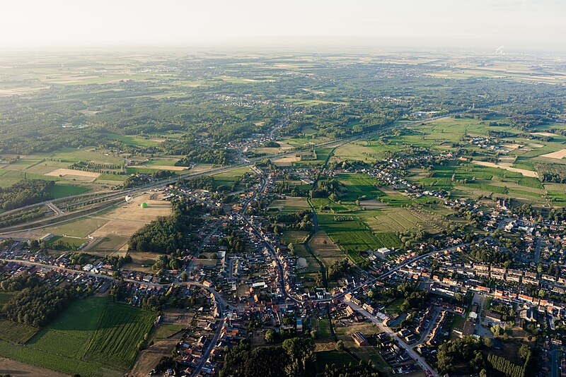
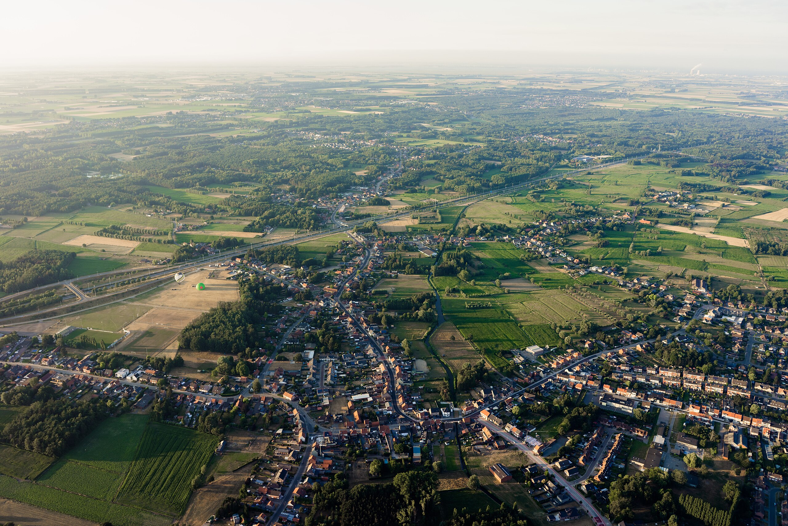
English: Aerial photograph of the Northern part of the village of Stekene, Belgium, viewed from the Southwest. The main road is the A11/N49 motorway. Nederlands: Luchtfoto van het noordelijk deel van het dorp Stekene, gezien vanuit het zuidwesten. De hoofdweg is de autosnelweg A11/N49. Français : Photo aérienne de la partie septentrionale du village de Stekene en Belgique, vu du sud-ouest. La route principale est l'autoroute A11/N49.
|
|||
| Date | ||||
| Source | Own work | |||
| Author | LionelCallewaert |


Licensing[edit]
I, the copyright holder of this work, hereby publish it under the following license:
This file is licensed under the Creative Commons Attribution 4.0 International license.
- You are free:
- to share – to copy, distribute and transmit the work
- to remix – to adapt the work
- Under the following conditions:
- attribution – You must give appropriate credit, provide a link to the license, and indicate if changes were made. You may do so in any reasonable manner, but not in any way that suggests the licensor endorses you or your use.

|
This image was uploaded as part of the photo contest Wiki Loves Heritage in Belgium in 2018 in the European Year of Cultural Heritage.
|
File history
Click on a date/time to view the file as it appeared at that time.
| Date/Time | Thumbnail | Dimensions | User | Comment | |
|---|---|---|---|---|---|
| current | 09:39, 9 September 2018 | | 7,360 × 4,912 (6.18 MB) | LionelCallewaert (talk | contribs) | User created page with UploadWizard |
You cannot overwrite this file.
File usage on Commons
The following page uses this file:
- File:Sint-Niklaas Stad.jpg (file redirect)
File usage on other wikis
The following other wikis use this file:
- Usage on nl.wikipedia.org