File:AdministrativnaCG.PNG
Jump to navigation
Jump to search

Size of this preview: 500 × 600 pixels. Other resolutions: 200 × 240 pixels | 400 × 480 pixels | 640 × 768 pixels | 853 × 1,024 pixels | 2,500 × 3,000 pixels.
Original file (2,500 × 3,000 pixels, file size: 153 KB, MIME type: image/png)
Captions
Captions
Add a one-line explanation of what this file represents
Summary[edit]
| Description |
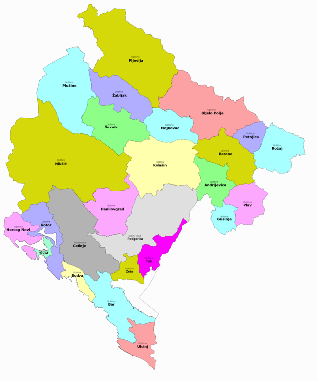
Српски / srpski: Подјела Црне Горе по општинама 2012. године |
| Date | 14 August 2012 (original upload date) |
| Source | Zakon o teritorijalnoj organizaciji Crne Gore, Sl. list Crne Gore 54/2011; Geodetska osnova: Uprava za nekretnine Crne Gore- granice katastarskih opština i naselja; |
| Author | The original uploader was Варја at Serbian Wikipedia. |
Licensing[edit]
The original uploader was Варја at Serbian Wikipedia., the copyright holder of this work, hereby publishes it under the following licenses:

|
Permission is granted to copy, distribute and/or modify this document under the terms of the GNU Free Documentation License, Version 1.2 or any later version published by the Free Software Foundation; with no Invariant Sections, no Front-Cover Texts, and no Back-Cover Texts. A copy of the license is included in the section entitled GNU Free Documentation License. Subject to disclaimers. |
This file is licensed under the Creative Commons Attribution 3.0 Serbia license.
Attribution: The original uploader was Варја at Serbian Wikipedia.
- You are free:
- to share – to copy, distribute and transmit the work
- to remix – to adapt the work
- Under the following conditions:
- attribution – You must give appropriate credit, provide a link to the license, and indicate if changes were made. You may do so in any reasonable manner, but not in any way that suggests the licensor endorses you or your use.

You may select the license of your choice.
Original upload log[edit]
The original description page was here. All following user names refer to sr.wikipedia.
| Date/Time | Dimensions | User | Comment |
|---|---|---|---|
| 2014-07-14 20:17 | 2500×3000× (301521 bytes) | Варја | додата општина Гусиње и кориговане границе градских општина Голубовци и Тузи |
| 2013-08-10 21:27 | 2500×3000× (289504 bytes) | Варја | Dodata opština Petnjica. |
| 2012-08-15 00:36 | 2500×3000× (306327 bytes) | Варја | |
| 2012-08-14 23:51 | 3000×3000× (337635 bytes) | Варја | autor: Varjačić Vladimir- Kragujevac, avgust 2012. godine; izvor: Zakon o teritorijalnoj organizaciji Crne Gore, Sl. list Crne Gore 54/2011; Geodetska osnova: Uprava za nekretnine Crne Gore- granice katastarskih opština i naselja. |
File history
Click on a date/time to view the file as it appeared at that time.
| Date/Time | Thumbnail | Dimensions | User | Comment | |
|---|---|---|---|---|---|
| current | 22:56, 22 March 2023 | | 2,500 × 3,000 (153 KB) | Ђидо (talk | contribs) | Opština Zeta |
| 14:08, 19 October 2020 |  | 2,500 × 3,000 (292 KB) | Delasse (talk | contribs) | color | |
| 14:06, 19 October 2020 |  | 2,500 × 3,000 (292 KB) | Delasse (talk | contribs) | Од 1. септембра 2018. године подгоричка градска општина Тузи је постала самостална општина. https://www.slobodnaevropa.org/a/samostalna-op%C5%A1tina-tuzi-nakon-20-godina-obe%C4%87anja/29468172.html | |
| 12:52, 19 October 2016 |  | 2,500 × 3,000 (294 KB) | Ранко Николић (talk | contribs) | Transferred from sr.wikipedia |
You cannot overwrite this file.
File usage on Commons
There are no pages that use this file.
File usage on other wikis
The following other wikis use this file:
- Usage on cs.wikipedia.org
- Usage on en.wikipedia.org
- Usage on it.wikipedia.org
- Usage on ru.wikipedia.org
- Usage on sh.wikipedia.org
- Usage on sr.wikipedia.org
- Црна Гора
- Историја Црне Горе
- Општина Бијело Поље
- Општине Црне Горе
- Корисник:Варја
- Шаблон:Општине Црне Горе
- Општина Бар
- Општина Беране
- Општина Будва
- Општина Даниловград
- Општина Жабљак
- Општина Котор
- Општина Мојковац
- Општина Никшић
- Општина Плав
- Општина Плужине
- Општина Пљевља
- Главни град Подгорица
- Општина Рожаје
- Општина Тиват
- Општина Херцег Нови
- Пријестоница Цетиње
- Општина Шавник
- Општина Улцињ
- Општина Андријевица
- Општина Колашин
- Општина Зета
- Бијело Поље
- Општина Тузи
- Општина Петњица
- Општина Гусиње
- Галерија грбова Црне Горе
- Административна подјела Краљевине Црне Горе