File:Administrative map of Borneo (Indonesian).png
Jump to navigation
Jump to search

Size of this preview: 539 × 600 pixels. Other resolutions: 216 × 240 pixels | 431 × 480 pixels | 690 × 768 pixels | 1,200 × 1,335 pixels.
Original file (1,200 × 1,335 pixels, file size: 207 KB, MIME type: image/png)
Captions
Captions
Add a one-line explanation of what this file represents
Summary[edit]
.png&action=edit§ion=1)
| Description |
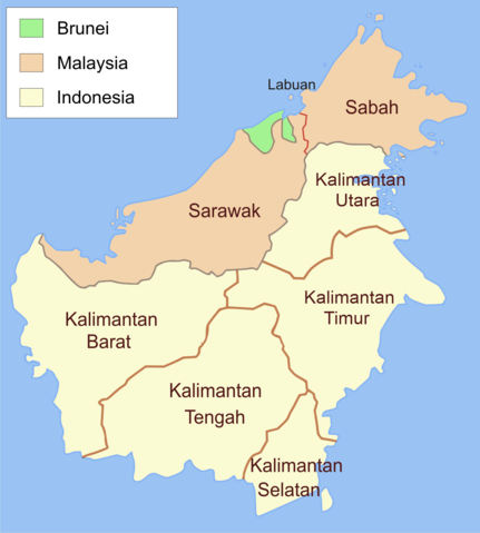
English: Administrative map of Borneo in Indonesian language. |
| Source | Own work |
| Author | M. Adiputra |
| Permission (Reusing this file) |
File:Administrative map of Borneo.svg |
Licensing[edit]
.png&action=edit§ion=2)
I, the copyright holder of this work, hereby publish it under the following licenses:
This file is licensed under the Creative Commons Attribution-Share Alike 3.0 Unported license.
- You are free:
- to share – to copy, distribute and transmit the work
- to remix – to adapt the work
- Under the following conditions:
- attribution – You must give appropriate credit, provide a link to the license, and indicate if changes were made. You may do so in any reasonable manner, but not in any way that suggests the licensor endorses you or your use.
- share alike – If you remix, transform, or build upon the material, you must distribute your contributions under the same or compatible license as the original.

|
Permission is granted to copy, distribute and/or modify this document under the terms of the GNU Free Documentation License, Version 1.2 or any later version published by the Free Software Foundation; with no Invariant Sections, no Front-Cover Texts, and no Back-Cover Texts. A copy of the license is included in the section entitled GNU Free Documentation License. |
You may select the license of your choice.
File history
Click on a date/time to view the file as it appeared at that time.
| Date/Time | Thumbnail | Dimensions | User | Comment | |
|---|---|---|---|---|---|
| current | 04:06, 21 July 2021 | | 1,200 × 1,335 (207 KB) | M. Adiputra (talk | contribs) | This map should be in Indonesian and refering to Indonesian Governement. Reverted to version as of 08:02, 31 July 2013 (UTC) |
| 10:04, 20 July 2021 |  | 1,080 × 1,202 (207 KB) | Davidelit (talk | contribs) | Provinces as during the Confrontation, i.e. no North Kalimantan | |
| 08:02, 31 July 2013 |  | 1,200 × 1,335 (207 KB) | Muffin Wizard (talk | contribs) | +Kalimantan Utara (North Kalimantan) | |
| 16:13, 27 September 2010 |  | 1,200 × 1,335 (272 KB) | M. Adiputra (talk | contribs) | add Labuan, region in Malaysia. | |
| 04:24, 27 September 2010 |  | 1,200 × 1,335 (268 KB) | M. Adiputra (talk | contribs) | {{Information |Description={{en|1=Administrative map of Borneo in Indonesian language.}} |Source={{own}} |Author=M. Adiputra |Date= |Permission=File:Administrative map of Borneo.svg |other_versions= }} Category:Borneo |
You cannot overwrite this file.
File usage on Commons
The following page uses this file:
File usage on other wikis
The following other wikis use this file:
- Usage on el.wikipedia.org
- Usage on es.wikipedia.org
- Usage on id.wikipedia.org
- Usage on ms.wikipedia.org
.png&oldid=782252118)