File:Accident at Connolly - 1971 - (2) - geograph.org.uk - 3244851.jpg
Jump to navigation
Jump to search
Size of this preview: 797 × 599 pixels. Other resolutions: 319 × 240 pixels | 638 × 480 pixels | 996 × 749 pixels.
Original file (996 × 749 pixels, file size: 750 KB, MIME type: image/jpeg)
Captions
Captions
Accident at Connolly - 1971 - (2) - geograph.org.uk - 3244851
Summary
[edit]_-_geograph.org.uk_-_3244851.jpg&action=edit§ion=1)
| Description |
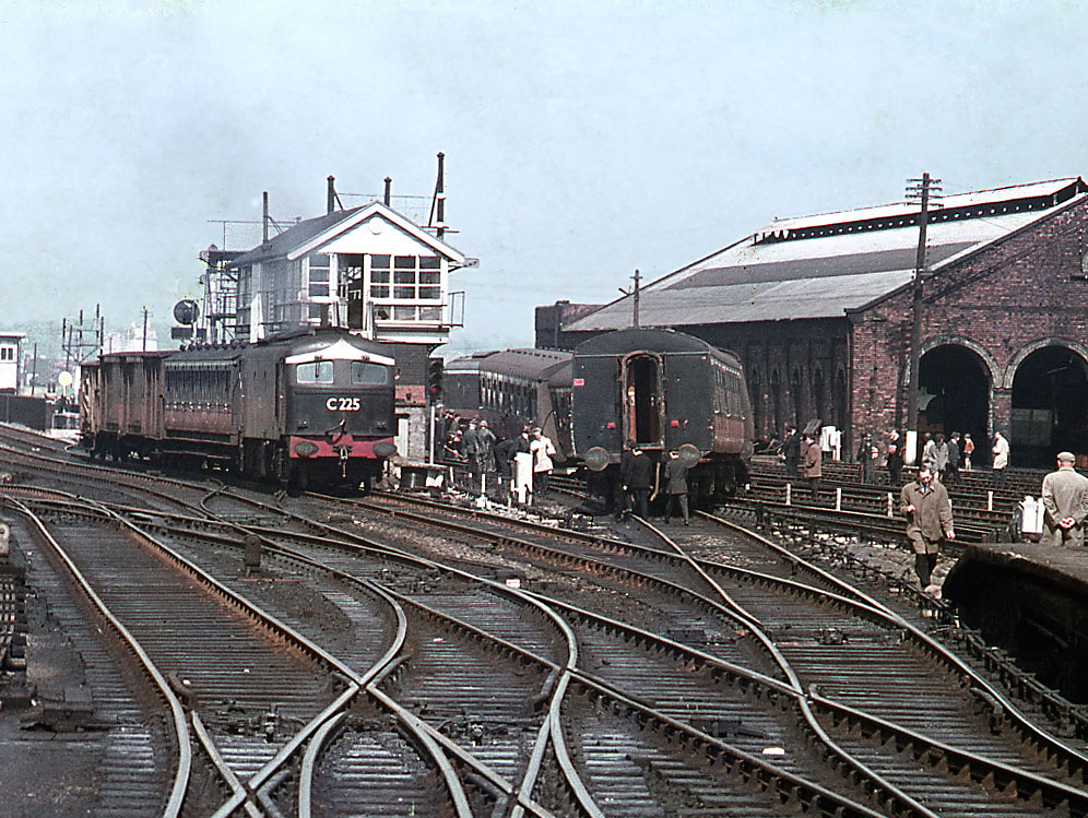
English: Accident at Connolly – 1971 – (2) Seen from the former CDJR platforms, Metropolitan Vickers built C201 class No. C225 and some very ancient coaching stock, attends the derailment at Connolly station. C225 entered service in July 1957, was re-engined in January 1972 (becoming B225 – later just 225), was withdrawn in September 1986 and scrapped in June 1990. |
| Date | |
| Source | https://www.geograph.ie/photo/3244851 |
| Author | The Carlisle Kid |
| Attribution (required by the license) | The Carlisle Kid / Accident at Connolly – 1971 – (2) / |
| Camera location | | View this and other nearby images on: OpenStreetMap |
|---|
_-_geograph.org.uk_-_3244851.jpg¶ms=053.353786_N_-006.244976_E_globe:Earth_type:camera_source:geograph-irishgrid(O16913514)_heading:45.00&language=en)
| Object location | | View this and other nearby images on: OpenStreetMap |
|---|
_-_geograph.org.uk_-_3244851.jpg¶ms=053.353790_N_-006.244980_E_globe:Earth_class:object_type:object_source:geograph-irishgrid(O16913514)_heading:45.00&language=en)
Licensing
[edit]_-_geograph.org.uk_-_3244851.jpg&action=edit§ion=2)

|
This image was taken from the Geograph project collection. See this photograph's page on the Geograph website for the photographer's contact details. The copyright on this image is owned by The Carlisle Kid and is licensed for reuse under the Creative Commons Attribution-ShareAlike 2.0 license.
|
This file is licensed under the Creative Commons Attribution-Share Alike 2.0 Generic license.
Attribution: The Carlisle Kid
- You are free:
- to share – to copy, distribute and transmit the work
- to remix – to adapt the work
- Under the following conditions:
- attribution – You must give appropriate credit, provide a link to the license, and indicate if changes were made. You may do so in any reasonable manner, but not in any way that suggests the licensor endorses you or your use.
- share alike – If you remix, transform, or build upon the material, you must distribute your contributions under the same or compatible license as the original.
File history
Click on a date/time to view the file as it appeared at that time.
| Date/Time | Thumbnail | Dimensions | User | Comment | |
|---|---|---|---|---|---|
| current | 23:22, 25 January 2022 | | 996 × 749 (750 KB) | Djm-mobile (talk | contribs) | Uploaded a work by [https://www.geograph.org.uk/profile/61944 The Carlisle Kid] from https://www.geograph.ie/photo/3244851 with UploadWizard |
You cannot overwrite this file.
File usage on Commons
The following page uses this file:
_-_geograph.org.uk_-_3244851.jpg&oldid=780429423)