File:Abies bracteata range map 4.png
Jump to navigation
Jump to search

Size of this preview: 800 × 594 pixels. Other resolutions: 320 × 238 pixels | 640 × 475 pixels | 1,024 × 760 pixels | 1,280 × 950 pixels | 2,560 × 1,900 pixels | 3,112 × 2,310 pixels.
Original file (3,112 × 2,310 pixels, file size: 332 KB, MIME type: image/png)
Captions
Captions
Add a one-line explanation of what this file represents
Summary[edit]
| Description |
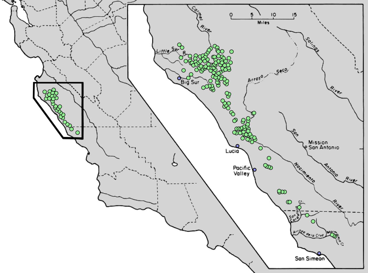
English: Distribution map for Abies bracteata D.Don -- bristlecone fir or Santa Lucia fir |
| Date | |
| Source | The distribution of forest trees in California. Berkeley: U.S.D.A. Forest Service. 1972 (modified by the uploader for clarity) |
| Author | James R. Griffin & William B. Critchfield |
Licensing[edit]
This work is in the public domain in the United States because it is a work prepared by an officer or employee of the United States Government as part of that person’s official duties under the terms of Title 17, Chapter 1, Section 105 of the US Code.
Note: This only applies to original works of the Federal Government and not to the work of any individual U.S. state, territory, commonwealth, county, municipality, or any other subdivision. This template also does not apply to postage stamp designs published by the United States Postal Service since 1978. (See § 313.6(C)(1) of Compendium of U.S. Copyright Office Practices). It also does not apply to certain US coins; see The US Mint Terms of Use.
|
 | |
| This file has been identified as being free of known restrictions under copyright law, including all related and neighboring rights. | ||
File history
Click on a date/time to view the file as it appeared at that time.
| Date/Time | Thumbnail | Dimensions | User | Comment | |
|---|---|---|---|---|---|
| current | 04:30, 15 December 2013 | | 3,112 × 2,310 (332 KB) | Nonenmac (talk | contribs) | Because 800px and larger thumbnails wouldn't render for this map, cut the resolution in half using bilinear resampling. It's still bigger than it needs to be. |
| 03:50, 15 December 2013 |  | 6,223 × 4,620 (667 KB) | Nonenmac (talk | contribs) | User created page with UploadWizard |
You cannot overwrite this file.
File usage on Commons
The following 2 pages use this file:
File usage on other wikis
The following other wikis use this file:
- Usage on de.wikipedia.org
- Usage on en.wikipedia.org
- Usage on is.wikipedia.org
- Usage on it.wikipedia.org