File:Aavasaksa Struve Geodetic Arc plaque.jpg
Original file (1,932 × 2,899 pixels, file size: 1.17 MB, MIME type: image/jpeg)
Captions
Summary[edit]
DescriptionAavasaksa Struve Geodetic Arc plaque.jpg |
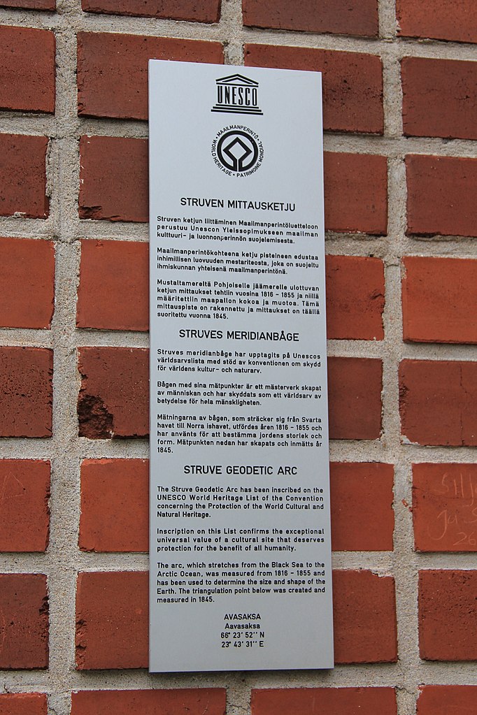
Suomi: Aavasaksan näkötorni, Ylitornio, Suomi. - Unescon maailmanperintöluettelon kyltti tornin seinällä.
English: Aavasaksa observation tower, Ylitornio, Finland. - UNESCO World Heritage Site plaque is on tower wall.
|
||||||
Date | |||||||
Source | Own work | ||||||
Author | Htm |
Camera location | 66° 23′ 52.26″ N, 23° 43′ 30.54″ E | View this and other nearby images on: OpenStreetMap | 66.397849; 23.725151 |
---|
Object location | 66° 23′ 52.27″ N, 23° 43′ 31.11″ E | View this and other nearby images on: OpenStreetMap | 66.397853; 23.725308 |
---|
Perspective corrected, cropped.
Licensing[edit]
- You are free:
- to share – to copy, distribute and transmit the work
- to remix – to adapt the work
- Under the following conditions:
- attribution – You must give appropriate credit, provide a link to the license, and indicate if changes were made. You may do so in any reasonable manner, but not in any way that suggests the licensor endorses you or your use.
- share alike – If you remix, transform, or build upon the material, you must distribute your contributions under the same or compatible license as the original.
This image was uploaded as part of Wiki Loves Monuments 2017.
Afrikaans ∙ Alemannisch ∙ azərbaycanca ∙ Bahasa Indonesia ∙ Bahasa Melayu ∙ Bikol Central ∙ bosanski ∙ brezhoneg ∙ català ∙ čeština ∙ Cymraeg ∙ dansk ∙ davvisámegiella ∙ Deutsch ∙ eesti ∙ English ∙ español ∙ Esperanto ∙ euskara ∙ français ∙ Frysk ∙ Gaeilge ∙ galego ∙ hrvatski ∙ Ido ∙ italiano ∙ latviešu ∙ Lëtzebuergesch ∙ Malagasy ∙ magyar ∙ Malti ∙ Nederlands ∙ norsk ∙ norsk nynorsk ∙ norsk bokmål ∙ polski ∙ português ∙ português do Brasil ∙ română ∙ shqip ∙ sicilianu ∙ slovenčina ∙ slovenščina ∙ suomi ∙ svenska ∙ Tagalog ∙ Türkçe ∙ Yorùbá ∙ Zazaki ∙ Ελληνικά ∙ беларуская ∙ беларуская (тарашкевіца) ∙ български ∙ кыргызча ∙ македонски ∙ русский ∙ српски / srpski ∙ українська ∙ ქართული ∙ հայերեն ∙ नेपाली ∙ हिन्दी ∙ বাংলা ∙ മലയാളം ∙ ไทย ∙ 한국어 ∙ +/− |
File history
Click on a date/time to view the file as it appeared at that time.
Date/Time | Thumbnail | Dimensions | User | Comment | |
---|---|---|---|---|---|
current | 15:02, 24 September 2017 | 1,932 × 2,899 (1.17 MB) | Htm (talk | contribs) | User created page with UploadWizard |
You cannot overwrite this file.
File usage on Commons
The following 3 pages use this file:
File usage on other wikis
The following other wikis use this file:
- Usage on fi.wikipedia.org
- Usage on www.wikidata.org
Metadata
This file contains additional information such as Exif metadata which may have been added by the digital camera, scanner, or software program used to create or digitize it. If the file has been modified from its original state, some details such as the timestamp may not fully reflect those of the original file. The timestamp is only as accurate as the clock in the camera, and it may be completely wrong.
Camera manufacturer | Canon |
---|---|
Camera model | Canon EOS 60D |
Copyright holder | Htm |
Exposure time | 1/60 sec (0.016666666666667) |
F-number | f/5.6 |
ISO speed rating | 100 |
Date and time of data generation | 08:27, 20 July 2017 |
Lens focal length | 42 mm |
Orientation | Normal |
Horizontal resolution | 350 dpi |
Vertical resolution | 350 dpi |
Software used | Digital Photo Professional |
File change date and time | 08:27, 20 July 2017 |
Y and C positioning | Centered |
Exif version | 2.3 |
Date and time of digitizing | 08:27, 20 July 2017 |
Meaning of each component |
|
APEX shutter speed | 6 |
APEX aperture | 5 |
APEX exposure bias | 0 |
Flash | Flash did not fire, compulsory flash suppression |
Supported Flashpix version | 1 |
Color space | sRGB |
Focal plane X resolution | 3,818.7845303867 |
Focal plane Y resolution | 3,872.268907563 |
Focal plane resolution unit | inches |
Custom image processing | Custom process |
Exposure mode | Auto exposure |
White balance | Auto white balance |
Scene capture type | Standard |
Structured data
Items portrayed in this file
depicts
20 July 2017
66°23'52.256"N, 23°43'30.544"E
66°23'52.269054"N, 23°43'31.107932"E
0.01666666666666666666 second
5.6
42 millimetre
100
image/jpeg
bf8244c96d874093b016088893db57cfa9800beb
1,223,322 byte
2,899 pixel
1,932 pixel
- Files with coordinates missing SDC location of creation
- CC-BY-SA-4.0
- Self-published work
- Images from Wiki Loves Monuments 2017
- Images from Wiki Loves Monuments 2017 in Finland
- Images from Wiki Loves Monuments missing SDC location of creation
- Photos by User:Htm
- Finland photographs taken on 2017-07-20
- Taken with Canon EOS 60D
- Uploaded via Campaign:wlm-fi-rephotography-wikidata
- Pages with maps