File:AN-FPS-16-1.jpg
Jump to navigation
Jump to search
Size of this preview: 800 × 521 pixels. Other resolutions: 320 × 209 pixels | 640 × 417 pixels | 1,024 × 667 pixels | 1,280 × 834 pixels | 3,008 × 1,960 pixels.
Original file (3,008 × 1,960 pixels, file size: 2.19 MB, MIME type: image/jpeg)
Captions
Captions
Add a one-line explanation of what this file represents
Summary
[edit]
| Description |
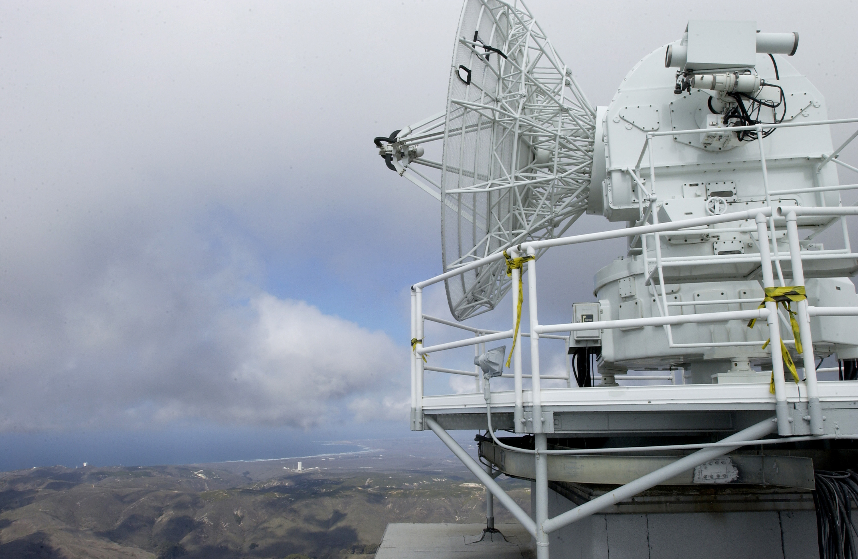
English: The FPS-16 radar sits atop Tranquillon Peak overlooking all of Vandenberg, including Space Launch Complex-6, and the shoreline. Tranquillon Peak's elevation of 2, 126 feet is the highest point on Vandenberg AFB. The radar provides data and range safety for missile launches. This radar, along with its data system, will be tracking the upcoming Feb. 7 Minuteman III launch. |
| Date | Taken on 1 February 2007 |
| Source |
U.S. Air Force image from Vandenberg AFB, California. http://www.vandenberg.af.mil/photos/media_search.asp?q=fps-16 |
| Author | (U.S. Air Force photo by Airman 1st Class Ashley Tyler) |
Licensing
[edit]
This image or file is a work of a U.S. Air Force Airman or employee, taken or made as part of that person's official duties. As a work of the U.S. federal government, the image or file is in the public domain in the United States.
|
 |
File history
Click on a date/time to view the file as it appeared at that time.
| Date/Time | Thumbnail | Dimensions | User | Comment | |
|---|---|---|---|---|---|
| current | 12:32, 3 July 2007 | | 3,008 × 1,960 (2.19 MB) | Mvannier (talk | contribs) | U.S. Air Force image from Vandenberg AFB, California. http://www.vandenberg.af.mil/photos/media_search.asp?q=fps-16 |
You cannot overwrite this file.
File usage on Commons
There are no pages that use this file.
File usage on other wikis
The following other wikis use this file:
- Usage on en.wikipedia.org