File:AMH-5484-NA Map of the area around Macassar and Bone on Celebes.jpg
Jump to navigation
Jump to search

Size of this preview: 420 × 599 pixels. Other resolutions: 168 × 240 pixels | 336 × 480 pixels | 538 × 768 pixels | 718 × 1,024 pixels | 1,682 × 2,400 pixels.
Original file (1,682 × 2,400 pixels, file size: 801 KB, MIME type: image/jpeg)
Captions
Captions
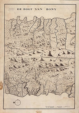
Map of the area around Macassar and Bone on Celebes
Summary[edit]
| Author |
Nederlands: Jean Michiel Aubert (landmeter / kaartenmaker)
English: Jean Michiel Aubert (land surveyor / mapmaker) |
|||||||||||||||||||||||
| Title |
Nederlands: Kaart van het gebied rondom Macassar en Bone op Celebes
English: Map of the area around Macassar and Bone on Celebes
Bahasa Indonesia: Peta daerah sekitar Makasar dan Bone di Sulawesi |
|||||||||||||||||||||||
| Description |
Nederlands: Titel catalogus Leupe (NA): Kaart van een gedeelte van de Westkust, tusschen de rivieren Gresse en Labakang, en aan de Oostkust tusschen de Rivieren Cadjang en Salanketa.
Notities verso: 906 f [in potlood]
English: Title in the Leupe catalogue (NA): Kaart van een gedeelte van de Westkust, tusschen de rivieren Gresse en Labakang, en aan de Oostkust tusschen de Rivieren Cadjang en Salanketa.
Notes on reverse: 906 f [in pencil]
Bahasa Indonesia: Judul dalam katalog Leupe (AN): Kaart van een gedeelte van de Westkust, tusschen de rivieren Gresse en Labakang, en aan de Oostkust tusschen de Rivieren Cadjang en Salanketa.
Catatan di belakang: 906 f [dengan pensil] |
|||||||||||||||||||||||
| Date | 1752 | |||||||||||||||||||||||
| Medium |
Nederlands: pen en penseel op papier
English: pen and brush on paper
Bahasa Indonesia: pulpen dan sikat di atas kertas |
|||||||||||||||||||||||
| Dimensions | height: 53 cm (20.8 in); width: 74 cm (29.1 in) | |||||||||||||||||||||||
| Collection |
|
|||||||||||||||||||||||
| Accession number |
NL-HaNA_4.VEL_1300 (old number: VEL1300) |
|||||||||||||||||||||||
| Inscriptions |
De bogt van Boni
|
|||||||||||||||||||||||
| Notes |
English: Subjects: chart / map / plan
Nederlands: Onderwerpen: plattegrond / kaart
English: Post: this image is related to a VOC trading post called Maros |
|||||||||||||||||||||||
| Source/Photographer |
|
|||||||||||||||||||||||
| Permission (Reusing this file) |
|
|||||||||||||||||||||||

| Object location | | View this and other nearby images on: OpenStreetMap |
|---|
File history
Click on a date/time to view the file as it appeared at that time.
| Date/Time | Thumbnail | Dimensions | User | Comment | |
|---|---|---|---|---|---|
| current | 18:29, 10 June 2014 | | 1,682 × 2,400 (801 KB) | HuskyBot (talk | contribs) | == {{int:filedesc}} == {{Artwork |title = {{nl|1=Kaart van het gebied rondom Macassar en Bone op Celebes}} {{en|1=Map of the area around Macassar and Bone on Celebes}} |description = {{nl|1=Titel catalogus Leup... |
You cannot overwrite this file.
File usage on Commons
The following page uses this file: