File:AMH-5418-NA Map of the small island of Poeloe Tjinkoek, or Chinco.jpg
Jump to navigation
Jump to search
Size of this preview: 800 × 576 pixels. Other resolutions: 320 × 230 pixels | 640 × 461 pixels | 1,024 × 737 pixels | 1,280 × 921 pixels | 2,400 × 1,727 pixels.
Original file (2,400 × 1,727 pixels, file size: 383 KB, MIME type: image/jpeg)
Captions
Captions
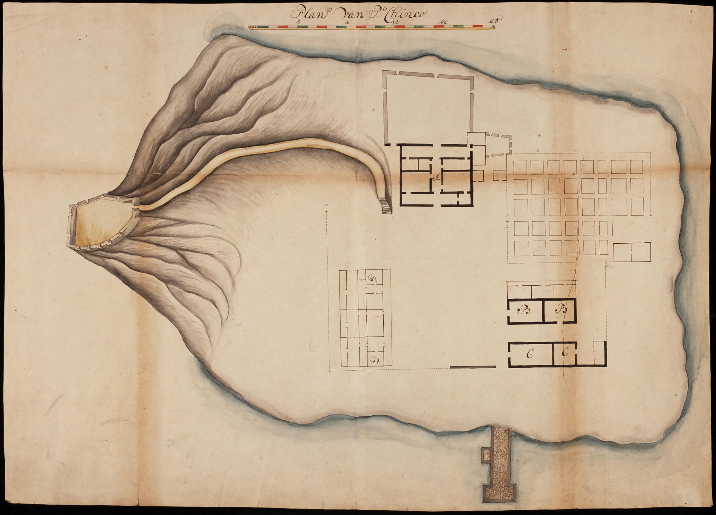
Map of the small island of Poeloe Tjinkoek, or Chinco
Summary[edit]
| Author |
Nederlands: Anoniem / Anonymous (landmeter / kaartenmaker)
English: Anoniem / Anonymous (land surveyor / mapmaker) |
|||||||||||||||||||||||
| Title |
Nederlands: Plattegrond van het eilandje Poeloe Tjinkoek ofwel Chinco
English: Map of the small island of Poeloe Tjinkoek, or Chinco
Bahasa Indonesia: Peta pulau kecil Poeloe Tjinkoek, atau Chinco |
|||||||||||||||||||||||
| Description |
Nederlands: Titel catalogus Leupe (NA): Plan van Poele Chinco, met eene afteekening van den Berg.
Notities verso: 1582 [folionummer in de band ?] / No. 15. [volgnummer van het stuk in de band ?] / 599 g / N 2.
English: Title in the Leupe catalogue (NA): Plan van Poele Chinco, met eene afteekening van den Berg.
Notes on reverse: 1582 [folio number in the volume ?] / No. 15. [serial number of the item in the volume ?] / 599 g / N 2.
Bahasa Indonesia: Judul dalam katalog Leupe (NA): Plan van Poele Chinco, met eene afteekening van den Berg.
Catatan di belakang: 1582 [nomor folio dalam volume ?] / No. 15. [nomor seri item dalam folder ?] / 599 g / N 2. |
|||||||||||||||||||||||
| Date | between 1700 and 1800 | |||||||||||||||||||||||
| Medium |
Nederlands: ingekleurde tekening op papier
English: coloured drawing on paper
Bahasa Indonesia: gambar berwarna di atas kertas |
|||||||||||||||||||||||
| Dimensions | height: 74 cm (29.1 in); width: 52.5 cm (20.6 in) | |||||||||||||||||||||||
| Collection |
|
|||||||||||||||||||||||
| Accession number |
NL-HaNA_4.VEL_1146 (old number: VEL1146) |
|||||||||||||||||||||||
| Inscriptions |
Plan van Plo Chinco
|
|||||||||||||||||||||||
| Notes |
English: Subjects: chart / map / plan
Nederlands: Onderwerpen: plattegrond / kaart |
|||||||||||||||||||||||
| Source/Photographer |
|
|||||||||||||||||||||||
| Permission (Reusing this file) |
|
|||||||||||||||||||||||

File history
Click on a date/time to view the file as it appeared at that time.
| Date/Time | Thumbnail | Dimensions | User | Comment | |
|---|---|---|---|---|---|
| current | 18:16, 10 June 2014 | | 2,400 × 1,727 (383 KB) | HuskyBot (talk | contribs) | == {{int:filedesc}} == {{Artwork |title = {{nl|1=Plattegrond van het eilandje Poeloe Tjinkoek ofwel Chinco}} {{en|1=Map of the small island of Poeloe Tjinkoek, or Chinco}} |description = {{nl|1=Titel catalogus... |
You cannot overwrite this file.
File usage on Commons
The following page uses this file: