File:ACCOBAMS map.png
Jump to navigation
Jump to search

Size of this preview: 716 × 599 pixels. Other resolutions: 287 × 240 pixels | 574 × 480 pixels | 918 × 768 pixels | 1,110 × 929 pixels.
Original file (1,110 × 929 pixels, file size: 223 KB, MIME type: image/png)
Captions
Captions
Add a one-line explanation of what this file represents
| Description |
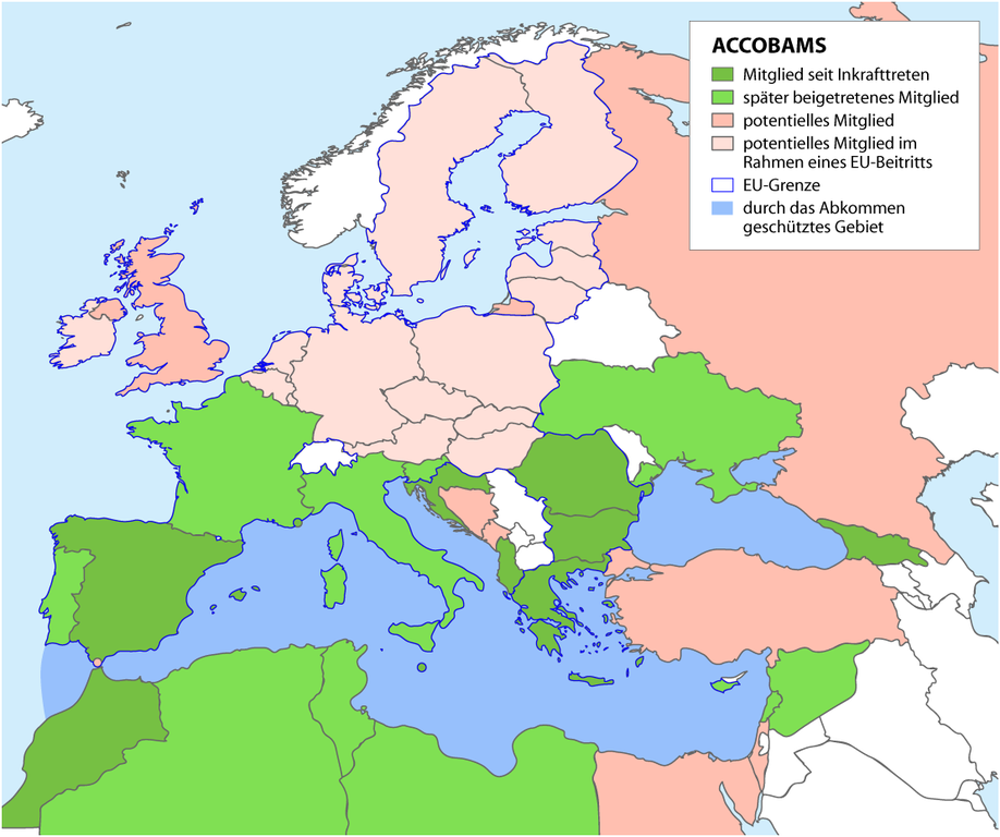
Deutsch: Karte der Mitglieder des ACCOBAMS-Abkommens.
ACCOBAMS ist das "Übereinkommen zum Schutz der Wale des Schwarzen Meeres, des Mittelmeeres und der angrenzenden Atlantischen Zonen". English: Map of the Parties of the ACCOBAMS (Agreement on the Conservation of Cetaceans of the Black Sea, Mediterranean Sea and Contiguous Atlantic Area) |
|
| Date | ||
| Source |
Self made, using
|
|
| Author | Maximilian Dörrbecker (Chumwa) | |
| Permission (Reusing this file) |
I, the copyright holder of this work, hereby publish it under the following license: This file is licensed under the Creative Commons Attribution-Share Alike 2.5 Generic license.
Sie dürfen das Bild zu den folgenden Bedingungen nutzen:
|
File history
Click on a date/time to view the file as it appeared at that time.
| Date/Time | Thumbnail | Dimensions | User | Comment | |
|---|---|---|---|---|---|
| current | 04:44, 6 May 2008 | | 1,110 × 929 (223 KB) | Chumwa (talk | contribs) | Monaco gehört nicht zur EU, andere Farbegebung |
| 22:04, 4 May 2008 |  | 1,110 × 929 (223 KB) | Chumwa (talk | contribs) | Noch 'ne Version mit Gibraltar und Kosovo | |
| 21:43, 4 May 2008 |  | 1,110 × 929 (222 KB) | Chumwa (talk | contribs) | ä bissle größer | |
| 21:39, 4 May 2008 |  | 799 × 717 (146 KB) | Chumwa (talk | contribs) | ein paar Inselchen in die EU eingefangen | |
| 21:23, 4 May 2008 |  | 1,666 × 1,493 (387 KB) | Chumwa (talk | contribs) | {{Information |Description= *{{ de }} Karte der Mitglieder des ACCOBAMS-Abkommens.<br/>ACCOBAMS ist das "Übereinkommen zum Schutz der Wale des Schwarzen Meeres, des Mittelmeeres und der angrenzenden Atlantischen Zonen". *{{ en }} Map of the Parties of th |
You cannot overwrite this file.
File usage on Commons
The following page uses this file:
File usage on other wikis
The following other wikis use this file:
- Usage on de.wikipedia.org