File:A48 at Castleton - geograph.org.uk - 900337.jpg
Jump to navigation
Jump to search
No higher resolution available.
A48_at_Castleton_-_geograph.org.uk_-_900337.jpg (640 × 479 pixels, file size: 112 KB, MIME type: image/jpeg)
Captions
Captions
Add a one-line explanation of what this file represents
Summary[edit]
| Description |
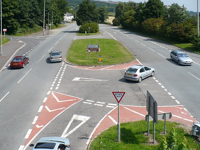
English: A48 at Castleton. View eastwards from the footbridge. At the top left is 897509. Up until the 1960s a row of cottages and shops existed where the central reservation now is; the early A48 following the line of the right-hand carriageway. |
| Date | |
| Source | From geograph.org.uk |
| Author | Robin Drayton |
| Attribution (required by the license) | Robin Drayton / A48 at Castleton / |
| Camera location | | View this and other nearby images on: OpenStreetMap |
|---|
_heading:45.00&language=en)
| Object location | | View this and other nearby images on: OpenStreetMap |
|---|
_heading:45.00&language=en)
Licensing[edit]

|
This image was taken from the Geograph project collection. See this photograph's page on the Geograph website for the photographer's contact details. The copyright on this image is owned by Robin Drayton and is licensed for reuse under the Creative Commons Attribution-ShareAlike 2.0 license.
|
This file is licensed under the Creative Commons Attribution-Share Alike 2.0 Generic license.
Attribution: Robin Drayton
- You are free:
- to share – to copy, distribute and transmit the work
- to remix – to adapt the work
- Under the following conditions:
- attribution – You must give appropriate credit, provide a link to the license, and indicate if changes were made. You may do so in any reasonable manner, but not in any way that suggests the licensor endorses you or your use.
- share alike – If you remix, transform, or build upon the material, you must distribute your contributions under the same or compatible license as the original.
File history
Click on a date/time to view the file as it appeared at that time.
| Date/Time | Thumbnail | Dimensions | User | Comment | |
|---|---|---|---|---|---|
| current | 18:41, 21 February 2011 | | 640 × 479 (112 KB) | GeographBot (talk | contribs) | == {{int:filedesc}} == {{Information |description={{en|1=A48 at Castleton View eastwards from the footbridge. At the top left is 897509. Up until the 1960s a row of cottages and shops existed where the central reservation now is; the early A48 followi |
You cannot overwrite this file.
File usage on Commons
There are no pages that use this file.
File usage on other wikis
The following other wikis use this file:
- Usage on en.wikipedia.org