File:753px-Interchange 21.jpg
Jump to navigation
Jump to search
No higher resolution available.
753px-Interchange_21.jpg (753 × 600 pixels, file size: 134 KB, MIME type: image/jpeg)
Captions
Captions
Add a one-line explanation of what this file represents
| Description |
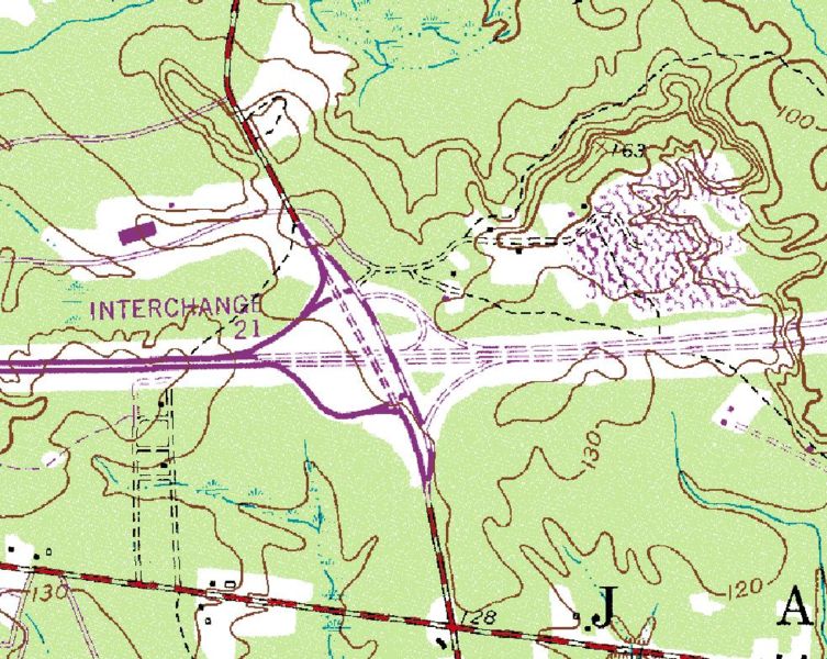
English: This is a en:USGS en:topographic map: [1]
SummaryInterchange 21 for many years was the eastern terminus of I-195 |
| Source | US gov |
| Author | US gov |
Licensing[edit]
This image is in the public domain in the United States because it only contains materials that originally came from the United States Geological Survey, an agency of the United States Department of the Interior. For more information, see the official USGS copyright policy.
|
Original upload log[edit]
The original description page was here. All following user names refer to en.wikipedia.
- 2006-10-16 17:05 Route 82 983×783×8 (249416 bytes) Interchange 21 for many years was the eastern terminus of I-195
File history
Click on a date/time to view the file as it appeared at that time.
| Date/Time | Thumbnail | Dimensions | User | Comment | |
|---|---|---|---|---|---|
| current | 03:23, 7 November 2007 | | 753 × 600 (134 KB) | JohnnyAlbert10~commonswiki (talk | contribs) | {{Information |Description={{en|This is a en:USGS en:topographic map: [http://www.terraserver-usa.com/image.aspx?T=2&S=12&Z=18&X=694&Y=5556&W=3] == Summary == Interchange 21 for many years was the eastern terminus of I-195}} |Source=Originally |
You cannot overwrite this file.
File usage on Commons
The following page uses this file: