File:6.57545E 62.10248N Romsdalsfjorden, Sunnmøre fjords, Nordfjord (cropped).png
Jump to navigation
Jump to search

Size of this preview: 800 × 416 pixels. Other resolutions: 320 × 166 pixels | 640 × 333 pixels | 1,060 × 551 pixels.
Original file (1,060 × 551 pixels, file size: 1.06 MB, MIME type: image/png)
Captions
Captions
Add a one-line explanation of what this file represents
| Description |
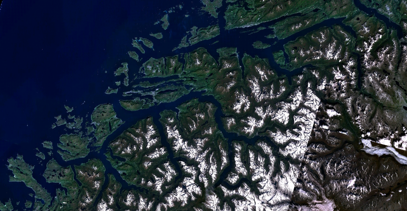
English: Satellite imagery of three large fjords: From top to bottom Romsdalsfjorden, the fjord system of Sunnmøre, and Nordfjord.
Norsk nynorsk: Satellittbilete av tre fjordar. Frå topp til botn Romsdalsfjorden, fjordsystemet i Sunnmøre, og Nordfjord. |
| Source | Taken from NASA WorldWind |
| Author | NASA Landsat imagery |
| Other versions |

| This image is in the public domain because it is a screenshot from NASA’s globe software World Wind using a public domain layer, such as Blue Marble, MODIS, Landsat, SRTM, USGS or GLOBE.
|
 |
File history
Click on a date/time to view the file as it appeared at that time.
| Date/Time | Thumbnail | Dimensions | User | Comment | |
|---|---|---|---|---|---|
| current | 22:05, 22 April 2020 | | 1,060 × 551 (1.06 MB) | Erik den yngre (talk | contribs) | File:6.57545E 62.10248N Romsdalsfjorden, Sunnmøre fjords, Nordfjord.png cropped 17 % horizontally, 42 % vertically using CropTool with precise mode. |
You cannot overwrite this file.
File usage on Commons
The following 2 pages use this file:
File usage on other wikis
The following other wikis use this file:
- Usage on ja.wikipedia.org
- Usage on no.wikipedia.org
.png&oldid=769440018)