File:25 de Abril Bridge Lisbon (10061877435).jpg
Original file (4,868 × 2,440 pixels, file size: 2.49 MB, MIME type: image/jpeg)
Captions
Captions
Summary[edit]
.jpg&action=edit§ion=1)
| Description |
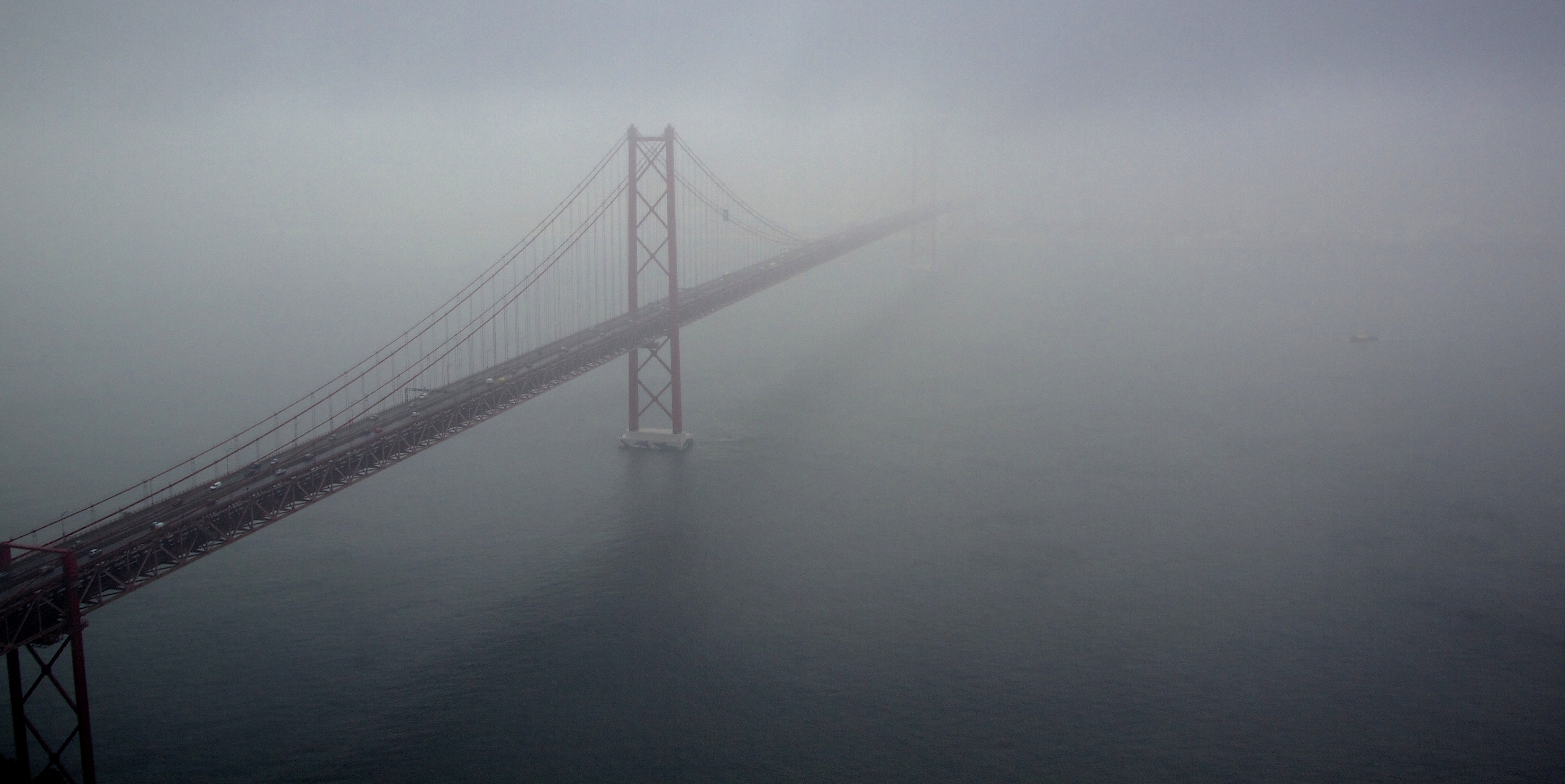
The 25 de Abril Bridge (Ponte 25 de Abril "25th of April Bridge", is a suspension bridge connecting the city of Lisbon, capital of Portugal, to the municipality of Almada on the left (south) bank of the Tejo river. It was inaugurated on August 6, 1966 and a train platform was added in 1999. Because it is a suspension bridge and has similar colouring, it is often compared to the Golden Gate Bridge in San Francisco, USA. In fact, it was built by the same company (American Bridge Company) that constructed the San Francisco-Oakland Bay Bridge and not the Golden Gate, also explaining its similarity in design. With a total length of 2,277 m, it is the 23rd largest suspension bridge in the world. The upper deck carries six car lanes, while the lower deck carries two train tracks. Until 1974, the bridge was named Salazar Bridge (Ponte Salazar).
LISBON CAPITAL CITY OF PORTUGAL OCTOBER 2013 <a href="http://loc.alize.us/#/flickr:10061877435" rel="nofollow">See where this picture was taken.</a> <a href="https://www.flickr.com/groups/geotagging/discuss/72157594165549916/">[?]</a> |
| Date | |
| Source | 25 de Abril Bridge Lisbon |
| Author | Terry Kearney from liverpool, merseyside |
| Camera location | | View this and other nearby images on: OpenStreetMap |
|---|
.jpg¶ms=038.686079_N_-009.176287_E_globe:Earth_type:camera_source:Flickr_&language=en)
Licensing[edit]
.jpg&action=edit§ion=2)
| This file is made available under the Creative Commons CC0 1.0 Universal Public Domain Dedication. | |
| The person who associated a work with this deed has dedicated the work to the public domain by waiving all of their rights to the work worldwide under copyright law, including all related and neighboring rights, to the extent allowed by law. You can copy, modify, distribute and perform the work, even for commercial purposes, all without asking permission.
|
| This image was originally posted to Flickr by Terry Kearney at https://flickr.com/photos/24490288@N04/10061877435. It was reviewed on 9 March 2022 by FlickreviewR 2 and was confirmed to be licensed under the terms of the cc-zero. |
File history
Click on a date/time to view the file as it appeared at that time.
| Date/Time | Thumbnail | Dimensions | User | Comment | |
|---|---|---|---|---|---|
| current | 01:07, 9 March 2022 | | 4,868 × 2,440 (2.49 MB) | Tm (talk | contribs) | Transferred from Flickr via #flickr2commons |
You cannot overwrite this file.
File usage on Commons
The following page uses this file:
.jpg&oldid=766608509)